U.S. flag

An official website of the United States government

Photo and Video Chronology – Kīlauea – April 5, 2021

April 5, 2021

Kīlauea's summit eruption continues on the Island of Hawai‘i; Halema‘uma‘u west vent erupts lava into the lava lake, which was 225 m (738 ft) deep this morning, April 5. Gas emissions and seismic activity at the summit remain elevated. HVO field crews—equipped with specialized safety gear—monitor the eruption from withi

HVO scientists collect detailed data to assess hazards and understand how the eruption is evolving at Kīlauea's summit, all of which are shared with the National Park Service and emergency managers. Access to this hazardous area is by permission from, and in coordination with, Hawai‘i Volcanoes National Park.

April 2, 2021 — Kīlauea summit eruption

Color photograph of lava lake
A wide view of the eruption within Halema‘uma‘u crater at the summit of Kīlauea. The western vent and perched lava lake remain active in the western portion of the crater (left). Sulfur dioxide emission rates remain elevated, with the most recent measurement being 1,200 tonnes per day on April 1. USGS photo taken by L. DeSmither on April 2, 2021.
Color photograph of lava lake
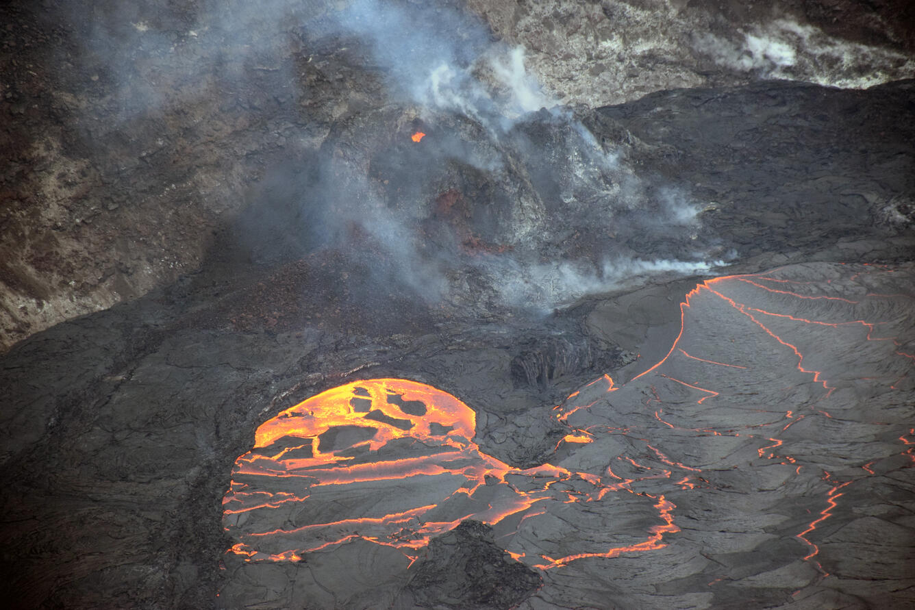
A telephoto image from the ongoing eruption within Halema‘uma‘u crater at the summit of Kīlauea. Lava continues to enter the lava lake through an inlet near the base of the west vent cone (right). An incandescent opening near the top of the cone (upper center), ejected occasional bursts of spatter. Crustal foundering of a section of the lava lake surface crust (lower center) is common. This photo was taken from the southern crater rim, in an area of Hawai‘i Volcanoes National Park which remains closed to the public due to safety reasons. USGS photo taken by L. DeSmither on April 2, 2021.
Color photograph of lava flow
A telephoto view of the eastern Halema‘uma‘u crater wall and portion of the crusted-over lava lake at Kīlauea summit. In this photo, molten lava from below the surface crust has squeezed up between the lava crust and the crater wall as an “ooze-out.” USGS photo taken by L. DeSmither on April 2, 2021.

Get Our News

These items are in the RSS feed format (Really Simple Syndication) based on categories such as topics, locations, and more. You can install and RSS reader browser extension, software, or use a third-party service to receive immediate news updates depending on the feed that you have added. If you click the feed links below, they may look strange because they are simply XML code. An RSS reader can easily read this code and push out a notification to you when something new is posted to our site.