U.S. flag

An official website of the United States government

Photo and Video Chronology - Kīlauea - August 10, 2018

August 10, 2018

Kīlauea lower East Rift Zone

image related to volcanoes. See description
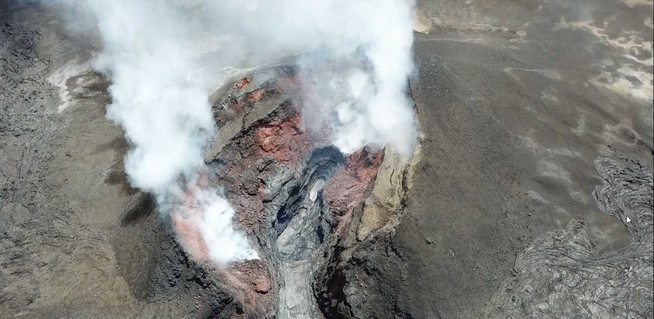
The UAS team (Unmanned Aircraft Systems) flew over fissure 8 today, providing this aerial view into the cinder cone. The lava pond has receded, and is about 40 m (130 ft) below the highest point on the cinder cone's rim.

July 5, 2018, collapse event at Kīlauea Volcano’s summit

Since August 4, 2018, Kīlauea Volcano's summit activity has diminished dramatically. But between mid-May and early August, 62 collapse events occurred, with each releasing energy equivalent to a magnitude-5+ earthquake and causing extensive ground shaking in the summit area. On July 5, 2018, USGS video cameras stationed at various summit locations happened to record one of the collapse events. The first clip shows the USGS Hawaiian Volcano Observatory entrance sign rattling in response to ground shaking. The second clip shows dramatic movement along the rock wall and a ground crack at the Jaggar Museum Overlook in Hawai‘i Volcanoes National Park—visual reminders of hazards associated with the collapses. Most of the audio is wind noise, but the sound of rocks falling from steep crater walls within Halema‘uma‘u can also be heard as dust rises from the Kīlauea caldera.

Get Our News

These items are in the RSS feed format (Really Simple Syndication) based on categories such as topics, locations, and more. You can install and RSS reader browser extension, software, or use a third-party service to receive immediate news updates depending on the feed that you have added. If you click the feed links below, they may look strange because they are simply XML code. An RSS reader can easily read this code and push out a notification to you when something new is posted to our site.