U.S. flag

An official website of the United States government

Photo and Video Chronology - Kīlauea - August 11, 2019

August 11, 2019

Water at bottom of Halema‘uma‘u continues to rise


image related to volcanoes. See description
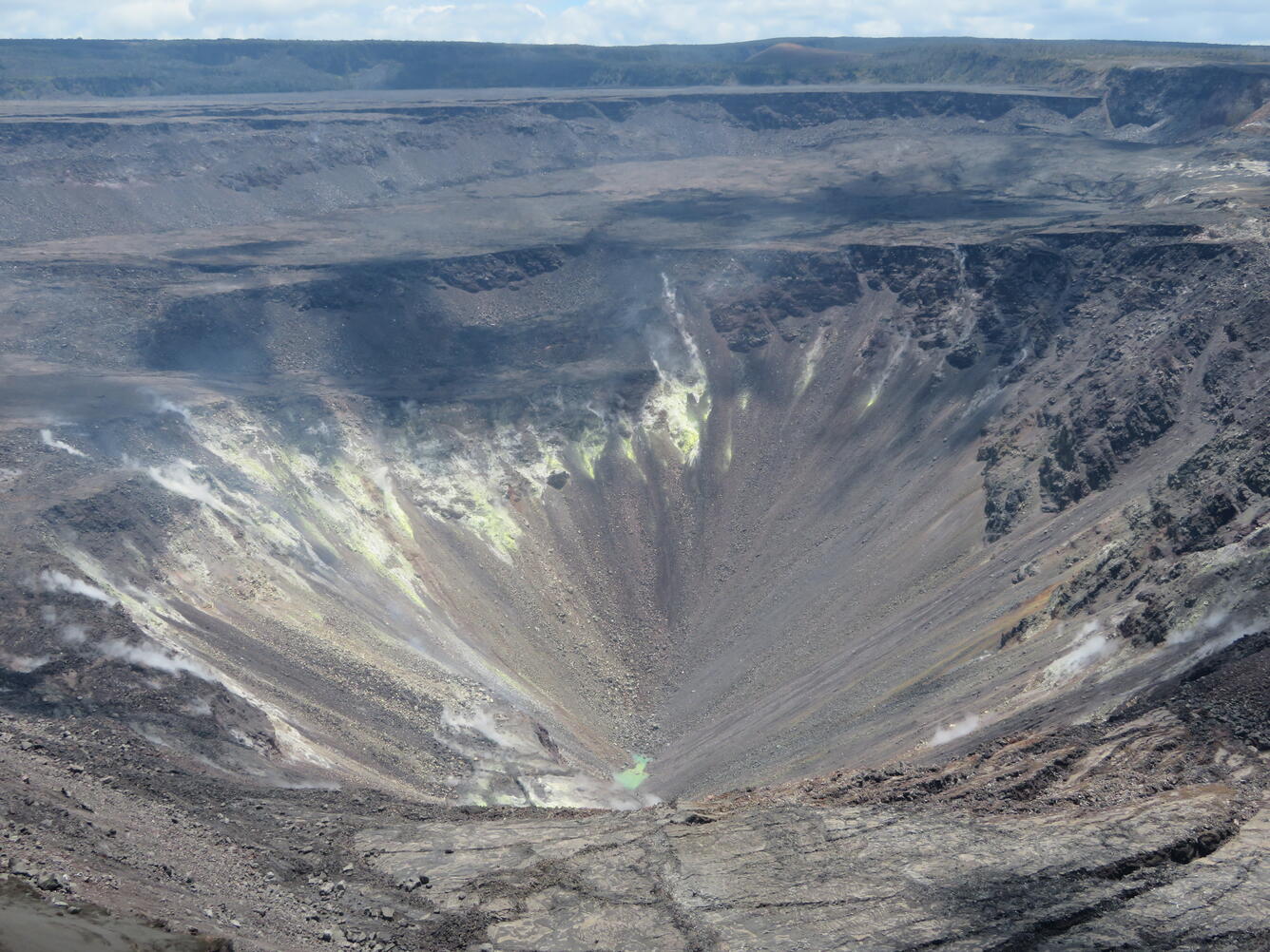
The ponded water at the bottom of Halema‘uma‘u has continued to slowly rise. This wide view shows much of Halema‘uma‘u and the fumaroles on the upper walls of the pit. USGS photo by M. Patrick, 08-11-2019.
image related to volcanoes. See description
A close up of the ponded water in Halema‘uma‘u. Laser rangefinder measurements on Sunday indicated that the east-west length of the pond (top to bottom in image) was approximately 67 m (220 ft). USGS photo by M. Patrick, 08-11-2019.
image related to volcanoes. See description
This comparison between Saturday, August 10, and Sunday, August 11, shows a slight rise in the water level. The day-to-day rise in water level is smaller than the precision of our laser rangefinder (about 1 meter) at this long distance, so photo comparisons and close inspection of the water level against key rocks is the best tool to see these small changes. Compare the water level against the small rock on the shoreline marked by the arrow, and note how it has risen. USGS photos by M. Patrick.

Get Our News

These items are in the RSS feed format (Really Simple Syndication) based on categories such as topics, locations, and more. You can install and RSS reader browser extension, software, or use a third-party service to receive immediate news updates depending on the feed that you have added. If you click the feed links below, they may look strange because they are simply XML code. An RSS reader can easily read this code and push out a notification to you when something new is posted to our site.