An official website of the United States government
Here's how you know
Official websites use .gov
A .gov website belongs to an official government organization in the United States.
Secure .gov websites use HTTPS
A lock () or https:// means you’ve safely connected to the .gov website. Share sensitive information only on official, secure websites.
Pu‘u ‘Ō‘ō has changed dramatically over the years. This map shows the configuration of Pu‘u ‘Ō‘ō's current crater (outlined in yellow) and vents (marked in red). The base image is a mosaic created from photographs captured during a helicopter overflight on January 19, 2016. The current crater, with a maximum width of about 290 m (317 yd), is nested within a much larger crater that was present in early 2011. The current crater is about 20 m (66 ft) deep and has distinct embayments at its northeast, northwest, and south sides. These embayments were pits when the current crater formed in mid-2014. A short distance west of the current crater is a 50-m- (~165-ft-) wide pit, informallly called the West pit, that contains a 25-m- (~80-ft-) wide lava pond. The source of the currently active June 27th lava flow is a vent on the northeast flank of Pu‘u ‘Ō‘ō, about 250 m (273 yd) downslope from the crater rim.
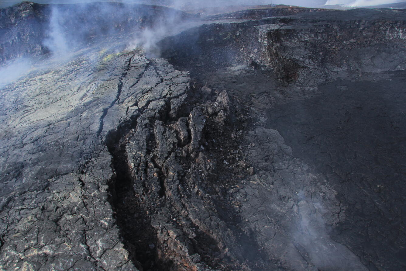
This photo looks north-northwest at the northeast embayment at Pu‘u ‘Ō‘ō, showing the vent (a spatter cone) on the floor of the embayment. The heavy fume on the rim of the embayment is another vent.
This photo, also of the northeast embayment at Pu‘u ‘Ō‘ō, is interesting because it shows the lava tube for the Kahauale‘a 2 flow, active during 2013 and 2014, exposed high on the crater wall. The Kahauale‘a 2 flow is the lava flow that preceded the currently active June 27th lava flow, which began June 27, 2014.
This photo, looking to the west, shows the two spatter cones that mark vents on the floor of the southern embayment in Pu‘u ‘Ō‘ō crater.
This photo looks north into the northwest embayment at Pu‘u ‘Ō‘ō. The spatter cone on edge of the embayment (the dark object nearly surrounded by white staining) has not fed lava flows for several months, but incandescent holes on the spatter cone (not visible in this photo) show that lava still resides beneath it. The fume in the distance at upper right is from the June 27th flow lava tube.
This photo looks west toward the West pit on Pu‘u ‘Ō‘ō.
The West pit, as seen in this photo looking west, contains a small lava pond that is tucked partly back under the pit's overhanging southwest wall. The walls are, in fact, overhanging most of the pit's circumference, making the pit wider at the bottom than at the top.
Get Our News
These items are in the RSS feed format (Really Simple Syndication) based on categories such as topics, locations, and more. You can install and RSS reader browser extension, software, or use a third-party service to receive immediate news updates depending on the feed that you have added. If you click the feed links below, they may look strange because they are simply XML code. An RSS reader can easily read this code and push out a notification to you when something new is posted to our site.