An official website of the United States government
Here's how you know
Official websites use .gov
A .gov website belongs to an official government organization in the United States.
Secure .gov websites use HTTPS
A lock () or https:// means you’ve safely connected to the .gov website. Share sensitive information only on official, secure websites.
Fissure 8 fountains reached heights up to 160 feet overnight. Lava fragments falling from the fountains are building a cinder-and-spatter cone around the vent, with the highest part of the cone (about 125 feet high) on the downwind side. USGS image taken June 12, 2018 around 6:10 a.m. HST.
The fissure 8 fountain (shown in the distance) feeds lava into an active braided channel that flows about 8 miles (north, then east) to the ocean entry in Kapoho Bay. USGS image taken June 12, 2018, around 6:50 a.m. HST.
Aerial view of the ocean entry at Kapoho, where a lava delta about 250 acres in size is filling the bay. USGS image taken June 12, 2018, around 6:50 a.m. HST.
The south side of the ocean entry was most active today, with many small streams of lava and corresponding steam plumes spread along a fairly broad section of the southern part of the delta. USGS image taken June 12, 2018, around 6:13 AM.
Aerial views of the ocean entry on Kīlauea Volcano's lower East Rift Zone on June 12, 2018, around 6:30 a.m. HST, show multiple small lava streams spilling into the ocean along the southern portion of the lava delta in Kapoho Bay. The interaction of molten lava and ocean water creates "laze," a corrosive mixture of seawater steam, hydrochloric acid, and fine volcanic glass particles that can irritate the skin, eyes, and lungs. The helicopter overflight traveled from north to south along the coastline. Fissure 8 is visible in the distance near the end of the video.
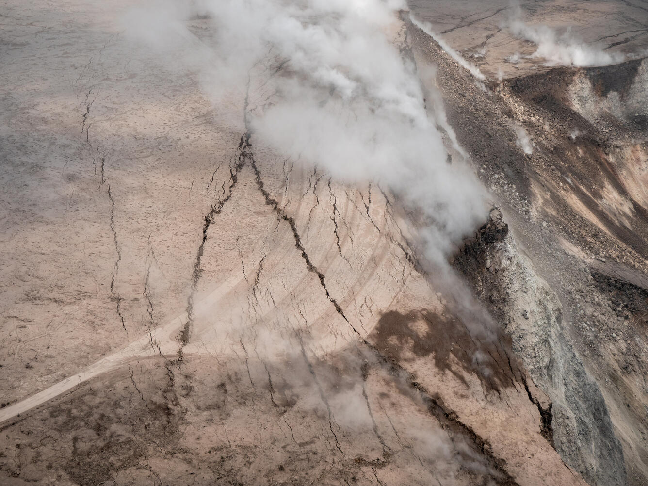
Events at the summit of Kīlauea over the past few weeks have dramatically reshaped Halema‘uma‘u, shown here in this aerial view, which looks west across the crater. The obvious flat surface (photo center) is the former Halema‘uma‘u crater floor, which has subsided at least 100 m (about 300 ft) during the past couple weeks. Ground cracks circumferential to the crater rim can be seen cutting across the parking lot (left) for the former Halema‘uma‘u visitor overlook (closed since 2008). The deepest part of Halema‘uma‘u (foreground) is now about 300 m (1,000 ft) below the crater rim. The Halema‘uma‘u crater rim and walls continue to slump inward and downward with ongoing subsidence at Kīlauea's summit.
A closer view of the cracks cutting across the parking lot for the former Halema‘uma‘u visitor overlook (closed since 2008, when an active vent opened within the crater). Additional photos—ground views—of the parking lot cracks were posted on June 7 and 11.
Get Our News
These items are in the RSS feed format (Really Simple Syndication) based on categories such as topics, locations, and more. You can install and RSS reader browser extension, software, or use a third-party service to receive immediate news updates depending on the feed that you have added. If you click the feed links below, they may look strange because they are simply XML code. An RSS reader can easily read this code and push out a notification to you when something new is posted to our site.