An official website of the United States government
Here's how you know
Official websites use .gov
A .gov website belongs to an official government organization in the United States.
Secure .gov websites use HTTPS
A lock () or https:// means you’ve safely connected to the .gov website. Share sensitive information only on official, secure websites.
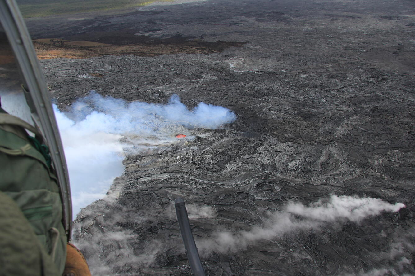
The active surface flow from Pu‘u ‘Ō‘ō is still advancing slowly downslope and was 4.4 km (2.7 miles) long when mapped today. Averaged over the past six days, the flow has been advancing at a rate of about 200 m (220 yards) per day. At that rate, it will take about 10 days to reach the top of Pūlama pali, which is in the middle distance about 2 km (1.2 miles) farther downslope. The coastal plain and ocean are in the far distance. The active flow is creeping across some of the last-exposed ‘A‘ā flows erupted from Pu‘u ‘Ō‘ō in the 1980's.
This view is of the front of the active lava flow, looking upslope. Pu‘u ‘Ō‘ō is partly obscured in the clouds at upper left. Most surface activity on the advancing flow is actually where the flow widens, upslope of the flow front.
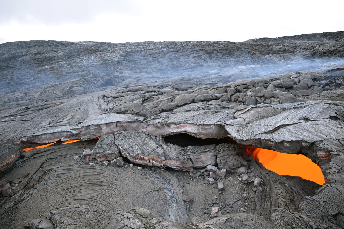
The uppermost part of the nascent lava tube has several skylights, which reveal the lava stream within the flow, like capillaries beneath the skin. This is the uppermost skylight, just downstream from where the lava broke out from the east flank of Pu‘u ‘Ō‘ō on May 24.
The lava stream was flowing toward the photographer in this photo. Higher lava levels are preserved in the shelf-like protrusions on the darker orange wall to the left.
Several vents have opened on Pu‘u ‘Ō‘ō's northeast flank since last December. A spatter cone grew over one of the vents in mid-May and is visible at the center of the photo emitting bluish fume. In recent weeks, a vent opened upslope from (to the left of) the spatter cone, revealing bright incandescence. The northeast edge of Pu‘u ‘Ō‘ō's crater, filled with white fume, is to the left of this vent.
Though difficult to photograph, aerial views showed that this open vent was but a small window into a large, hot cavity beneath Pu‘u ‘Ō‘ō's northeast flank. Inside, streams of lava from an unseen source (or sources) closer to the crater rim (visible at lower right) were cascading toward the upper left into unknown depths. This view, looking almost straight down, shows the surface of one of these lava streams through the open vent. The ground around this entire area is sunken, corroded, and unstable, and may someday collapse to form a pit.
Get Our News
These items are in the RSS feed format (Really Simple Syndication) based on categories such as topics, locations, and more. You can install and RSS reader browser extension, software, or use a third-party service to receive immediate news updates depending on the feed that you have added. If you click the feed links below, they may look strange because they are simply XML code. An RSS reader can easily read this code and push out a notification to you when something new is posted to our site.