U.S. flag

An official website of the United States government

Photo and Video Chronology - Kīlauea - November 10, 2014

November 10, 2014

Areas of active lava behind the stalled front


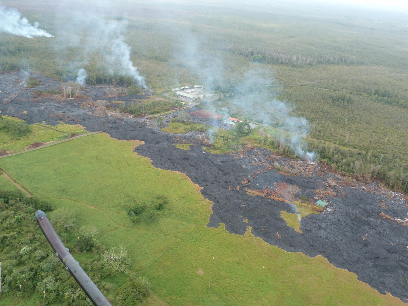
Helicopter view of the June 27th flow tip showing areas of active lava on the morning of November 10. Smoke from burning vegetation rises from the north margin of the flow. Active areas include regions just downslope and upslope of the transfer station, and a new lobe of lava, marked by a smoke plume at the upper right of the photo, is moving to the northeast approximately 750 meters (820 yards) above AP‘A‘ā Street / Cemetery Road.


Helicopter view looking upslope along the June 27 flow from above Pāhoa. Plumes of smoke from burning vegetation mark areas of active lava breakouts.
Helicopter view looking west across the lower part of the June 27th lava flow. Smoke plumes show areas of active lava breakouts. The transfer station is in the middle of the image (white roofed structures). At upper left, smoke rises from the margin of a new, northeastward directed finger of lava.

Get Our News

These items are in the RSS feed format (Really Simple Syndication) based on categories such as topics, locations, and more. You can install and RSS reader browser extension, software, or use a third-party service to receive immediate news updates depending on the feed that you have added. If you click the feed links below, they may look strange because they are simply XML code. An RSS reader can easily read this code and push out a notification to you when something new is posted to our site.