An official website of the United States government
Here's how you know
Official websites use .gov
A .gov website belongs to an official government organization in the United States.
Secure .gov websites use HTTPS
A lock () or https:// means you’ve safely connected to the .gov website. Share sensitive information only on official, secure websites.
June 27th lava flow continues advancement towards northeast
The June 27th lava flow remains active, and continues to advance towards the northeast along the northern boundary of Kaohe Homesteads subdivision. Over the past day, the leading edge of the flow has moved ahead as a narrow lobe, and covered part of a dirt road. The flow front today was 815 meters (0.5 miles) from AP‘A‘ā St., as measured along a straight line.
A wider view of the flow front, showing its proximity to AP‘A‘ā St. and the transfer station. The vent for the June 27th lava flow is on Pu‘u ‘Ō‘ō cone, which can be seen in the upper right portion of the photograph. The residential area in the lower left corner is in the western portion of Pāhoa.
A closer view of the flow front from the air, showing the narrow lobe of lava moving along the dirt road. Kaohe Homesteads is in the left side of the photograph. Pu‘u ‘Ō‘ō can be seen in the upper right.
Another view of the flow front, showing the numerous smoke plumes arising from active breakouts burning vegetation at the flow margin. Kaohe Homesteads is in the left side of the photograph.
A comparison of a normal photograph of the flow front with a thermal image. The white box shows the approximate extent of the thermal image. The thermal image shows that active breakouts (white and yellow areas) are focused along the narrow lobe at the leading edge of the flow, but are also scattered for about 2 km (1.2 miles) behind the flow front.
A vertical view of the lava upslope from the flow front covering the dirt road.
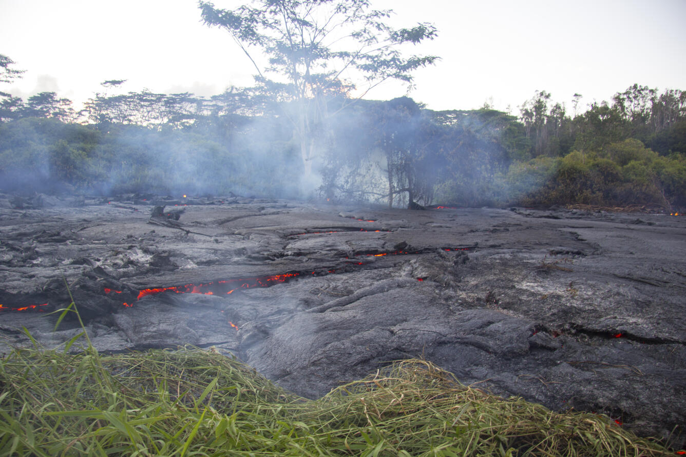
A view of the flow front from the ground, showing the pāhoehoe lava slowly moving through thick vegetation and creating thick plumes of smoke. Frequent methane explosions were occurring. These result from the cooked vegetation releasing methane, which then ignites. The explosions can range from small puffs to loud cannon-like blasts, and are an additional hazard in the immediate area of the flow margin. More information on methane explosions can be found here: https://volcanoes.usgs.gov/observatories/hvo/hvo_volcano_watch.html?vwid...
An HVO geologist marks the coordinates of the flow front with a GPS unit.
HVO geologists walk over the surface of the flow to track surface breakouts along a portion of the flow margin, about a kilometer (0.6 miles) upslope of the flow front.
Preview image for video: provides an aerial overview of the flow front.
Preview image for video: was captured at the flow front, and shows a small channelized portion of the pāhoehoe flow pouring over the dirt road embankment. Gas trapped within the flow is released via occasional small bubble bursts.
Get Our News
These items are in the RSS feed format (Really Simple Syndication) based on categories such as topics, locations, and more. You can install and RSS reader browser extension, software, or use a third-party service to receive immediate news updates depending on the feed that you have added. If you click the feed links below, they may look strange because they are simply XML code. An RSS reader can easily read this code and push out a notification to you when something new is posted to our site.