An official website of the United States government
Here's how you know
Official websites use .gov
A .gov website belongs to an official government organization in the United States.
Secure .gov websites use HTTPS
A lock () or https:// means you’ve safely connected to the .gov website. Share sensitive information only on official, secure websites.
Aerial view of Halema‘uma‘u, showing typical spattering activity at the south lake margin. Golden brown Pele's hair is covering the previous lake overflows which are darker in color. The plume was light at the time of the overflight, allowing a view of the southern wall, which recently experienced two collapses exposing the lighter wall rock beneath.
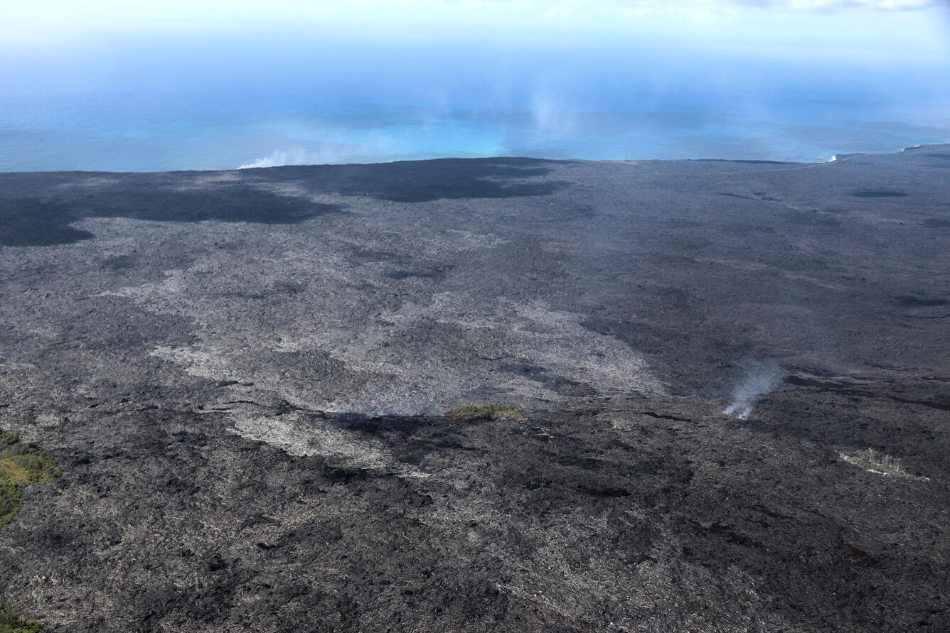
Aerial view from the top of the pali, looking towards the ocean entry. The lighter silver lava flow breakouts over the past week have spread out at the base of the pali. The closest location of activity is 1.6 km (1 mile) from the gravel road. Fume is rising from the main lava tube on the right of the image. The coastal entry plume is on the horizon, staying close to the ground near the Kamokuna delta.
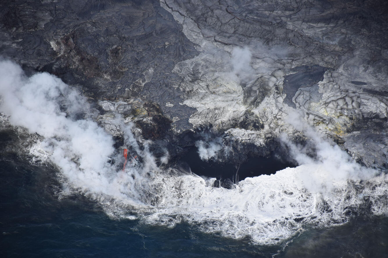
The front half of the lava delta is shown, with an open lava stream left of center. In the upper left is a circular rubble feature, called a shatter ring, which formed between Aug 15 and Sept 19, and is the source of many of the lava flows on the left (west) side of the image. Yellow sulfur can be seen on some areas on the delta as well, especially on the right hand side of this image. Today the delta was measured at approximately 10 acres (4 hectares) in size.
HVO geologists change data cards on a time-lapse camera positioned on the rim of the west pit within Pu‘u ‘Ō‘ō Crater. A lava pond has been active in this pit for over a year, and the time-lapse camera tracks changes in the pond activity.
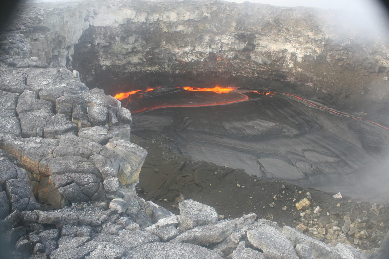
An example time-lapse image from the camera shown to the left. This image is from September 14 and shows typical activity in the lava pond, with spattering along the western pond margin.
Get Our News
These items are in the RSS feed format (Really Simple Syndication) based on categories such as topics, locations, and more. You can install and RSS reader browser extension, software, or use a third-party service to receive immediate news updates depending on the feed that you have added. If you click the feed links below, they may look strange because they are simply XML code. An RSS reader can easily read this code and push out a notification to you when something new is posted to our site.