


During a recent dive on the New England Seamount chain off the North Atlantic coast, researchers aboard the NOAA Ocean Exploration Expedition, North Atlantic Stepping Stones, discovered a marine geological feature known as a ferromanganese (Fe-Mn) nodule field in the saddle between two peaks of Gosnold Seamount.
Photo Roundup - July-August 2021
By Coastal and Marine Hazards and Resources Program
August 31, 2021
A selection of coastal and ocean images and videos from across the USGS
Sea turtle nesting habitat: Cape Hatteras and Cape Lookout National Seashores
USGS Wetland and Aquatic Research Center researchers will be surveying nesting beaches in Cape Hatteras and Cape Lookout National Seashores. They will record GPS locations for all crawls, nests, and turtles encountered/captured, and will be placing satellite tags on a subset of individuals to determine habitat use and delineate inter-nesting areas used by reproductive females. Field work for this project began in June 2021, and will continue for 3 years. Learn more

Sources/Usage: Public Domain. View Media Details

Sources/Usage: Public Domain. View Media Details

Sources/Usage: Public Domain. View Media Details
Five-year Collaborative Study Investigating Sea Turtle Nesting on Recently Nourished Beaches
Scientists RC Mickey and Dave Thompson from the USGS St. Petersburg Coastal and Marine Science Center are conducting beach surveys on nourished beaches (where sand has been added) to study influences on green sea turtle (Chelonia mydas) and loggerhead sea turtle (Caretta caretta) nesting. The scientists use a utility task vehicle (UTV) to cover a large area of beach and locate sea turtle crawls. Here, a turtle track can be seen extending down to the ocean.
This is a five-year collaborative study investigating sea turtle nesting on recently nourished beaches. The primary goal is to quantify beach parameters that may influence sea turtle nesting on nourished beaches as these beaches typically display rapid (2 to 3 years) reshaping by ocean waves. The results of the study can then be used to suggest improvements beach nourishment design such that impacts to sea turtle nesting are minimized. USGS is working with partners at US Fish and Wildlife (USFW), Florida Fish and Wildlife Conservation Commission (FWC) and University of South Florida (USF) on this National Fish and Wildlife Foundation (NFWF) funded study.
USGS's role is to map (position and elevation) the beach profile from the water line into the dune, and map turtle crawl paths at nesting decision locations using precise GPS. These GPS surveys are conducted monthly for two consecutive days during the height of sea turtle nesting season (May through September). The surveys have been conducted at four nourished beaches that also have high-density of sea turtle nesting, including Melbourne Beach, Jensen Beach, Jupiter Island, and Juno Beach. The GPS data is processed to quantify various beach parameters, including water line, dune toe, dune top, and locations of nests or false crawl apex (landward point that turtle crawled and decided not to nest) locations.

Sources/Usage: Public Domain. View Media Details

Sources/Usage: Public Domain. View Media Details

Sources/Usage: Public Domain. View Media Details
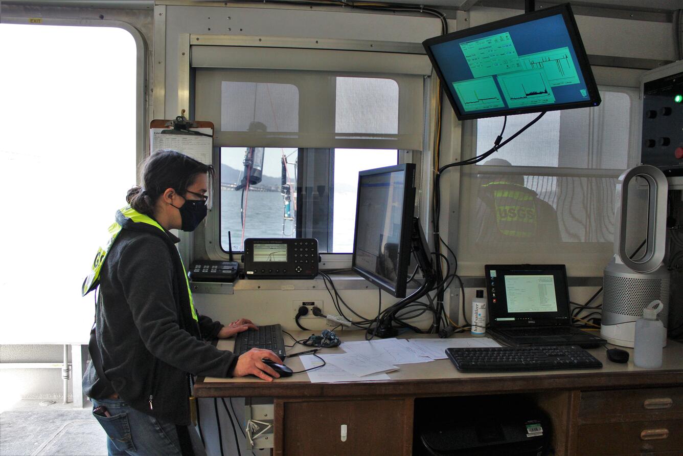
Water Quality of San Francisco Bay Research and Monitoring Project
Since 1969, the U.S. Geological Survey has maintained a research project in the San Francisco Bay-Delta system to measure and understand how estuarine systems and tidal river deltas function and change in response to hydro-climatic variability and human activities. Learn more

Sources/Usage: Public Domain. View Media Details

Sources/Usage: Public Domain. View Media Details
Sources/Usage: Public Domain. View Media Details
Waterfowl Ecology in Suisun Marsh and the Pacific Flyway
Suisun Marsh and the Central Valley of California contain some of the world’s most important wetlands, providing critical breeding and wintering habitat for many waterfowl species in the Pacific Flyway. Wetlands in the Suisun Marsh and wetland and agricultural habitats in the Central Valley support 10–12 million waterfowl wintering in or migrating through these two regions annually. Learn about USGS waterfowl research in this area from the USGS Western Ecological Research Center’s Project Webpage, or in this beautiful geonarrative.

Sources/Usage: Public Domain. View Media Details
Coral Reef Community Calcification and Metabolism
Researchers at the USGS St. Petersburg Coastal and Marine Science Center focus on forecasting and hind-casting the future and past response of coral reef calcification and growth to changes in seawater carbonate chemistry from pre-industrial time to the year 2100. Changing ocean chemistry resulting from climate change and ocean acidification also affects coral reefs at the community level. The severity of impacts to coral reefs depends, in part, on the ability of reefs to continue growing enough to keep up with rising sea level. Learn more

Sources/Usage: Some content may have restrictions. View Media Details
USGS bathymetric survey vessel on Lucky Peak Lake, southwestern Idaho
In 2004, about 90 migrating elk and 25 mule deer broke through thin ice and drowned as they attempted to cross the Mores Creek arm of Lucky Peak Lake upstream of the Highway 21 bridge. To prevent any similar incidents, reservoir managers and wildlife biologists needed a better understanding of water depths over a range of reservoir pool elevations. Learn more

Sources/Usage: Public Domain. View Media Details
2021 North Atlantic Stepping Stones Expedition
Join USGS researchers Jason Chaytor and Kira Mizell as they virtually participate in a NOAA Ocean Exploration expedition to the depths of the North Atlantic. The 2021 North Atlantic Stepping Stones: New England and Corner Rise Seamounts expedition runs from June 30 to July 29. At-sea and shore-based science teams will study deep-water habitats in the high seas, which are among the least understood ecosystems on Earth. Researchers use remotely operated vehicles to explore seamounts (steep underwater mountains) all without getting wet! USGS scientists Jason Chaytor and Kira Mizell are the expedition’s geology science leads. From land, they will work with a team to develop the dive plans, lead and narrate the dives for a world-wide audience, and coordinate science outcomes. This video highlights the collaboration between USGS and NOAA scientists as they explore the largely unmapped seafloor.
- Visit the video page for the transcript, or to access an audio-described version, or to download the video file.
- Read the USGS News Story about this expedition.
- Visit the USGS Pacific Coastal and Marine Science Center’s project website, Global Marine Mineral Resources, to learn more about our studies in these deep-sea locations.
Stepping Stones Part 2: Ferromanganese Nodules
During the recent dive on the New England Seamount chain off the North Atlantic coast, researchers aboard the NOAA Ocean Exploration Expedition “North Atlantic Stepping Stones” discovered a marine geological feature known as a ferromanganese (Fe-Mn) nodule field in the saddle between two peaks of Gosnold Seamount. These seamount-hosted nodules were an exciting find, since Fe-Mn crusts are more common in seamount settings. Marine Fe-Mn minerals are unique among marine rocks in that they grow slowly over millions of years, building layers and accumulating metals as they precipitate from seawater and/or sediment pore waters. The study of Fe-Mn deposits can yield clues about past climatic conditions and geologic history, shedding light on how the world’s oceans have changed over time.
- Visit the video page for the transcript, or to access an audio-described version, or to download the video file.
- Read the USGS News Story about this expedition.
- Visit the USGS Pacific Coastal and Marine Science Center’s project website, Global Marine Mineral Resources, to learn more about our studies in these deep-sea locations.
Related Content
Global Marine Mineral Resources
Researching seafloor mineral resources that occur within the U.S. Exclusive Economic Zone and areas beyond national jurisdictions.
Post-Hurricane Florence Sea Turtle Nesting Habitat Nest Site Selection at Cape Hatteras and Cape Lookout National Seashores
WARC researchers will be surveying nesting beaches in Cape Hatteras and Cape Lookout National Seashores. They will record GPS locations for all crawls, nests, and turtles encountered/captured, and will be placing satellite tags on a subset of individuals to determine habitat use and delineate inter-nesting areas used by reproductive females.
Bathymetric Survey of the Mores Creek Arm of Lucky Peak Lake
In 2004, about 90 migrating elk and 25 mule deer broke through thin ice and drowned as they attempted to cross the Mores Creek arm of Lucky Peak Lake upstream of the Highway 21 bridge. To prevent any similar incidents, reservoir managers and wildlife biologists needed a better understanding of water depths over a range of reservoir pool elevations.
Water Quality of San Francisco Bay Research and Monitoring Project
Since 1969, the U.S. Geological Survey has maintained a research project in the San Francisco Bay-Delta system to measure and understand how estuarine systems and tidal river deltas function and change in response to hydro-climatic variability and human activities.
Suisun Marsh Waterfowl and Wildlife Studies
Suisun Marsh provides critical habitat for wintering and breeding waterbirds in California. USGS WERC collaborates with the California Department of Water Resources to examine trends in bird declines and to assess the habitat factors driving long-term survival of waterfowl, rails, and other birds in this important area.
Coral Reef Seafloor Erosion and Coastal Hazards
Synchronized field work focused on geochemistry, geology, and metabolic processes overlaid on a habitat map of an entire reef to produce a synoptic overview of reef processes that contribute to carbonate precipitation and dissolution.

Ferromanganese Nodules—2021 North Atlantic Stepping Stones Expedition
During a recent dive on the New England Seamount chain off the North Atlantic coast, researchers aboard the NOAA Ocean Exploration Expedition, North Atlantic Stepping Stones, discovered a marine geological feature known as a ferromanganese (Fe-Mn) nodule field in the saddle between two peaks of Gosnold Seamount.

NOAA-USGS Stepping Stones 2021 Expedition
Join USGS researchers Jason Chaytor and Kira Mizell as they virtually participate in a NOAA Ocean Exploration expedition to the depths of the North Atlantic.
Join USGS researchers Jason Chaytor and Kira Mizell as they virtually participate in a NOAA Ocean Exploration expedition to the depths of the North Atlantic.
Related Content
- Science
Global Marine Mineral Resources
Researching seafloor mineral resources that occur within the U.S. Exclusive Economic Zone and areas beyond national jurisdictions.Post-Hurricane Florence Sea Turtle Nesting Habitat Nest Site Selection at Cape Hatteras and Cape Lookout National Seashores
WARC researchers will be surveying nesting beaches in Cape Hatteras and Cape Lookout National Seashores. They will record GPS locations for all crawls, nests, and turtles encountered/captured, and will be placing satellite tags on a subset of individuals to determine habitat use and delineate inter-nesting areas used by reproductive females.Bathymetric Survey of the Mores Creek Arm of Lucky Peak Lake
In 2004, about 90 migrating elk and 25 mule deer broke through thin ice and drowned as they attempted to cross the Mores Creek arm of Lucky Peak Lake upstream of the Highway 21 bridge. To prevent any similar incidents, reservoir managers and wildlife biologists needed a better understanding of water depths over a range of reservoir pool elevations.Water Quality of San Francisco Bay Research and Monitoring Project
Since 1969, the U.S. Geological Survey has maintained a research project in the San Francisco Bay-Delta system to measure and understand how estuarine systems and tidal river deltas function and change in response to hydro-climatic variability and human activities.Suisun Marsh Waterfowl and Wildlife Studies
Suisun Marsh provides critical habitat for wintering and breeding waterbirds in California. USGS WERC collaborates with the California Department of Water Resources to examine trends in bird declines and to assess the habitat factors driving long-term survival of waterfowl, rails, and other birds in this important area.Coral Reef Seafloor Erosion and Coastal Hazards
Synchronized field work focused on geochemistry, geology, and metabolic processes overlaid on a habitat map of an entire reef to produce a synoptic overview of reef processes that contribute to carbonate precipitation and dissolution. - Multimedia
Ferromanganese Nodules—2021 North Atlantic Stepping Stones Expedition
During a recent dive on the New England Seamount chain off the North Atlantic coast, researchers aboard the NOAA Ocean Exploration Expedition, North Atlantic Stepping Stones, discovered a marine geological feature known as a ferromanganese (Fe-Mn) nodule field in the saddle between two peaks of Gosnold Seamount.
During a recent dive on the New England Seamount chain off the North Atlantic coast, researchers aboard the NOAA Ocean Exploration Expedition, North Atlantic Stepping Stones, discovered a marine geological feature known as a ferromanganese (Fe-Mn) nodule field in the saddle between two peaks of Gosnold Seamount.
NOAA-USGS Stepping Stones 2021 ExpeditionJoin USGS researchers Jason Chaytor and Kira Mizell as they virtually participate in a NOAA Ocean Exploration expedition to the depths of the North Atlantic.
Join USGS researchers Jason Chaytor and Kira Mizell as they virtually participate in a NOAA Ocean Exploration expedition to the depths of the North Atlantic.
- Web Tools
- News
Get Our News
These items are in the RSS feed format (Really Simple Syndication) based on categories such as topics, locations, and more. You can install and RSS reader browser extension, software, or use a third-party service to receive immediate news updates depending on the feed that you have added. If you click the feed links below, they may look strange because they are simply XML code. An RSS reader can easily read this code and push out a notification to you when something new is posted to our site.