
Summary of Recent Hawaiian Volcano Observatory Publications and Data
See a list of recent Hawaiian Volcano Observatory publications and data releases here.
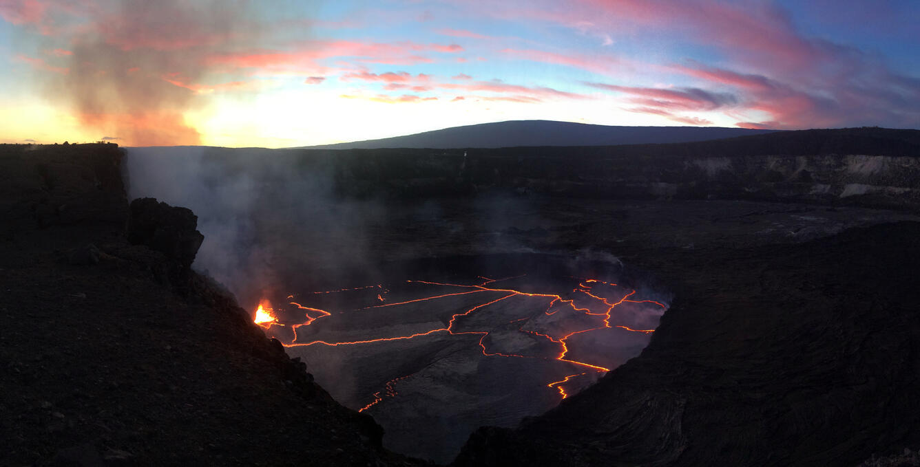
Alternately, use the "Publications" and "Data & Tools" tabs below to explore recent Hawaiian Volcano Observatory publications and data releases. Many of these publications present summaries or data for recent eruptions of Kīlauea, including the 2008-2018 summit lava lake and 2018 lower East Rift Zone and summit collapse.
Related Content
Crater geometry data for Puʻuʻōʻō, on Kīlauea Volcano’s East Rift Zone, in May 2018
Unoccupied Aircraft Systems (UAS) video of the 2018 lower East Rift Zone eruption of K'lauea Volcano, Hawaii
Groundwater chemistry in the Lower East Rift Zone and summit of Kilauea Volcano, Hawai'i
Volcanic plume heights from the summit of Kilauea Volcano, Hawai'i
Continuous gravity data from K?lauea Volcano, Hawai?i
Campaign GPS measurements on the Island of Hawai'i collected by the Hawaiian Volcano Observatory in 2019
Lava level and crater geometry data during the 2018 lava lake draining at Kilauea Volcano, Hawaii
Differential Optical Absorption Spectroscopy data acquired during the 2018 rift eruption of Kilauea Volcano
Digital elevation model of K?lauea Volcano, Hawaii, based on July 2019 airborne lidar surveys
Geospatial database of the 2018 lower East Rift Zone eruption of Kilauea Volcano, Hawaii
Gas emission and ground temperature measurements at Puhimau thermal area, Kilauea Volcano, Hawaii
Whole-rock and glass chemistry of lava samples collected during the 2018 Lower East Rift Zone eruption of Kilauea
Patterns of bubble bursting and weak explosive activity in an active lava lake—Halema‘uma‘u, Kīlauea, 2015
The historic events at Kilauea Volcano in 2018: Summit collapse, rift zone eruption, and Mw 6.9 earthquake: Preface to the special issue
Have humans influenced volcanic activity on the lower East Rift Zone of Kīlauea Volcano? A publication review
Preliminary analyses of volcanic hazards at Kīlauea Volcano, Hawai‘i, 2017–2018
The lava flow that came to Hilo—The 1880–81 eruption of Mauna Loa volcano, Island of Hawai‘i
Conversing with Pelehonuamea: A workshop combining 1,000+ years of traditional Hawaiian knowledge with 200 years of scientific thought on Kīlauea volcanism
Related Content
- Data
Filter Total Items: 14
Crater geometry data for Puʻuʻōʻō, on Kīlauea Volcano’s East Rift Zone, in May 2018
The 2018 lower East Rift Zone eruption and accompanying summit collapse of Kīlauea Volcano, Hawaiʻi, comprised one of the most impactful events on the volcano in the past 200 years, with hundreds of homes destroyed and major changes in the topography of the summit caldera. The opening stages of this eruptive sequence started on 30 April, when a magmatic dike began moving east from Puʻuʻōʻō, a conUnoccupied Aircraft Systems (UAS) video of the 2018 lower East Rift Zone eruption of K'lauea Volcano, Hawaii
This dataset contains Unoccupied Aircraft Systems (UAS) footage from the 2018 eruption of K'lauea Volcano's lower East Rift Zone (LERZ), Island of Hawai'i. The four-month-long eruption, from May 3 to September 5, produced lava flows that destroyed 723 structures, inundated 35.5 km2 of land, and added 3.5 km2 of new land to the Island of Hawai'i. There are 1178 UAS videos in this publication, recorGroundwater chemistry in the Lower East Rift Zone and summit of Kilauea Volcano, Hawai'i
Chemical and isotopic analyses are reported for water samples collected from water supply wells, a geothermal well in the Puna Geothermal Venture (PGV) power plant, a hot spring in the Puna District, a research well on the summit of Kilauea Volcano (informally called "NSF Well", or "Keller Well "), and a water catchment in the headquarters area of Hawai'i Volcanoes National Park, Hawai'i. These waVolcanic plume heights from the summit of Kilauea Volcano, Hawai'i
This data release provides volcanic plume heights from the summit of Kilauea Volcano for 2008-2015, and during the eruptive events of 2018. For 2018, a Secacam Wild Vision Full HD camera with a 7mm focal length was located at 1717 m elevation approximately 15 m south of the Mauna Loa Strip Road within Hawai'i Volcanoes National Park, 19.475843degreesN, 155.363560degreesW (WGS84). The camera was poContinuous gravity data from K?lauea Volcano, Hawai?i
This Data Release contains continuous gravity records from two instruments on Kilauea Volcano, Hawaiʻ'i the HOVL gravimeter, located on the east rim of Halema'uma'u Crater directly above the 2008-2018 summit eruptive vent, and the PUOC gravimeter, located on northern rim of Puu Oo crater on Kīlauea's East Rift Zone. Both instruments were collocated with GNSS stations. The HOVL gravimeter was instaCampaign GPS measurements on the Island of Hawai'i collected by the Hawaiian Volcano Observatory in 2019
This dataset includes raw and rinex data from 2019 campaign gps data from the Island of Hawai'i in 2019. There were a total of 69 sites occupied. All data is included along with metadata, log sheets and raw/rinex data.Lava level and crater geometry data during the 2018 lava lake draining at Kilauea Volcano, Hawaii
In May 2018, the onset of new eruptive activity on the lower flank of Kīlauea Volcano, Hawaiʻi, accompanied the draining of the lava lake at the summit, 40 km upslope. The lava lake draining lasted over seven days, and transitioned into the largest collapse event at the summit of Kīlauea in over 200 years, with the paired flank and summit activity marking a historic episode in the modern record ofDifferential Optical Absorption Spectroscopy data acquired during the 2018 rift eruption of Kilauea Volcano
A fissure eruption occurred in K?lauea Volcano?s Lower East Rift Zone (LERZ) from April to September 2018. During this event, volcanic gases were emitted from three active areas on the volcano. The most intense degassing occurred at the active fissures in the LERZ, thus causing parts of Hawai?i Island?s Puna district to be exposed to life-threatening sulfur dioxide (SO2) concentrations. At the samDigital elevation model of K?lauea Volcano, Hawaii, based on July 2019 airborne lidar surveys
The 2018 eruption of Kilauea Volcano on the Island of Hawaii saw the collapse of a new, nested caldera at the volcano?s summit, and the inundation of 35.5 square kilometers (13.7 square miles) of the lower Puna District with lava. Between May and August, while the summit caldera collapsed, a lava channel extended 11 kilometers (7 miles) from fissure 8 in Leilani Estates to Kapoho Bay, where it forGeospatial database of the 2018 lower East Rift Zone eruption of Kilauea Volcano, Hawaii
The 2018 lower East Rift Zone eruption of Kilauea Volcano began in the late afternoon of 3 May, with fissure 1 opening and erupting lava onto Mohala Street in the Leilani Estates subdivision, part of the lower Puna District of the Island of Hawaii. For the first week of the eruption, relatively viscous lava flowed only within a kilometer (0.6 miles) of the fissures within Leilani Estates, before aGas emission and ground temperature measurements at Puhimau thermal area, Kilauea Volcano, Hawaii
Puhimau thermal area, located in the upper East Rift Zone of K?lauea Volcano, Hawai`i formed around 1936 when heat and gases migrated to the surface following a magma intrusion. As of April 2020, the area is about 0.2 km2 in size with regions of steaming ground. The site may be valuable for monitoring changes in gas and heat emissions related to movement of magma down the rift zone. On November 4-Whole-rock and glass chemistry of lava samples collected during the 2018 Lower East Rift Zone eruption of Kilauea
This data release contains selected results of whole-rock and glass analyses of lava samples collected during the 2018 eruption of Kilauea's lower East Rift Zone (LERZ). Included are sampling-site information, eruptive vent/fissure, and sampling descriptions. During the 2018 LERZ eruption, the chemical analysis of lava samples was performed within hours of collection using an energy-dispersive X-r - Publications
Patterns of bubble bursting and weak explosive activity in an active lava lake—Halema‘uma‘u, Kīlauea, 2015
The rise of the Halemaʻumaʻu lava lake in 2013–2018 to depths commonly 40 meters or less below the rim of the vent was an excellent opportunity to study outgassing and the link to associated eruptive activity. We use videography to investigate the rise and bursting of bubbles through the free surface of the lake in 2015. We focus on low-energy explosive activity (spattering) in which the ascent anAuthorsBianca G. Mintz, Bruce F. Houghton, Edward W. Llewellin, Tim R. Orr, Jacopo Taddeucci, Rebecca J. Carey, Ulrich Kueppers, Damien Gaudin, Matthew R. Patrick, Michael Burton, Piergiorgio Scarlato, Alessandro La SpinaThe historic events at Kilauea Volcano in 2018: Summit collapse, rift zone eruption, and Mw 6.9 earthquake: Preface to the special issue
Kīlauea Volcano, on the Island of Hawaiʻi, has had a prominent role in the science of volcanology, and a long history of generating new insights into how volcanoes operate (Tilling et al. 2014; Garcia 2015). Native Hawaiians shared ideas on the behavior of the volcano with early Western visitors to Kīlauea, addressing the basic geometry of magma supply and transport (Ellis 1825; Bishop 1827). ThAuthorsMatthew R. Patrick, Ingrid Johanson, Thomas Shea, Greg WaiteHave humans influenced volcanic activity on the lower East Rift Zone of Kīlauea Volcano? A publication review
Since the 2018 eruption of Kīlauea Volcano, the topic of whether commercial developments not only caused the eruption to occur in the lower East Rift Zone (LERZ), but also caused its high eruption rate has been a subject of public discussion. We review Kīlauea Volcano publications from the past several decades and show that the eruptive behavior of the volcano has varied and that the 2018 eruptionAuthorsJames P. Kauahikaua, Frank A. TrusdellPreliminary analyses of volcanic hazards at Kīlauea Volcano, Hawai‘i, 2017–2018
From 2017 to 2018, the U.S. Geological Survey (USGS) Hawaiian Volcano Observatory (HVO) responded to ongoing and changing eruptions at Kīlauea Volcano as part of its mission to monitor volcanic processes, issue warnings of dangerous activity, and assess volcanic hazards. To formalize short-term hazards assessments—and, in some cases, issue prognoses for future activity—and make results discoverablAuthorsChristina A. Neal, Kyle R. AndersonThe lava flow that came to Hilo—The 1880–81 eruption of Mauna Loa volcano, Island of Hawai‘i
The Mauna Loa eruption sequence of 1880–81 consists of two eruptions. The May 1880 eruption in Mokuʻāweoweo at the summit of Mauna Loa lasted just a few days and was followed 6 months later by three lava flows that issued from vents along the Northeast Rift Zone. The November 1880 eruption lasted almost a year and one of its flows nearly reached Hilo Bay.Public reaction in Hilo to the advancing laAuthorsJames P. Kauahikaua, Ben Gaddis, Ku`ulei Kanahele, Ken Hon, Valerie WasserConversing with Pelehonuamea: A workshop combining 1,000+ years of traditional Hawaiian knowledge with 200 years of scientific thought on Kīlauea volcanism
The events surrounding volcanic eruptions and damaging earthquakes in Hawai‘i have often been described in journals, letters, and newspapers articles in the English language; however, the Hawaiian nation was among the most literate of countries in the 19th century, and many Hawaiian-language newspapers were in circulation through all but the earliest decades of the 19th century. Any modern reconst
Get Our News
These items are in the RSS feed format (Really Simple Syndication) based on categories such as topics, locations, and more. You can install and RSS reader browser extension, software, or use a third-party service to receive immediate news updates depending on the feed that you have added. If you click the feed links below, they may look strange because they are simply XML code. An RSS reader can easily read this code and push out a notification to you when something new is posted to our site.