
Volcano Watch — Helicopter pilots and mechanics crucial for monitoring and observing active volcanoes
Helicopter pilots and mechanics crucial for monitoring and observing active volcanoes.
Ask almost any volcanologist and field technician what they consider to be the most important and yet potentially dangerous aspect of their work on active volcanoes and they will probably say, "flying in a helicopter to remote areas to make observations or install and maintain monitoring instruments and radio systems."
Consider what it takes to land in the middle of a jagged lava flow or near the edge of a deep crater to service the monitoring network many dozens of times in a year. Or, landing at more than 30 sites on many different lava flows at least twice in the span of a week to complete an annual GPS survey to determine the way in which a volcano deforms from year to year.
Lava flows are highly irregular with surface relief measured in meters (yards), and almost never level even over the narrow width of a small helicopter's skids. A pilot has to pick a landing spot to place the skids so they're level side-to-side and front-to-back, and with plenty of room between the tail rotor and ground. On any single flight day, the pilot might have to repeat this maneuver a few dozen times.
One of the most challenging environments for a small helicopter's capability and a pilot’s skill is flying at high elevation (considered above 2,440 m or 8,000 ft above sea level). The helicopter's rapidly turning rotors create lift to keep the aircraft aloft, but lift efficiency is strongly affected by air density. At high elevations, lower air density decreases lift, reducing maneuverability and the payload that a helicopter can carry.
The top of Mauna Loa Volcano is at 4,170 m (13,680 ft) above sea level. Since the 1984 eruption, we have installed dozens of instruments and radio hubs at high elevation, many of which have solar power and radio systems that need regular maintenance and upgrades. Just a few months ago, HVO installed new Web cams on the volcano's Southwest Rift Zone and south rim of the summit caldera as high as 4,046 m (13,275 ft).
These and many other monitoring stations on Kīlauea, Hualālai, and Mauna Kea volcanoes were installed, and subsequently maintained, with helicopter support. The skill and keen observational ability of pilots, and the resolve of mechanics working behind the scenes to maintain the helicopters, make it possible for us to work at remote sites again and again, and return home safely at the end of the day, every day.
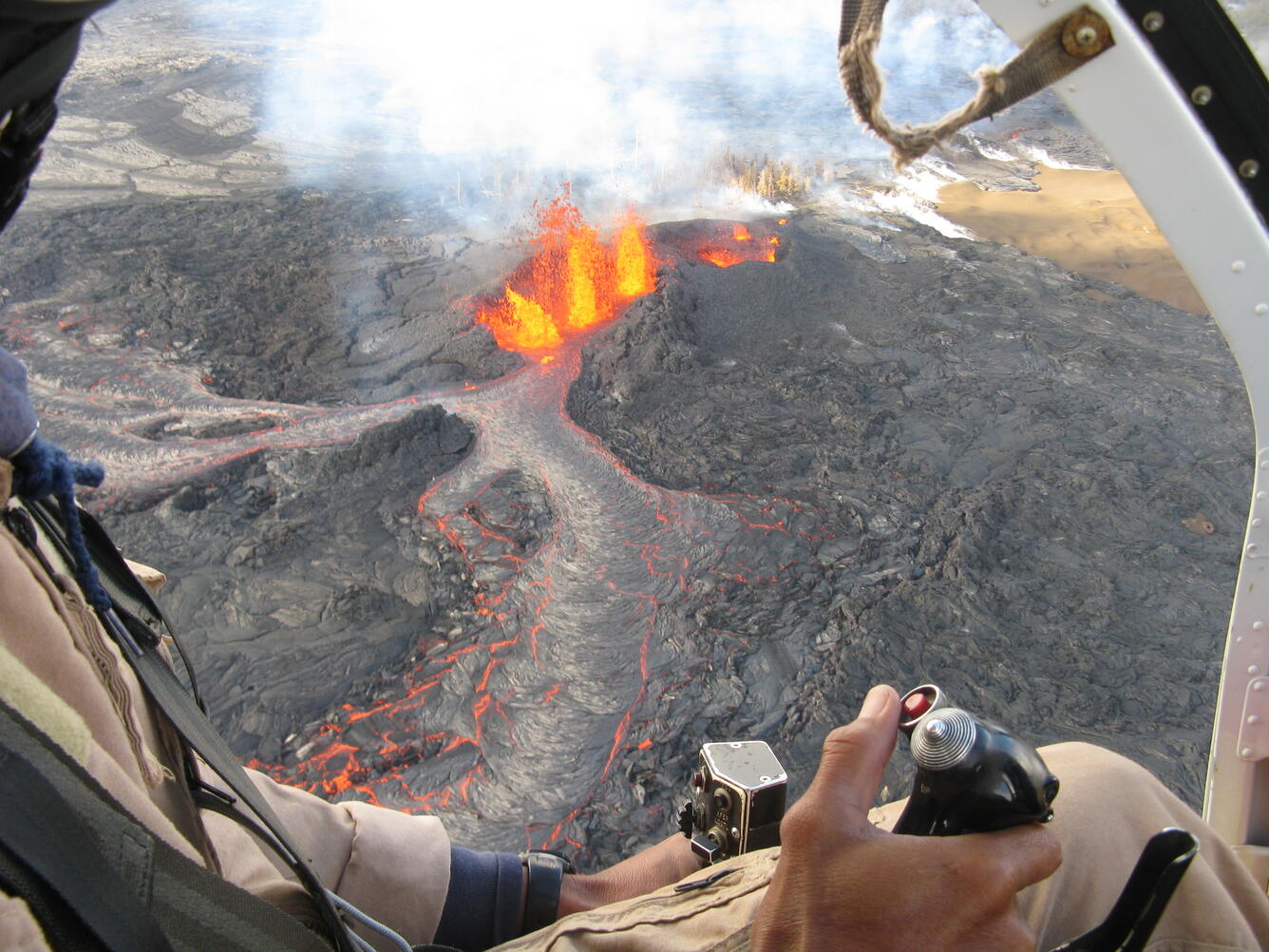
Pilot skill is also critical to position the helicopter at just the right distance from and height above an active lava flow so that we can take a series of photographs (hundreds!) and thermal video that allow us to create accurate maps of the flow that we routinely share with Civil Defense, post on the HVO Web site, and use for research. You can find recent examples of these on our web site: http://hvo.wr.usgs.gov/maps/
A helicopter flight may appear as routine as driving to the grocery store, but thinking so invites misfortune. The professionalism shown by pilots and mechanics and their commitment to safe flight—witnessed every time we board their aircraft—means that we can perform our mission with confidence.
Mahalo nui loa to current and past companies, most of all to their pilots and mechanics, who, over the years, have made it possible to build and sustain one of the best volcano-monitoring networks in the world here on the Island of Hawai‘i.
Volcano Activity Update
Kīlauea continues to erupt at its summit and East Rift Zone. This past week, when measured directly, the summit lava lake level varied between 11 and 17.5 m (36–57 ft) below the vent rim. The 61g lava flowcontinued to enter the ocean near Kamokuna. Activity has been concentrated at the front of the east delta. The lava flow does not pose an immediate threat to nearby communities.
Mauna Loa is not erupting. During the past week, earthquakes occurred primarily beneath the summit and upper Southwest Rift Zone at depths less than 5 km (3 mi). Additional earthquakes occurred in the Ka‘ōiki area of the east flank between Kīlauea and Mauna Loa, mostly in the 5–11 km (3–7 mile) depth range. GPS measurements continue to show deformation related to inflation of a magma reservoir beneath the summit and upper Southwest Rift Zone, with inflation occurring mainly in the southwestern part of the magma storage complex.
No earthquakes were reported felt on the Island of Hawai‘i this past week.
Get Our News
These items are in the RSS feed format (Really Simple Syndication) based on categories such as topics, locations, and more. You can install and RSS reader browser extension, software, or use a third-party service to receive immediate news updates depending on the feed that you have added. If you click the feed links below, they may look strange because they are simply XML code. An RSS reader can easily read this code and push out a notification to you when something new is posted to our site.