Volcano Watch — High-flying NASA aircraft instruments simulate future satellite images over Hawaiian volcanoes
From late January through February, 2017, NASA is conducting this high-altitude airborne remote sensing data collection campaign over the State of Hawaii. Several NASA-funded, multi-year projects will use these data to study coral reefs and volcanic processes.
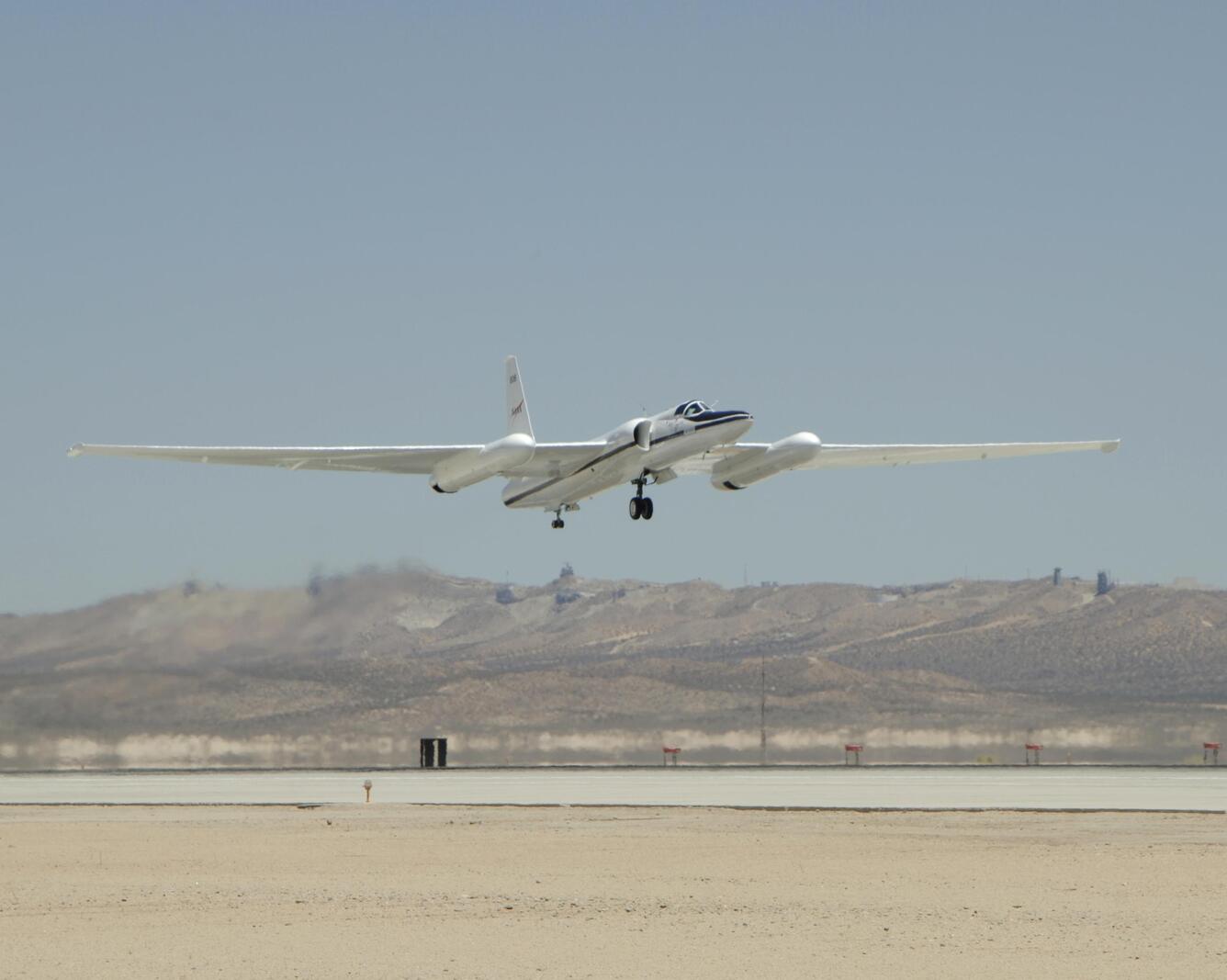
If you’re on the Island of O‘ahu and notice an unusual airplane landing and taking off from the KāneOHE Bay Marine Corps Base, you might be seeing NASA's ER-2 aircraft.
This aircraft is a modified U-2 reconnaissance plane designed to collect scientific data at high altitudes. These data will help scientists calibrate, validate, and simulate remote sensing data from future satellites that will eventually orbit the Earth at even higher altitudes. "Remote sensing" refers to the use of imaging technology that allows us to see the world in a new light, from a remote and unique vantage point.
From late January through February, 2017, NASA is conducting this high-altitude airborne remote sensing data collection campaign over the State of Hawaii. Several NASA-funded, multi-year projects will use these data to study coral reefs and volcanic processes.
The data will also be used to help develop a future Earth observing satellite instrument called the Hyperspectral Infrared Imager (HyspIRI). If funded, HyspIRI will be a global mission that will provide crucial information for studying the world's ecosystems, as well as natural hazard events, such as volcanic eruptions, wildfires, and drought.
To replicate the characteristics of data collected by Earth observing sensors aboard orbiting satellites, the ER-2 will cruise at an altitude of about 65,000 feet (above 95 percent of Earth's atmosphere) with a diverse suite of instruments. In its wing pods and under the fuselage, it carries the Airborne Visible Infrared Imaging Spectrometer (AVIRIS - http://aviris.jpl.nasa.gov/index.html), the MODIS-ASTER Airborne Simulator (MASTER - https://masterweb.jpl.nasa.gov/), and the Hyperspectral Thermal Emission Spectrometer (HyTES - https://hytes.jpl.nasa.gov/).
These instruments are designed to measure reflected and emitted radiation (light) in hundreds of distinct wavelengths, from the visible through the thermal infrared parts of the electromagnetic spectrum. Such data give us quantitative information about surface composition, texture, and temperature of the ground. This information, combined with field-based measurements, enables scientists to study a variety of atmospheric, geologic, and ecological processes to better understand our natural environment and how our environment responds to human activities.
On the Island of Hawai‘i, with the support of USGS Hawaiian Volcano Observatory scientists and the National Park Service, research scientists from universities, NASA, and the U.S. Geological Survey are conducting field work and collecting data. They are using these data to investigate (1) links between vegetation health and volcanic gas and thermal emissions; (2) volcanic thermal anomalies; (3) the composition and chemical evolution of volcanic gas plumes from Kīlauea Volcano; and (4) active volcanic processes and hazards, such as surface lava flow activity.
The overarching goals of this mission and the related scientific research projects are to characterize key volcanic processes, such as the rate of magma ascent to the surface, the amount of lava being erupted per day at Kīlauea, and interpretation of possible eruption precursors. Lessons learned should help scientists inform emergency response agencies and the public before, during, and after future eruptions.
Specific questions that this mission will address include: How do volcanoes signal impending eruptions through changes in surface temperature, gas and aerosol emission rates, or health and extent of vegetation cover? How can we improve forecasts of volcanic activity? How can we mitigate the impacts of eruptions by remotely measuring surface temperature and volcanic gas emission rates?
This research, conducted in one of the best natural volcanic laboratories on Earth, will help us answer these questions, and ultimately extend this knowledge to the monitoring of other active volcanoes around the world.
Volcano Activity Update
Kīlauea continues to erupt at its summit and East Rift Zone. This past week, the summit lava lake level varied between about 15 and 34 m (49–112 ft) below the vent rim. The 61g flow was still active, with lava entering the ocean near Kamokuna and surface breakouts near Pu‘u ‘Ō‘ō. The 61g flows do not pose an immediate threat to nearby communities.
Mauna Loa is not erupting. During the past week, small-magnitude (up to magnitude 3.0) earthquakescontinued, primarily beneath the upper Southwest Rift Zone and the Northeast Rift zone at depths less than 5 km (3 miles). A small number of earthquakes also occurred on the west flank of the volcano at depths above 13 km (8 miles). Global Positioning System (GPS) measurements continue to show deformation related to inflation of a magma reservoir beneath the summit and upper Southwest Rift Zone.
Three earthquakes were reported felt in Hawaii this past week. On February 3, 2017, at 10:07 a.m., HST, a magnitude-2.8 earthquake occurred 4.8 km (3.0 mi) north of Mauna Loa's summit at a depth of 10 km (6 mi), and at 12:41 a.m., a magnitude-3.4 earthquake occurred 13.8 km (8.6 mi) southeast of Kīlauea's summit at a depth of 9 km (5 mi). On February 6, at 12:08 a.m., a magnitude-3.0 earthquake occurred 69.1 km (42.9 mi) southwest of Mākena, Maui, at a depth of 44 km (27 mi).
Get Our News
These items are in the RSS feed format (Really Simple Syndication) based on categories such as topics, locations, and more. You can install and RSS reader browser extension, software, or use a third-party service to receive immediate news updates depending on the feed that you have added. If you click the feed links below, they may look strange because they are simply XML code. An RSS reader can easily read this code and push out a notification to you when something new is posted to our site.


