Volcano Watch — Kīlauea Volcano's eruptions offer picturesque viewing opportunities
What an exciting time for Kīlauea volcano-watchers!
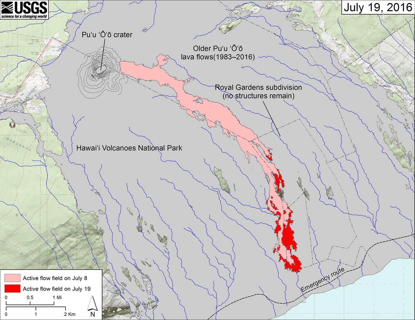
Simultaneous eruptions at the summit and along the East Rift Zone of Kīlauea might be old news, but a change in late May has created some excitement: a new vent opened on the eastern flank of Pu‘u ‘Ō‘ō and is now sending lava down the south flank of Kīlauea and across the coastal plain for the first time since 2013.
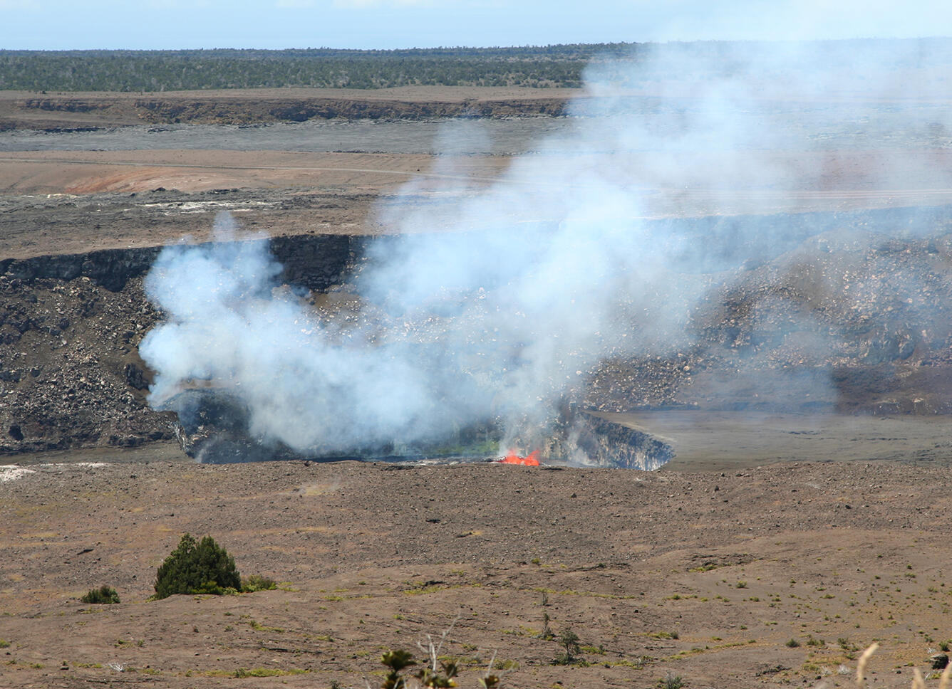
At Kīlauea's summit, the sloshing, splashing lava lake within the Halema‘uma‘u Crater vent has been high enough at times that spatter (bits of molten lava) is occasionally visible from the Jaggar Museum overlook in Hawai‘i Volcanoes National Park. At night, spectacular views of reddish glow against the dark sky and Milky Way have enthralled visitors.
The new Pu‘u ‘Ō‘ō lava flow has been informally named "61g," as it is the 7th flow (g) in the 61st episode of the ongoing Kīlauea East Rift Zone eruption, which began in 1983. The flow now extends roughly 10 km (6 miles) from the vent, and is advancing to the southeast along the eastern border of Hawai‘i Volcanoes National Park.
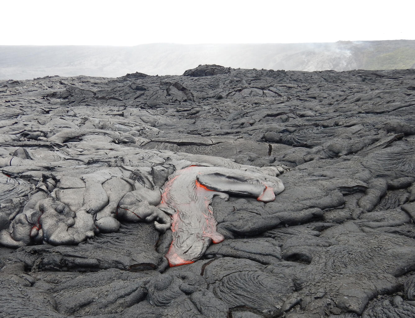
Closer to the vent at Pu‘u ‘Ō‘ō, molten lava moves downslope beneath a newly solidified lava surface through a system of lava tubes. It then streams over Pūlama pali, a lava-mantled fault scarp, where, at times, the lava produces impressive ‘a‘ā channels on the steep slopes. On the more gentle gradients of the coastal plain, the flow advances as slower-moving pāhoehoe lava lobes and sheets.
The lava flow front remains active, but has made little forward progress toward the ocean in the past two weeks. As of July 20, the flow front remained about 720 m (0.4 mi) from the emergency road and 850 m (0.5 mi) from the ocean. A few hundred meters (yards) upslope of the flow front, breakouts of pāhoehoe lava continue to widen the flow margins.
Visitors hoping to view the flow should consult access and critical safety information before attempting the long hike. Lava-viewing information is available from both the National Park (http://www.nps.gov/havo/planyourvisit/lava2.htm)
and Hawai‘i County (http://www.hawaiicounty.gov/lava-viewing/).
At this point, we cannot say with certainty if or when lava might reach the ocean. If it does, a different set of hazards—from steam explosions to collapsing lava deltas—will impact lava-viewing opportunities. Staying informed will help you stay safe.
To keep up with recent Kīlauea activity, you can sign up for daily updates via email and text message through the free USGS Volcano Notification Service (http://volcanoes.usgs.gov/vns/). You can also visit the USGS Hawaiian Volcano Observatory website (hvo.wr.usgs.gov) for daily updates, recent photos, maps, and other resources.
Volcano Activity Update
Mauna Loa is not erupting. The volcano is, however, restless, with rates of deformation and seismicityremaining above long-term background levels. During the past week, small earthquakes occurred beneath the west and north flanks of Mauna Loa, mostly in the 5–11 km (3–7 mi) depth range. Earthquakes are also occurring in the south caldera and upper Southwest Rift Zone of Mauna Loa at depths less than 5 km (3 mi). Global Positioning System (GPS) measurements show deformation related to inflation of a magma reservoir beneath the summit and upper Southwest Rift Zone, with inflation occurring mainly in the southwestern part of the magma storage complex.
One earthquake was reported felt on the Island of Hawai‘i in the past week. On July 15, 2016, at 11:11 p.m., HST, a magnitude-2.5 earthquake occurred 7.1 km (4.4 mi) southeast of Pāhoa at a depth of 3.0 km (1.9 mi).
Get Our News
These items are in the RSS feed format (Really Simple Syndication) based on categories such as topics, locations, and more. You can install and RSS reader browser extension, software, or use a third-party service to receive immediate news updates depending on the feed that you have added. If you click the feed links below, they may look strange because they are simply XML code. An RSS reader can easily read this code and push out a notification to you when something new is posted to our site.


