
Picture of Paul H Rydlund, new profile picture. Picture was taking on 12/21/2023.
Multimedia
Images

Paul new profile picture.
Picture of Paul H Rydlund, new profile picture. Picture was taking on 12/21/2023.

Gage Greatness Bracket Round 1
At the USGS, we monitor our nation’s water. Our data informs many people, from kayakers to water managers. Gage Greatness allows any Twitter user to vote for their favorite gage (data collection station).
At the USGS, we monitor our nation’s water. Our data informs many people, from kayakers to water managers. Gage Greatness allows any Twitter user to vote for their favorite gage (data collection station).

Illinois River Basin Airborne Electromagnetic Survey Area
This map shows the airborne geophysical survey area and planned flight paths across the Illinois River Basin in Illinois and northwest Indiana. Surveys will not occur directly over areas that are populated. Planned flight lines and survey progress can be found online.
(USGS map)
This map shows the airborne geophysical survey area and planned flight paths across the Illinois River Basin in Illinois and northwest Indiana. Surveys will not occur directly over areas that are populated. Planned flight lines and survey progress can be found online.
(USGS map)

NPS biological technician with white-tailed deer
National Park Service Biological Technician Eileen Kramer harvests her first white-tailed deer in New York.
National Park Service Biological Technician Eileen Kramer harvests her first white-tailed deer in New York.
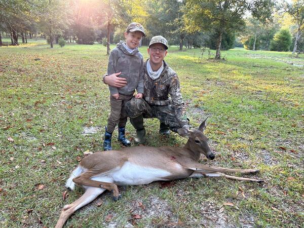
USGS research biologist and son with white-tailed deer
USGS Research Biologist Nathan Johnson’s son Bryce harvests his first white-tailed deer on private property near High Springs, Florida.
USGS Research Biologist Nathan Johnson’s son Bryce harvests his first white-tailed deer on private property near High Springs, Florida.

USGS, CMWSC, Hydrologic Technician Prepares to Monitor Lake Bathymetric Data
USGS, Central Midwest Water Science, Hydrologic Technician, Daniel Grant is preparing to monitor lake bathymetric data on a Cook County Illinois lake.
USGS, Central Midwest Water Science, Hydrologic Technician, Daniel Grant is preparing to monitor lake bathymetric data on a Cook County Illinois lake.
Videos

NGWOS AEMs For Illinois - Aerially Mapping the Illinois River Basin
The USGS is bringing expertise in the use of airborne electromagnetic (AEM) surveys to support groundwater studies. Like medical imaging allows us to non-invasively measure inside the human body, AEM surveys help to investigate Earth's subsurface without the need for expensive drilling.
The USGS is bringing expertise in the use of airborne electromagnetic (AEM) surveys to support groundwater studies. Like medical imaging allows us to non-invasively measure inside the human body, AEM surveys help to investigate Earth's subsurface without the need for expensive drilling.
")
NGWOS AEMs For Illinois - Aerially Mapping the Illinois River Basin (AD)
The USGS is bringing expertise in the use of airborne electromagnetic (AEM) surveys to support groundwater studies. Like medical imaging allows us to non-invasively measure inside the human body, AEM surveys help to investigate Earth's subsurface without the need for expensive drilling.
The USGS is bringing expertise in the use of airborne electromagnetic (AEM) surveys to support groundwater studies. Like medical imaging allows us to non-invasively measure inside the human body, AEM surveys help to investigate Earth's subsurface without the need for expensive drilling.

USGS Continuous Nutrient Monitoring in the Mississippi River Basin
USGS “supergages” are very complex. Continuous concentrations of nutrients and streamflow are measured at supergages and the information is available to the public in real-time.
USGS “supergages” are very complex. Continuous concentrations of nutrients and streamflow are measured at supergages and the information is available to the public in real-time.
")
The Phragmites Adaptive Management Framework (PAMF)
This is an introductory video to an adaptive management approach for the invasive plant Phragmites australis in the Great Lakes basin. An adaptive management framework is an iterative process of robust decision making aimed at reducing uncertainty over time, for a variety of stakeholders with differing backgrounds and interests, via system monitoring.
This is an introductory video to an adaptive management approach for the invasive plant Phragmites australis in the Great Lakes basin. An adaptive management framework is an iterative process of robust decision making aimed at reducing uncertainty over time, for a variety of stakeholders with differing backgrounds and interests, via system monitoring.

Timelapse of Brandon Road Lock during USGS Dye Study
This is a timelapse video of a dye tracer study at Brandon Road Lock, a U.S. Army Corps of Engineers (USACE) facility in Joliet, IL, on the Des Plaines River on October 20, 2015.
This is a timelapse video of a dye tracer study at Brandon Road Lock, a U.S. Army Corps of Engineers (USACE) facility in Joliet, IL, on the Des Plaines River on October 20, 2015.

Visualizing Flow Through the Brandon Road Lock & Dam
This video portrays two areas near the Brandon Road Lock and Dam, a US Army Corps of Engineers facility in Joliet, IL. This video was collected as the lock was emptied through the downstream valves, refilled with water, and then emptied again. This data collection is supporting efforts to combat the spread of invasive Asian carp into the Great Lakes Basin.
This video portrays two areas near the Brandon Road Lock and Dam, a US Army Corps of Engineers facility in Joliet, IL. This video was collected as the lock was emptied through the downstream valves, refilled with water, and then emptied again. This data collection is supporting efforts to combat the spread of invasive Asian carp into the Great Lakes Basin.
Webcams
Kankakee River near Wilmington IL
Controllable webcam that is located on IL-53 and Will Road on the Kankakee River near Wilmington, Illinois.
Controllable webcam that is located on IL-53 and Will Road on the Kankakee River near Wilmington, Illinois.
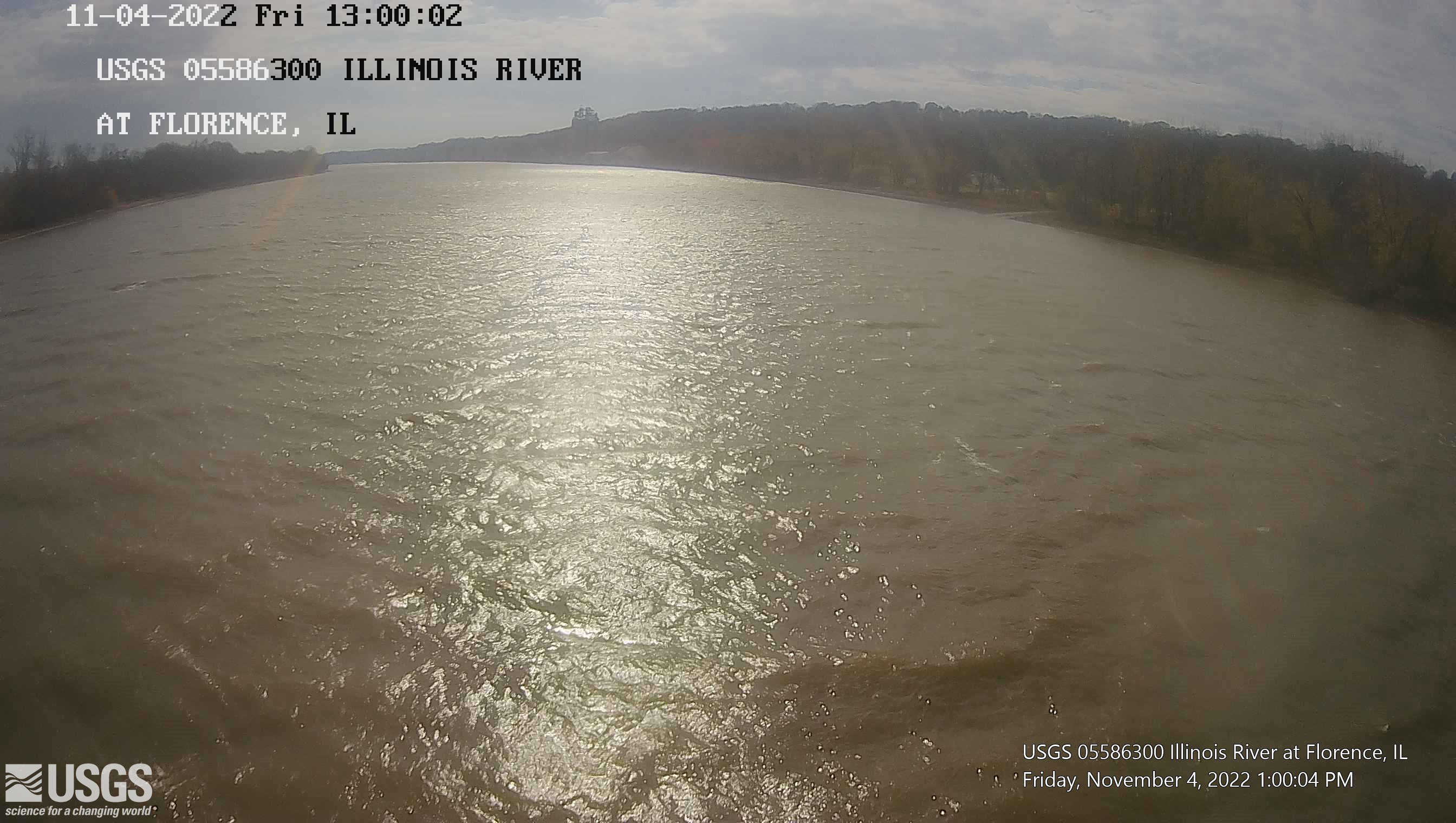
Streamgage 05586300 Illinois River at Florence, IL
Webcam at USGS Streamgage 05586300 Illinois River at Florence, IL.
Visit Water Data For the Nation to get current data for this site.
Webcam at USGS Streamgage 05586300 Illinois River at Florence, IL.
Visit Water Data For the Nation to get current data for this site.
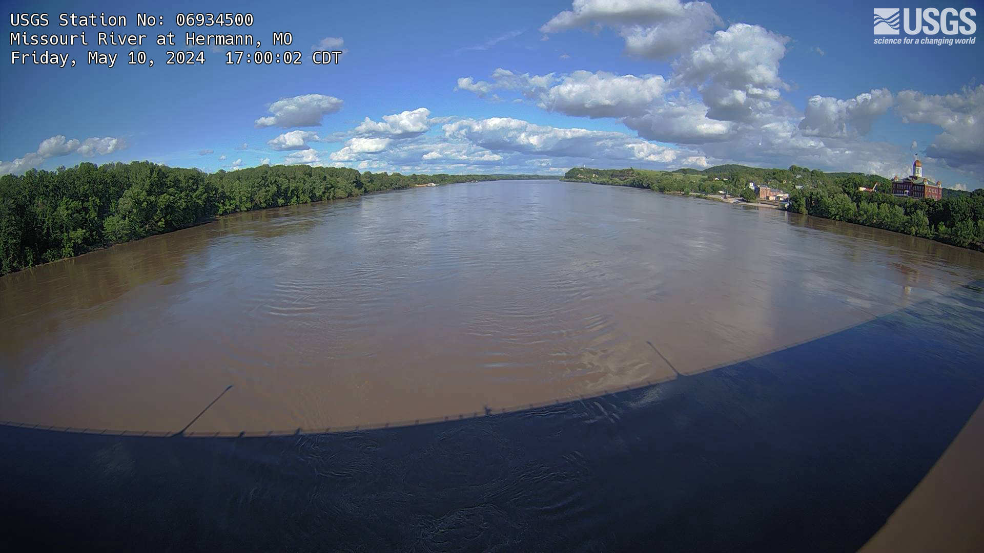
Missouri River at Hermann, MO (06934500)
The webcam is located on a gaging station (06934500) on the Missouri River in Hermann, MO. View the current conditions at the gaging station.
The webcam is located on a gaging station (06934500) on the Missouri River in Hermann, MO. View the current conditions at the gaging station.
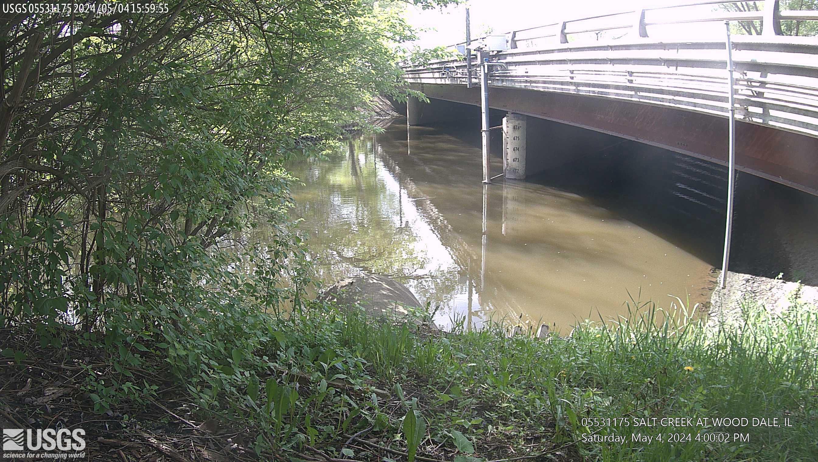
Salt Creek at Wood Dale, IL (05531175)
This site is located at Irving Park Road in Wood Dale, Illinois. The time is reported in Central Standard Time and the bridge-pier elevations are referenced to NGVD 1929.
This site is operated in cooperation with the DuPage County, Illinois, Stormwater Management Division
This site is located at Irving Park Road in Wood Dale, Illinois. The time is reported in Central Standard Time and the bridge-pier elevations are referenced to NGVD 1929.
This site is operated in cooperation with the DuPage County, Illinois, Stormwater Management Division