
Southwest Study Area Water-Quality Data Completed
In southwest Colorado, drought, wildfires, mining activities, agriculture, and population growth have altered the landscape from its natural condition. These changes have potentially degraded the water-quality of streams, rivers, reservoirs, and groundwater by introducing or increasing levels of metals, nutrients, synthetic organic chemicals, and sediment.
Recognizing the need to understand how these changes affect the receiving waters, local, State, Tribal, and Federal agencies expressed a desire for a compilation and analysis of existing water-resources information.
A comprehensive, watershed-scale, study was conducted as a result, to update information pertaining to surface-water quality, streamflow, groundwater quality, and water-table elevations in southwest Colorado. This common data repository provides an invaluable contribution to the planning, monitoring, conservation, and management of water resources in southwest Colorado.
OBJECTIVES:
- To compile and characterize existing water-resources data for the Dolores River and San Juan River watersheds.
- To develop a relational database containing information on water-quality and Geographic Information System (GIS) features/coverages.
- To create a Web-based interface to the relational database to streamline sharing of data.
- To identify gaps in the available data and design a water-quality sampling network to fill these gaps.
APPROACH:
Historic surface-water and groundwater quality data, instantaneous streamflow data associated with a water-quality sample, and water-table elevations that are available in electronic form were compiled and screened for the Dolores River and San Juan River watersheds.
- The historic water-quality data and published reports for the Dolores River and San Juan River watersheds will be used to develop an interpretive retrospective analysis. The retrospective analysis will include: a description of the spatial and temporal distribution of physical and chemical data,
- a statistical summary of the data including range, maximum, minimum and mean values,
- a comparison of the historic data to State and Federal water-quality standards,
- an analysis of trends at sites where the length of record is sufficient, and (5) an evaluation of the environmental and cultural factors, such as geology and land use, that affect water quality within the limits of the available data.
Below are other science projects associated with the Colorado Water-Quality Data Repository.

Upper Yampa Watershed Water-Quality Data

Eagle River Water-Quality Data

Piceance Basin Water-Quality Data

Upper Gunnison River Water-Quality Data

Roaring Fork Watershed Water-Quality Data

Arkansas River Water-Quality Data

Blue River Water-Quality Data
- Overview
In southwest Colorado, drought, wildfires, mining activities, agriculture, and population growth have altered the landscape from its natural condition. These changes have potentially degraded the water-quality of streams, rivers, reservoirs, and groundwater by introducing or increasing levels of metals, nutrients, synthetic organic chemicals, and sediment.
Recognizing the need to understand how these changes affect the receiving waters, local, State, Tribal, and Federal agencies expressed a desire for a compilation and analysis of existing water-resources information.
A comprehensive, watershed-scale, study was conducted as a result, to update information pertaining to surface-water quality, streamflow, groundwater quality, and water-table elevations in southwest Colorado. This common data repository provides an invaluable contribution to the planning, monitoring, conservation, and management of water resources in southwest Colorado.
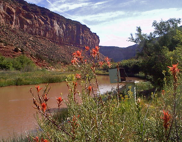
Sources/Usage: Public Domain. View Media DetailsSpring season at USGS streamgage 09171100, Dolores River near Bedrock, Colorado. OBJECTIVES:
- To compile and characterize existing water-resources data for the Dolores River and San Juan River watersheds.
- To develop a relational database containing information on water-quality and Geographic Information System (GIS) features/coverages.
- To create a Web-based interface to the relational database to streamline sharing of data.
- To identify gaps in the available data and design a water-quality sampling network to fill these gaps.
APPROACH:
Historic surface-water and groundwater quality data, instantaneous streamflow data associated with a water-quality sample, and water-table elevations that are available in electronic form were compiled and screened for the Dolores River and San Juan River watersheds.
- The historic water-quality data and published reports for the Dolores River and San Juan River watersheds will be used to develop an interpretive retrospective analysis. The retrospective analysis will include: a description of the spatial and temporal distribution of physical and chemical data,
- a statistical summary of the data including range, maximum, minimum and mean values,
- a comparison of the historic data to State and Federal water-quality standards,
- an analysis of trends at sites where the length of record is sufficient, and (5) an evaluation of the environmental and cultural factors, such as geology and land use, that affect water quality within the limits of the available data.
- Science
Below are other science projects associated with the Colorado Water-Quality Data Repository.
Upper Yampa Watershed Water-Quality Data
The Upper Yampa River Watershed (UYRW) drains approximately 1,798 square miles west of the Continental Divide in northwestern Colorado. The Upper Yampa River Watershed includes the Yampa River Basin upstream from Elkhead Creek and the Elkhead Creek Basin and primarily is in Routt County. The city of Steamboat Springs and the towns of Hayden, Oak Creek, and Yampa are in the watershed. The Yampa...Eagle River Water-Quality Data
The Eagle River drains approximately 970 square miles (sq mi) west of the Continental Divide in central Colorado before flowing into the Colorado River. The Eagle River watershed (ERW) is located primarily within Eagle County and includes the towns of Vail, Minturn, Avon, Edwards, Eagle, and Gypsum. The eastern boundary of the Eagle River watershed is drained by Gore Creek, located at Vail Pass...Piceance Basin Water-Quality Data
As large-scale energy development continues in the Piceance Basin, there is potential for changes in surface-water and groundwater resources. In the southern Piceance Basin, a water task force consisting of numerous local governments, municipalities, and energy companies collectively identified the need for a common data repository. In the northern Piceance Basin, similar efforts were underway in...Upper Gunnison River Water-Quality Data
The Upper Gunnison River Watershed, located in the Rocky Mountains 150 miles southwest of Denver, Colorado, drains approximately 3,965 square miles. Forest and rangeland comprise 89 percent of land within the watershed, but the traditional western ranching economy is increasingly supplemented through a tourism economy centered around Crested Butte Mountain Resort and the Curecanti National...Roaring Fork Watershed Water-Quality Data
The Roaring Fork Watershed, located in the Rocky Mountains 150 miles west of Denver, Colorado, has seen rapid development and population growth in recent years. The USGS, in cooperation with Pitkin County, Colorado Water Conservation District, Ruedi Water and Power Authority, and other local entities, conducted a comprehensive surface- and ground-water resource assessment in the Roaring Fork River...Arkansas River Water-Quality Data
The Arkansas River Basin drains an area of 24,904 square miles of southeastern Colorado. Like other basins on the Front Range, the Arkansas Basin has experienced growth and is expected to have significant increases in growth in the future. Demands on the limited water resources also will increase as changes in water storage, water releases, and/or transfer of waters within or outside of the basin...Blue River Water-Quality Data
The Blue River drains approximately 680 square miles west of the Continental Divide in central Colorado before flowing northward into the Colorado River near Kremmling, Colorado. The Blue River watershed (BRW) is almost entirely located in Summit County and includes the towns of Breckenridge, Dillon, Frisco, Montezuma, and Silverthorne. Dillon Reservoir and Green Mountain Reservoir are major water... - Multimedia
- Publications
- Partners