
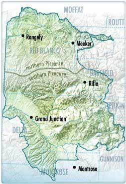
Piceance Basin Water-Quality Data Completed
As large-scale energy development continues in the Piceance Basin, there is potential for changes in surface-water and groundwater resources. In the southern Piceance Basin, a water task force consisting of numerous local governments, municipalities, and energy companies collectively identified the need for a common data repository. In the northern Piceance Basin, similar efforts were underway in approximately the same timeframe. The outcome of these efforts is the combined northern and southern Piceance Basins project, referred to collectively as "the Piceance Basin." Data collected for the Piceance Basin provide an invaluable contribution to the planning, monitoring, conservation, and management of water resources.
Approach
The U.S. Geological Survey (USGS), in cooperation with energy industry and local and State agency partners, is in the process of creating and maintaining a public, web-accessible common data repository. The repository will combine waterquality data from industry, local, State, Federal, and other sources. Data will be screened and merged from disparate locations and formatted into a single uniform format. The quality and completeness of the incoming data will be reviewed and documented. Using the repository, the USGS will evaluate all available water-quality data to develop a baseline assessment of the region’s water resources. Results of the baseline assessment will facilitate the development of regional monitoring strategies to fill identified data gaps and minimize redundancies in current and future water-resource monitoring
- Overview
As large-scale energy development continues in the Piceance Basin, there is potential for changes in surface-water and groundwater resources. In the southern Piceance Basin, a water task force consisting of numerous local governments, municipalities, and energy companies collectively identified the need for a common data repository. In the northern Piceance Basin, similar efforts were underway in approximately the same timeframe. The outcome of these efforts is the combined northern and southern Piceance Basins project, referred to collectively as "the Piceance Basin." Data collected for the Piceance Basin provide an invaluable contribution to the planning, monitoring, conservation, and management of water resources.
Sources/Usage: Public Domain. View Media DetailsPiceance Basin Water Quality Data Study Area Approach
The U.S. Geological Survey (USGS), in cooperation with energy industry and local and State agency partners, is in the process of creating and maintaining a public, web-accessible common data repository. The repository will combine waterquality data from industry, local, State, Federal, and other sources. Data will be screened and merged from disparate locations and formatted into a single uniform format. The quality and completeness of the incoming data will be reviewed and documented. Using the repository, the USGS will evaluate all available water-quality data to develop a baseline assessment of the region’s water resources. Results of the baseline assessment will facilitate the development of regional monitoring strategies to fill identified data gaps and minimize redundancies in current and future water-resource monitoring
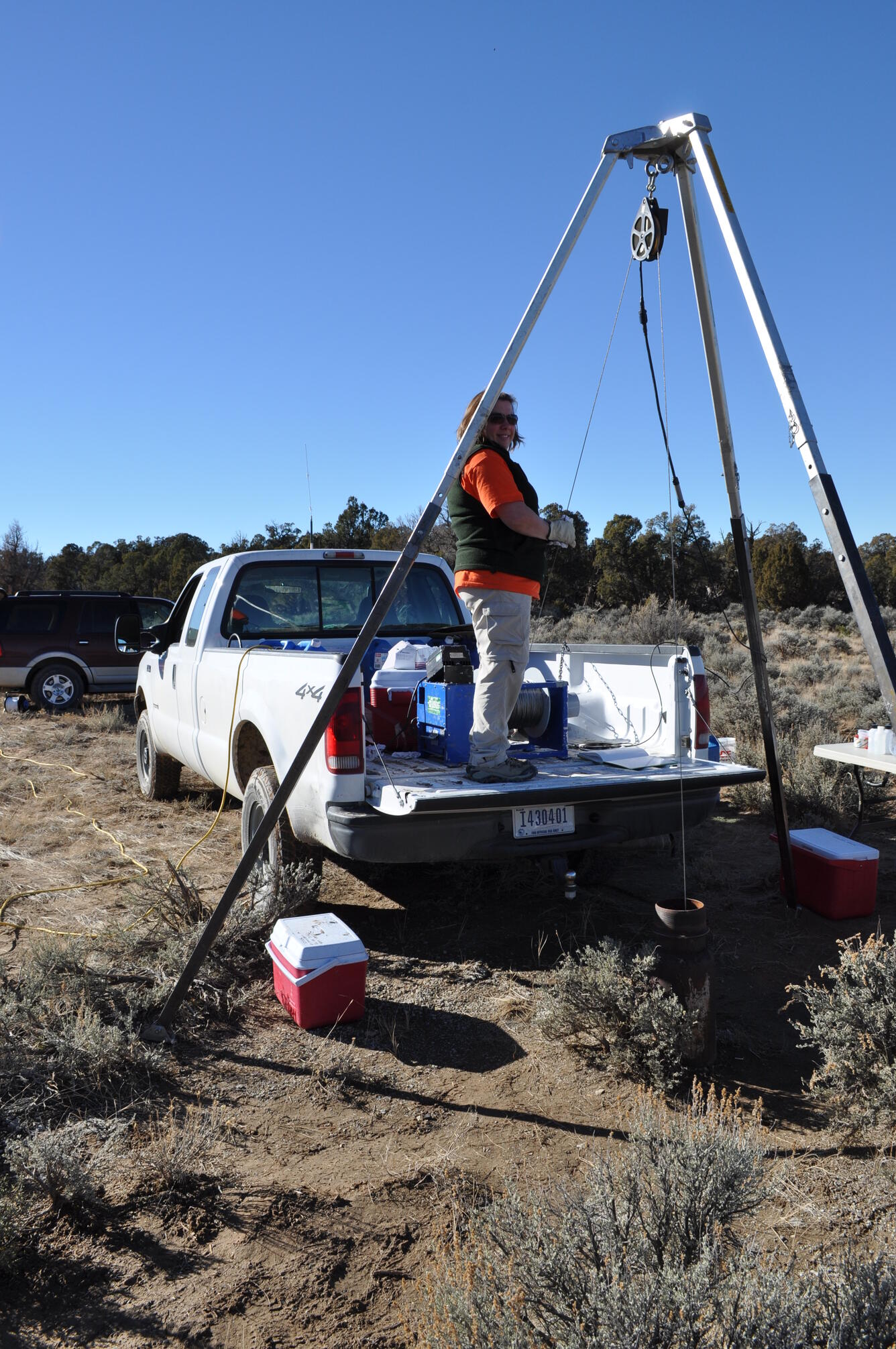
Sources/Usage: Some content may have restrictions. View Media DetailsGroundwater sampling Piceance Basin, CO - Science
- Multimedia
- Publications
- Partners