
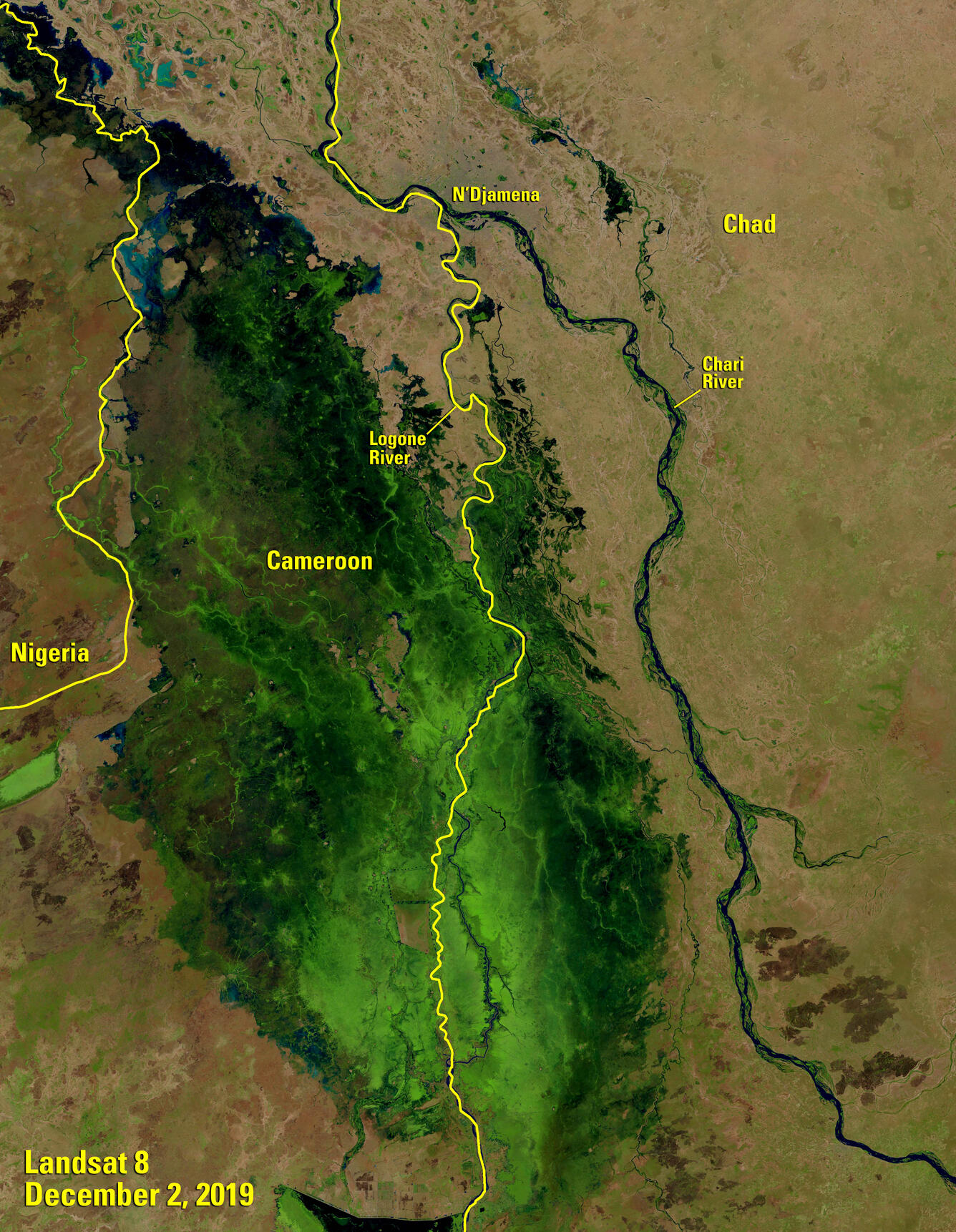
Flooding in the Lake Chad Basin
The Lake Chad Basin covers 2.4 million square kilometers, eight countries and nearly 8 percent of the African continent’s landmass.

Given its position in developing nations, the water that moves through the basin’s river systems after the rainy season has an out-sized impact on the human beings who live there.
In some seasons, there isn’t enough water to go around. This season, the impact came in the form of too much water.
Flooding across the basin from heavier-than-average rainfall in the fall of 2019 is just one of the factors expected to intensify the need for food aid for the region well into 2020, according to a report from the U.S. Agency for International Development (USAID). Some 9.9 million people across the basin are likely to need humanitarian assistance this year.
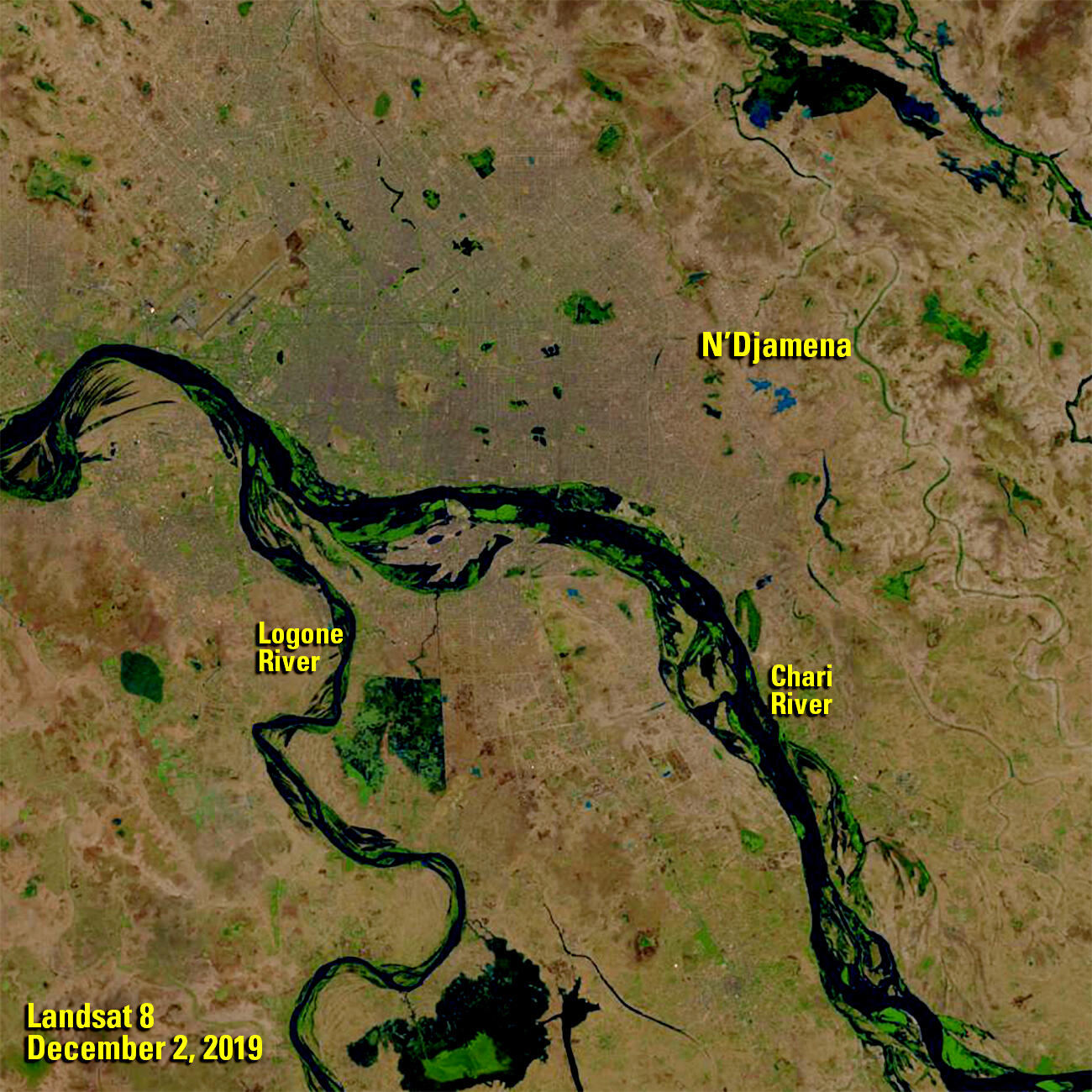
At least 220,000 people had been affected by flooding across the basin as of late November, and northern Cameroon and northeast Nigeria (yellow inset) were hit particularly hard. According to data from the Famine Early Warning Systems Network (FEWS NET), the areas just upstream from those flood zones saw between two and six inches more rainfall than average in the month of October. Those rains followed above-average rainfall from May through September.


Data from FEWS NET, collected and distributed through the USGS Earth Resources Observation and Science (EROS) Center, help inform decisions on food aid across the developing world. Landsat data, archived by EROS and available at no cost to the user, can be used to support myriad applications. Find and download Landsat data at EarthExplorer.usgs.gov.