
Panoramic image of the Mountain Home Plateau, southern Idaho. Hydrologists from the USGS Idaho Water Science Center, in cooperation with the Idaho Department of Water Resources, assessed the water resources of the plateau to help improve resource management.
Multimedia
Images

Mountain Home Plateau, Southern Idaho
Panoramic image of the Mountain Home Plateau, southern Idaho. Hydrologists from the USGS Idaho Water Science Center, in cooperation with the Idaho Department of Water Resources, assessed the water resources of the plateau to help improve resource management.

USGS Monitoring of Snake River Quagga Mussel Treatment
USGS scientists collect macroinvertebrate samples from the Snake River in southern Idaho as part of monitoring to determine the effects of quagga mussel eradication efforts on benthic communities.
USGS scientists collect macroinvertebrate samples from the Snake River in southern Idaho as part of monitoring to determine the effects of quagga mussel eradication efforts on benthic communities.

F.H. Newell Building, Boise, Idaho
The F.H. Newell Building in Boise, Idaho, is the headquarters of the USGS Idaho Water Science Center and the Snake River Area Office of the Bureau of Reclamation.
The F.H. Newell Building in Boise, Idaho, is the headquarters of the USGS Idaho Water Science Center and the Snake River Area Office of the Bureau of Reclamation.

Demonstration of multibeam echosounder technology, Knik River near Palmer, Alaska
Mike Knapp, hydraulic engineer with the Alaska Department of Transportation and Public Facilities (far right) introduces USGS hydrologist Taylor Dudunake (back to camera) for a demonstration of multibeam echosounder technology on the Knik River near Palmer, Alaska, July 27, 2023.
Mike Knapp, hydraulic engineer with the Alaska Department of Transportation and Public Facilities (far right) introduces USGS hydrologist Taylor Dudunake (back to camera) for a demonstration of multibeam echosounder technology on the Knik River near Palmer, Alaska, July 27, 2023.
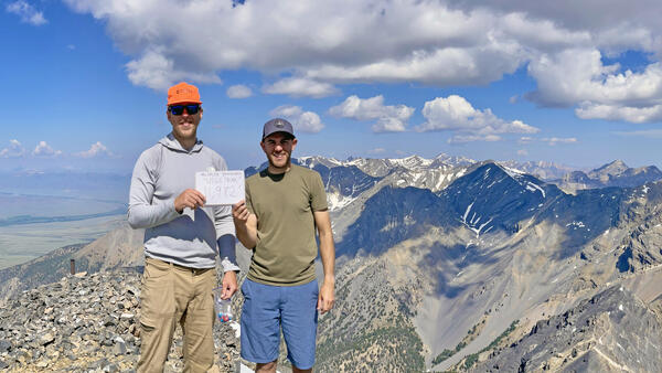
USGS hydro techs Jeff Zingre and Tate Wilson-Johns on the Summit of USGS Peak, Idaho
When you work for the USGS in Idaho, what do you do on the weekend? Climb USGS Peak, of course! Idaho Falls-based USGS hydrologic technicians Jeff Zingre and Tate Wilson-Johns celebrate on the summit of Idaho's 10th highest peak.
When you work for the USGS in Idaho, what do you do on the weekend? Climb USGS Peak, of course! Idaho Falls-based USGS hydrologic technicians Jeff Zingre and Tate Wilson-Johns celebrate on the summit of Idaho's 10th highest peak.

Gage Greatness Bracket Round 1
At the USGS, we monitor our nation’s water. Our data informs many people, from kayakers to water managers. Gage Greatness allows any Twitter user to vote for their favorite gage (data collection station).
At the USGS, we monitor our nation’s water. Our data informs many people, from kayakers to water managers. Gage Greatness allows any Twitter user to vote for their favorite gage (data collection station).
Videos

Lightning Creek at Clark Fork, Idaho: December 9, 2015
On December 9, 2015, heavy rain and resulting snowmelt swelled many Pacific Northwest rivers to flood stage. One of these streams was Lightning Creek at Clark Fork, Idaho. In a 24-hour period, Lightning Creek rose from about 200 cubic feet per second (cfs) to more than 10,000 cfs as recorded at USGS strreamgage 12392155.
On December 9, 2015, heavy rain and resulting snowmelt swelled many Pacific Northwest rivers to flood stage. One of these streams was Lightning Creek at Clark Fork, Idaho. In a 24-hour period, Lightning Creek rose from about 200 cubic feet per second (cfs) to more than 10,000 cfs as recorded at USGS strreamgage 12392155.