
Rafters enjoy the floating down the Illinois River in northeast Okalahoma.
Images
Photographs taken by Oklahoma-Texas Water Science Center employees at local, national, and international project locations.
Filter Total Items: 543

Illinois River Floatcam
Rafters enjoy the floating down the Illinois River in northeast Okalahoma.

Collecting information about rock properties from a groundwater well
USGS scientists setting up the nuclear magnetic resonance (NMR) geophyiscal logging cable to collect information about rock properties from a groundwater well borehole in the Texas southern highplains.
USGS scientists setting up the nuclear magnetic resonance (NMR) geophyiscal logging cable to collect information about rock properties from a groundwater well borehole in the Texas southern highplains.

Blanco River Valley
Photograph showing the Blanco River Valley, looking north from Little Arkansas Road, Hays County, Texas (photograph by Allan K. Clark, U.S. Geological Survey, February 27, 2018).
U.S. Geological Survey Scientific Investigations Map 3418, https://doi.org/10.3133/sim3418.
Photograph showing the Blanco River Valley, looking north from Little Arkansas Road, Hays County, Texas (photograph by Allan K. Clark, U.S. Geological Survey, February 27, 2018).
U.S. Geological Survey Scientific Investigations Map 3418, https://doi.org/10.3133/sim3418.

Low water crossing on the Blanco River, Hays County, Texas
Photograph showing a low water crossing on the Blanco River, looking south from Little Arkansas Road, Hays County, Texas (photograph by Allan K. Clark, U.S. Geological Survey, February 27, 2018).
U.S. Geological Survey Scientific Investigations Map 3418, https://doi.org/10.3133/sim3418.
Photograph showing a low water crossing on the Blanco River, looking south from Little Arkansas Road, Hays County, Texas (photograph by Allan K. Clark, U.S. Geological Survey, February 27, 2018).
U.S. Geological Survey Scientific Investigations Map 3418, https://doi.org/10.3133/sim3418.

Swimming hole on Cypress Creek in Blue Hole Regional Park, Wimberley
Photograph showing swimming hole on Cypress Creek in Blue Hole Regional Park, Wimberley, Hays County, Texas (photograph by Allan K. Clark, U.S. Geological Survey, February 27, 2018).
U.S. Geological Survey Scientific Investigations Map 3418, https://doi.org/10.3133/sim3418.
Photograph showing swimming hole on Cypress Creek in Blue Hole Regional Park, Wimberley, Hays County, Texas (photograph by Allan K. Clark, U.S. Geological Survey, February 27, 2018).
U.S. Geological Survey Scientific Investigations Map 3418, https://doi.org/10.3133/sim3418.

Conglomerates, Sycamore Sand at Hammetts Crossing, Travis Cty, Texas
Conglomerates within the Sycamore Sand at Hammetts Crossing, Travis County, Texas (photograph by Allan K. Clark, U.S. Geological Survey, February 27, 2018).
U.S. Geological Survey Scientific Investigations Map 3418, https://doi.org/10.3133/sim3418
Conglomerates within the Sycamore Sand at Hammetts Crossing, Travis County, Texas (photograph by Allan K. Clark, U.S. Geological Survey, February 27, 2018).
U.S. Geological Survey Scientific Investigations Map 3418, https://doi.org/10.3133/sim3418

Bedding plane porosity in fracture at Cow Creek Limestone
Bedding plane porosity that developed at the junction between the bedding plane and a fracture within the Cow Creek Limestone (Cow Creek hydrostratigraphic unit) at Hammetts Crossing, Travis County, Texas (photograph by Allan K. Clark, U.S. Geological Survey, February 27, 2018).
Bedding plane porosity that developed at the junction between the bedding plane and a fracture within the Cow Creek Limestone (Cow Creek hydrostratigraphic unit) at Hammetts Crossing, Travis County, Texas (photograph by Allan K. Clark, U.S. Geological Survey, February 27, 2018).

Jacobs Well Spring, headwaters of Cypress Creek, Wimberley, Tex.
Jacobs Well Spring, which forms the headwaters of Cypress Creek north of Wimberley, Texas (photograph by Allan K. Clark,
U.S. Geological Survey, February 27, 2018).
U.S. Geological Survey Scientific Investigations Map 3418, https://doi.org/10.3133/sim3418
Jacobs Well Spring, which forms the headwaters of Cypress Creek north of Wimberley, Texas (photograph by Allan K. Clark,
U.S. Geological Survey, February 27, 2018).
U.S. Geological Survey Scientific Investigations Map 3418, https://doi.org/10.3133/sim3418

Dry Frio below Concan
Photograph from page 19 of
Photograph from page 19 of

Helotes flood
Page 67 photo from
Page 67 photo from
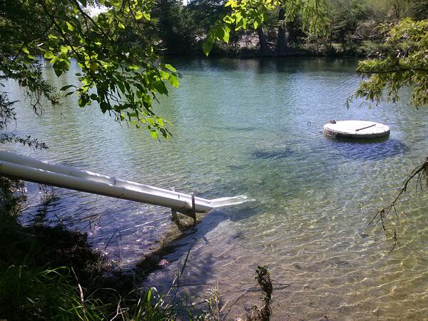
Monitoring equipment at Frio River at Concan, Tex.
Monitoring equipment at Frio River at Concan, Tex.
Monitoring equipment at Frio River at Concan, Tex.

Pump hoist truck at Shavano Park at Fawn Drive
Back cover photo from

Groundwater sampling equipment at AY-68-27-610 (Parkwood Park).
Back cover photo from

Comal 1 spring run
Back cover photo from
Back cover photo from

Nitrate sensor at the Frio River at Concan, Tex.
Back cover photo from

Comal spring run
Cover background photo from
Cover background photo from

Frio Stilling well
Photo from pages 8 and 9 of
Photo from pages 8 and 9 of

Recording high water marks after Harvey
USGS scientist David Rodriguez records high water marks from storm surge near Corpus Christi, Texas.
USGS scientist David Rodriguez records high water marks from storm surge near Corpus Christi, Texas.

Recording high water marks following Harvey
USGS scientist David Rodriguez records high water marks from storm surge following Harvey near Corpus Christi, Texas.
USGS scientist David Rodriguez records high water marks from storm surge following Harvey near Corpus Christi, Texas.

High Water Mark Surveying
USGS scientist Alec McDonald surveying high water marks from storm surge from Hurricane Harvey at Packery Channel near Corpus Christi, Texas.
USGS scientist Alec McDonald surveying high water marks from storm surge from Hurricane Harvey at Packery Channel near Corpus Christi, Texas.

Surveying High Water Marks following Harvey
USGS scientist Vidal Mendoza surveying high water marks from storm surge from Hurricane Harvey near Port Aransas, Texas.
USGS scientist Vidal Mendoza surveying high water marks from storm surge from Hurricane Harvey near Port Aransas, Texas.