


Narrated presentation that provides a unique, long-term perspective (1950-2050) of the major drivers of nitrogen change up to the present, and forecasts how they may affect nitrogen into the future for the Chesapeake Bay watershed. Information is based off of U.S. Geological Survey Circular 1486.
Pennsylvania and the Chesapeake Bay Watershed Active
By Pennsylvania Water Science Center
August 4, 2023
USGS Releases new fact sheet on conservation practices
Your land, your water—Using research to guide conservation practices on local farms in the Chesapeake Bay watershed
Your land, your water—Using research to guide conservation practices on local farms in the Chesapeake Bay watershed
USGS Evaluates Effects of Agricultural Conservation Practices
A new study on best management practices and nitrogen in streams of the Chesapeake Bay Watershed
A new study on best management practices and nitrogen in streams of the Chesapeake Bay Watershed
Nitrogen in the Chesapeake Bay Watershed — A Century of Change
Nitrogen in the Chesapeake Bay Watershed — A Century of Change
Groundwater is a major source of nitrate to Chesapeake Bay
Land use, organic carbon in soils, and geology can explain where groundwater contributions are the most important
Land use, organic carbon in soils, and geology can explain where groundwater contributions are the most important
Removal of Legacy Sediments Effects Nutrient Loads in Streamflow
Effects of Legacy Sediment Removal on Nutrients and Sediment in Big Spring Run, Lancaster County, Pennsylvania, 2009–15
Effects of Legacy Sediment Removal on Nutrients and Sediment in Big Spring Run, Lancaster County, Pennsylvania, 2009–15
USGS provides monitoring, analysis, modeling and research on streams and water quality to better understand the fate and transport of nutrients and sediment to the Susquehanna and other rivers, and their tributaries, and eventually to the Chesapeake Bay. Additional research focuses on emerging contaminants and other stressors that effect human and aquatic life in the watershed and estuary.
Sediment Response of Stream Restoration Practices
Sediment Response of Stream Restoration Practices
Assessing stream restoration effectiveness by quantifying sediment erosion and deposition along restored and eroded agricultural stream reaches
Water Quality to Inform Conservation Management
Water Quality to Inform Conservation Management

The occurrence and distribution of nutrients, and an understanding of biogeochemical processes aims to help aid conservation efforts.
The Susquehanna River drains the largest watershed (48 percent) and supplies 55 percent of the freshwater flowing into the Chesapeake Bay. In 2010, the largest and most complex total maximum daily load (TMDL) in the Nation was initiated in the Chesapeake Bay for nitrogen, phosphorus, and sediment. These pollution allocations were further divided by major river basins and states. Pennsylvania contributes approximately 44 percent of the nitrogen load and 24 percent of the phosphorus load to the Bay (Chesapeake Bay TMDL Document).

Sources/Usage: Public Domain. View Media Details
Also see regional science at Chesapeake Bay Activities
Filter Total Items: 16
Floodplains provide millions of dollars in benefits every year to people in the Chesapeake Bay and Delaware River watersheds
Issue: Floodplains provide important services to people by retaining sediments, nutrients, and floodwaters, thereby improving water quality and reducing flooding impacts. Having information on how the monetary benefit that floodplains provide varies across the Chesapeake Bay and Delaware River watersheds helps resource managers describe the benefits that floodplains provide in their current state...
New study evaluates effects of agricultural conservation practices on nitrogen in streams of the Chesapeake Bay
Issue: Adaptive management in support of Chesapeake Bay restoration is complicated by uncertainty about the effects of agricultural management practices on water quality. Despite increasing investment, effects of agricultural conservation practices on regional water quality remain difficult to quantify due to factors such as groundwater travel times, varying modes-of-action, and the general lack...
Improving Understanding and Coordination of Science Activities for Per- and Polyfluoroalkyl Substances (PFAS) in the Chesapeake Bay Watershed
Issue: Per- and polyfluoroalkyl substances (PFAS) have been manufactured and used in a variety of industries in the United States since the 1940s. PFAS are ubiquitous and persistent in the environment and have the potential to have adverse human and ecological health effects. The Chesapeake Bay Program (CBP) partnerships has concerns about how PFAS will affect the Chesapeake Bay ecosystem. The CBP...
Sediment Response of Stream Restoration Practices, Turtle Creek, Union County, Pennsylvania
USGS is providing data and analyses to assess stream restoration effectiveness in Turtle Creek, Union County, Pennsylvania, by measuring differences in sediment erosion and deposition in restored and eroded stream reaches.
USGS Chesapeake Publication Receives National Award for Superior Communication Product
The Award USGS received a 2022 Blue Pencil & Gold Screen Award, in the category of Technical/Statistical Reports, from the National Association of Government Communications (NAGC) for the U.S. Geological Survey Circular titled Nitrogen in the Chesapeake Bay Watershed—A Century of Change, 1950–2050 . Each year the NAGC recognizes products that provide excellence in government communications and the...
Tracking Status and Trends in Seven Key Indicators of River and Stream Condition in the Chesapeake Bay Watershed
Identifying and tracking the status of, and trends in, stream health within the Chesapeake Bay watershed is essential to understanding the past, present, and future trajectory of the watershed’s resources and ecological condition. A team of USGS ecosystem scientists is meeting this need with an initiative to track the status of, and trends in, key indicators of the health of non-tidal freshwater...
Susquehanna River and Basin
In Pennsylvania, the USGS's water-resources roots date back to the late 1800's, with the initiation of streamflow gaging on the Susquehanna and Delaware Rivers and assessments of groundwater resources near Philadelphia. The USGS Pennsylvania Water Science Center continues to provide scientific information about the water resources of the Susquehanna River Basin, in cooperation with regional and...
Greatest Opportunities for Future Nitrogen Reductions to the Chesapeake Bay Watershed are in Developed and Agricultural Areas
Issue: As human population has increased, land-use changes have led to increases in nutrients (nitrogen and phosphorus) and sediment into the Bay. The excess nutrients cause algal blooms which contribute to water-quality impairments such as low oxygen or hypoxia (dead zones), and poor water clarity in the Chesapeake Bay. Management efforts to improve water quality focus on dissolved oxygen needed...
Summarizing Scientific Findings for Common Stakeholder Questions to Inform Nutrient and Sediment Management Activities in the Chesapeake Bay Watershed
Issue: The Chesapeake Bay Program (CBP) partnership is striving to improve water-quality conditions in the Bay by using a variety of management strategies to reduce nutrient and sediment loads. The partnership uses monitoring results and modeling tools to implement management strategies, relying on the scientific community to synthesize existing information and direct new research to address...
Updated 2020 Nutrient and Suspended-Sediment Trends for the Nine Major Rivers Entering the Chesapeake Bay
Issue: The amount of nutrients and suspended sediment entering the Chesapeake Bay affect water-quality conditions in tidal waters. Excess nutrients contribute to algal blooms that lower the oxygen levels in tidal waters that are important for fish and shellfish. The algal blooms, along with suspended sediment, also decrease visibility in shallow waters for submerged aquatic grasses. The grasses...
Data-sharing agreement renewed to evaluate conservations practices and water quality in the Chesapeake Watershed
Issue: The U.S. Geological Survey (USGS) and the Natural Resources Conservation Service (NRCS) have a mutual interest in meeting the goals of the Chesapeake Bay Watershed Agreement, and in determining the benefits and challenges of agricultural conservation practices on water-quality patterns. Understanding the sources of nutrients and sediment and how these nutrients move into streams and...
Water Quality Monitoring to Inform Conservation Management, Fishing Creek, Clinton County, Pennsylvania
USGS conducted synoptic sampling of major-ion chemistry and the nitrogen and oxygen isotopic composition of nitrate in Fishing Creek during base flow to evaluate the occurrence and distribution of nutrients and to characterize biogeochemical processes.

Nitrogen in the Chesapeake Bay Watershed: A Century of Change
Narrated presentation that provides a unique, long-term perspective (1950-2050) of the major drivers of nitrogen change up to the present, and forecasts how they may affect nitrogen into the future for the Chesapeake Bay watershed. Information is based off of U.S. Geological Survey Circular 1486.
")
Nitrogen in the Chesapeake Bay Watershed: A Century of Change (AD)
Narrated presentation that provides a unique, long-term perspective (1950-2050) of the major drivers of nitrogen change up to the present, and forecasts how they may affect nitrogen into the future for the Chesapeake Bay watershed. Information is based off of U.S. Geological Survey Circular 1486.

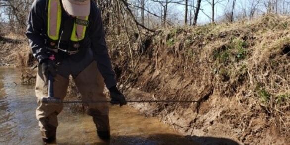
USGS Employees Collect Water Quality Samples In The Susquehanna River
USGS New Jersey Water Science Center Hydrographers on the Susquehanna River collect water quality samples.
USGS New Jersey Water Science Center Hydrographers on the Susquehanna River collect water quality samples.

Susquehanna River - Conowingo Dam
Conowingo Dam on the Susquehanna River in Maryland.
Conowingo Dam on the Susquehanna River in Maryland.
- Overview
USGS provides monitoring, analysis, modeling and research on streams and water quality to better understand the fate and transport of nutrients and sediment to the Susquehanna and other rivers, and their tributaries, and eventually to the Chesapeake Bay. Additional research focuses on emerging contaminants and other stressors that effect human and aquatic life in the watershed and estuary.
Sediment Response of Stream Restoration Practices
Assessing stream restoration effectiveness by quantifying sediment erosion and deposition along restored and eroded agricultural stream reaches
Water Quality to Inform Conservation Management
The occurrence and distribution of nutrients, and an understanding of biogeochemical processes aims to help aid conservation efforts.
The Susquehanna River drains the largest watershed (48 percent) and supplies 55 percent of the freshwater flowing into the Chesapeake Bay. In 2010, the largest and most complex total maximum daily load (TMDL) in the Nation was initiated in the Chesapeake Bay for nitrogen, phosphorus, and sediment. These pollution allocations were further divided by major river basins and states. Pennsylvania contributes approximately 44 percent of the nitrogen load and 24 percent of the phosphorus load to the Bay (Chesapeake Bay TMDL Document).
Sources/Usage: Public Domain. View Media DetailsAnnual nitrogen loads exported to the Chesapeake Bay by source, 1950–2050. Fertilizer and manure are combined into a single agricultural source for the modeled time period. After 2010, the two future agricultural scenarios represent (1) increased intensity of both crop and animal agriculture, and (2) decreased intensity of both crop and animal agriculture. Only the future scenario for constant wastewater treatment technology is shown (from Nitrogen in the Chesapeake Bay watershed—A century of change, 1950–2050). - Science
Also see regional science at Chesapeake Bay Activities
Filter Total Items: 16Floodplains provide millions of dollars in benefits every year to people in the Chesapeake Bay and Delaware River watersheds
Issue: Floodplains provide important services to people by retaining sediments, nutrients, and floodwaters, thereby improving water quality and reducing flooding impacts. Having information on how the monetary benefit that floodplains provide varies across the Chesapeake Bay and Delaware River watersheds helps resource managers describe the benefits that floodplains provide in their current state...New study evaluates effects of agricultural conservation practices on nitrogen in streams of the Chesapeake Bay
Issue: Adaptive management in support of Chesapeake Bay restoration is complicated by uncertainty about the effects of agricultural management practices on water quality. Despite increasing investment, effects of agricultural conservation practices on regional water quality remain difficult to quantify due to factors such as groundwater travel times, varying modes-of-action, and the general lack...Improving Understanding and Coordination of Science Activities for Per- and Polyfluoroalkyl Substances (PFAS) in the Chesapeake Bay Watershed
Issue: Per- and polyfluoroalkyl substances (PFAS) have been manufactured and used in a variety of industries in the United States since the 1940s. PFAS are ubiquitous and persistent in the environment and have the potential to have adverse human and ecological health effects. The Chesapeake Bay Program (CBP) partnerships has concerns about how PFAS will affect the Chesapeake Bay ecosystem. The CBP...Sediment Response of Stream Restoration Practices, Turtle Creek, Union County, Pennsylvania
USGS is providing data and analyses to assess stream restoration effectiveness in Turtle Creek, Union County, Pennsylvania, by measuring differences in sediment erosion and deposition in restored and eroded stream reaches.USGS Chesapeake Publication Receives National Award for Superior Communication Product
The Award USGS received a 2022 Blue Pencil & Gold Screen Award, in the category of Technical/Statistical Reports, from the National Association of Government Communications (NAGC) for the U.S. Geological Survey Circular titled Nitrogen in the Chesapeake Bay Watershed—A Century of Change, 1950–2050 . Each year the NAGC recognizes products that provide excellence in government communications and the...Tracking Status and Trends in Seven Key Indicators of River and Stream Condition in the Chesapeake Bay Watershed
Identifying and tracking the status of, and trends in, stream health within the Chesapeake Bay watershed is essential to understanding the past, present, and future trajectory of the watershed’s resources and ecological condition. A team of USGS ecosystem scientists is meeting this need with an initiative to track the status of, and trends in, key indicators of the health of non-tidal freshwater...Susquehanna River and Basin
In Pennsylvania, the USGS's water-resources roots date back to the late 1800's, with the initiation of streamflow gaging on the Susquehanna and Delaware Rivers and assessments of groundwater resources near Philadelphia. The USGS Pennsylvania Water Science Center continues to provide scientific information about the water resources of the Susquehanna River Basin, in cooperation with regional and...Greatest Opportunities for Future Nitrogen Reductions to the Chesapeake Bay Watershed are in Developed and Agricultural Areas
Issue: As human population has increased, land-use changes have led to increases in nutrients (nitrogen and phosphorus) and sediment into the Bay. The excess nutrients cause algal blooms which contribute to water-quality impairments such as low oxygen or hypoxia (dead zones), and poor water clarity in the Chesapeake Bay. Management efforts to improve water quality focus on dissolved oxygen needed...Summarizing Scientific Findings for Common Stakeholder Questions to Inform Nutrient and Sediment Management Activities in the Chesapeake Bay Watershed
Issue: The Chesapeake Bay Program (CBP) partnership is striving to improve water-quality conditions in the Bay by using a variety of management strategies to reduce nutrient and sediment loads. The partnership uses monitoring results and modeling tools to implement management strategies, relying on the scientific community to synthesize existing information and direct new research to address...Updated 2020 Nutrient and Suspended-Sediment Trends for the Nine Major Rivers Entering the Chesapeake Bay
Issue: The amount of nutrients and suspended sediment entering the Chesapeake Bay affect water-quality conditions in tidal waters. Excess nutrients contribute to algal blooms that lower the oxygen levels in tidal waters that are important for fish and shellfish. The algal blooms, along with suspended sediment, also decrease visibility in shallow waters for submerged aquatic grasses. The grasses...Data-sharing agreement renewed to evaluate conservations practices and water quality in the Chesapeake Watershed
Issue: The U.S. Geological Survey (USGS) and the Natural Resources Conservation Service (NRCS) have a mutual interest in meeting the goals of the Chesapeake Bay Watershed Agreement, and in determining the benefits and challenges of agricultural conservation practices on water-quality patterns. Understanding the sources of nutrients and sediment and how these nutrients move into streams and...Water Quality Monitoring to Inform Conservation Management, Fishing Creek, Clinton County, Pennsylvania
USGS conducted synoptic sampling of major-ion chemistry and the nitrogen and oxygen isotopic composition of nitrate in Fishing Creek during base flow to evaluate the occurrence and distribution of nutrients and to characterize biogeochemical processes. - Data
- Multimedia
Nitrogen in the Chesapeake Bay Watershed: A Century of Change
Narrated presentation that provides a unique, long-term perspective (1950-2050) of the major drivers of nitrogen change up to the present, and forecasts how they may affect nitrogen into the future for the Chesapeake Bay watershed. Information is based off of U.S. Geological Survey Circular 1486.
Nitrogen in the Chesapeake Bay Watershed: A Century of Change (AD)Narrated presentation that provides a unique, long-term perspective (1950-2050) of the major drivers of nitrogen change up to the present, and forecasts how they may affect nitrogen into the future for the Chesapeake Bay watershed. Information is based off of U.S. Geological Survey Circular 1486.
Narrated presentation that provides a unique, long-term perspective (1950-2050) of the major drivers of nitrogen change up to the present, and forecasts how they may affect nitrogen into the future for the Chesapeake Bay watershed. Information is based off of U.S. Geological Survey Circular 1486.
USGS Employees Collect Water Quality Samples In The Susquehanna RiverUSGS New Jersey Water Science Center Hydrographers on the Susquehanna River collect water quality samples.
USGS New Jersey Water Science Center Hydrographers on the Susquehanna River collect water quality samples.
Susquehanna River - Conowingo DamConowingo Dam on the Susquehanna River in Maryland.
Conowingo Dam on the Susquehanna River in Maryland.
- Publications
- News
- Partners