Pennsylvania and the Chesapeake Bay Watershed Active
USGS Releases new fact sheet on conservation practices
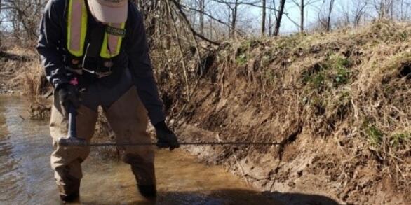
Your land, your water—Using research to guide conservation practices on local farms in the Chesapeake Bay watershed
USGS Evaluates Effects of Agricultural Conservation Practices
A new study on best management practices and nitrogen in streams of the Chesapeake Bay Watershed
Groundwater is a major source of nitrate to Chesapeake Bay
Land use, organic carbon in soils, and geology can explain where groundwater contributions are the most important
Removal of Legacy Sediments Effects Nutrient Loads in Streamflow
Effects of Legacy Sediment Removal on Nutrients and Sediment in Big Spring Run, Lancaster County, Pennsylvania, 2009–15
USGS provides monitoring, analysis, modeling and research on streams and water quality to better understand the fate and transport of nutrients and sediment to the Susquehanna and other rivers, and their tributaries, and eventually to the Chesapeake Bay. Additional research focuses on emerging contaminants and other stressors that effect human and aquatic life in the watershed and estuary.
The Susquehanna River drains the largest watershed (48 percent) and supplies 55 percent of the freshwater flowing into the Chesapeake Bay. In 2010, the largest and most complex total maximum daily load (TMDL) in the Nation was initiated in the Chesapeake Bay for nitrogen, phosphorus, and sediment. These pollution allocations were further divided by major river basins and states. Pennsylvania contributes approximately 44 percent of the nitrogen load and 24 percent of the phosphorus load to the Bay (Chesapeake Bay TMDL Document).
Also see regional science at Chesapeake Bay Activities
Nitrogen in the Chesapeake Bay Watershed: A Century of Change
Narrated presentation that provides a unique, long-term perspective (1950-2050) of the major drivers of nitrogen change up to the present, and forecasts how they may affect nitrogen into the future for the Chesapeake Bay watershed. Information is based off of U.S. Geological Survey Circular 1486.
Response of nitrogen loading to the Chesapeake Bay to source reduction and land use change scenarios: A SPARROW‐informed analysis
A Generalized Additive Model approach to evaluating water quality: Chesapeake Bay Case Study
Variable impacts of contemporary versus legacy agricultural phosphorus on US river water quality
Toward explaining nitrogen and phosphorus trends in Chesapeake Bay tributaries, 1992-2012
Spatial and Temporal Patterns of Best Management Practice Implementation in the Chesapeake Bay Watershed, 1985–2014
Spatially referenced models of streamflow and nitrogen, phosphorus, and suspended-sediment loads in streams of the northeastern United States
Estimates of nitrate loads and yields from groundwater to streams in the Chesapeake Bay watershed based on land use and geology
Thresholds of lake and reservoir connectivity in river networks control nitrogen removal
Optimal hydrograph separation using a recursive digital filter constrained by chemical mass balance, with application to selected Chesapeake Bay watersheds
Spatial and temporal variation of stream chemistry associated with contrasting geology and land-use patterns in the Chesapeake Bay watershed—Summary of results from Smith Creek, Virginia; Upper Chester River, Maryland; Conewago Creek, Pennsylvania; and Di
Decadal-scale export of nitrogen, phosphorus, and sediment from the Susquehanna River basin, USA: Analysis and synthesis of temporal and spatial patterns
Sediment transport and capacity change in three reservoirs, Lower Susquehanna River Basin, Pennsylvania and Maryland, 1900-2012
- Overview
USGS provides monitoring, analysis, modeling and research on streams and water quality to better understand the fate and transport of nutrients and sediment to the Susquehanna and other rivers, and their tributaries, and eventually to the Chesapeake Bay. Additional research focuses on emerging contaminants and other stressors that effect human and aquatic life in the watershed and estuary.
The Susquehanna River drains the largest watershed (48 percent) and supplies 55 percent of the freshwater flowing into the Chesapeake Bay. In 2010, the largest and most complex total maximum daily load (TMDL) in the Nation was initiated in the Chesapeake Bay for nitrogen, phosphorus, and sediment. These pollution allocations were further divided by major river basins and states. Pennsylvania contributes approximately 44 percent of the nitrogen load and 24 percent of the phosphorus load to the Bay (Chesapeake Bay TMDL Document).
- Science
Also see regional science at Chesapeake Bay Activities
Filter Total Items: 16 - Data
- Multimedia
Nitrogen in the Chesapeake Bay Watershed: A Century of Change
Narrated presentation that provides a unique, long-term perspective (1950-2050) of the major drivers of nitrogen change up to the present, and forecasts how they may affect nitrogen into the future for the Chesapeake Bay watershed. Information is based off of U.S. Geological Survey Circular 1486.
- Publications
Filter Total Items: 42
Response of nitrogen loading to the Chesapeake Bay to source reduction and land use change scenarios: A SPARROW‐informed analysis
In response to concerns regarding the health of streams and receiving waters, the United States Environmental Protection Agency established a total maximum daily load for nitrogen in the Chesapeake Bay watershed for which practices must be in place by 2025 resulting in an expected 25% reduction in load from 2009 levels. The response of total nitrogen (TN) loads delivered to the Bay to nine sourceAuthorsMatthew P. Miller, Paul D. Capel, Ana M. Garcia, Scott W. AtorA Generalized Additive Model approach to evaluating water quality: Chesapeake Bay Case Study
Nutrient-reduction efforts have been undertaken in recent decades to mitigate the impacts of eutrophication in coastal and estuarine systems worldwide. To track progress in response to one of these efforts we use Generalized Additive Models (GAMs) to evaluate a diverse suite of water quality constituents over a 32-year period in the Chesapeake Bay, an estuary on the east coast of the United StatesAuthorsRebecca Murphy, Elgin Perry, Jon Harcum, Jennifer L. KeismanVariable impacts of contemporary versus legacy agricultural phosphorus on US river water quality
Phosphorus (P) fertilizer has contributed to the eutrophication of freshwater ecosystems. Watershed-based conservation programs aiming to reduce external P loading to surface waters have not resulted in significant water-quality improvements. One factor that can help explain the lack of water-quality response is remobilization of accumulated legacy (historical) P within the terrestrial-aquatic conAuthorsSarah M. Stackpoole, Edward G. Stets, Lori A. SpragueToward explaining nitrogen and phosphorus trends in Chesapeake Bay tributaries, 1992-2012
Understanding trends in stream chemistry is critical to watershed management, and often complicated by multiple contaminant sources and landscape conditions changing over varying time scales. We adapted spatially-referenced regression (SPARROW) to infer causes of recent nutrient trends in Chesapeake Bay tributaries by relating observed fluxes during 1992, 2002, and 2012 to contemporary inputs andAuthorsScott Ator, Ana M. Garcia, Gregory E. Schwarz, Joel Blomquist, Andrew SekellickSpatial and Temporal Patterns of Best Management Practice Implementation in the Chesapeake Bay Watershed, 1985–2014
Efforts to restore water quality in Chesapeake Bay and its tributaries often include extensive Best Management Practice (BMP) implementation on agricultural and developed lands. These BMPs include a variety of methods to reduce nutrient and sediment loads, such as cover crops, conservation tillage, urban filtering systems, and other practices.Estimates of BMP implementation throughout the ChesapeaAuthorsAndrew J. Sekellick, Olivia H. Devereux, Jennifer L. D. Keisman, Jeffrey S. Sweeney, Joel D. BlomquistSpatially referenced models of streamflow and nitrogen, phosphorus, and suspended-sediment loads in streams of the northeastern United States
SPAtially Referenced Regression On Watershed attributes (SPARROW) models were developed to quantify and improve the understanding of the sources, fate, and transport of nitrogen, phosphorus, and suspended sediment in the northeastern United States. Excessive nutrients and suspended sediment from upland watersheds and tributary streams have contributed to ecological and economic degradation of nortAuthorsScott W. AtorEstimates of nitrate loads and yields from groundwater to streams in the Chesapeake Bay watershed based on land use and geology
The water quality of the Chesapeake Bay may be adversely affected by dissolved nitrate carried in groundwater discharge to streams. To estimate the concentrations, loads, and yields of nitrate from groundwater to streams for the Chesapeake Bay watershed, a regression model was developed based on measured nitrate concentrations from 156 small streams with watersheds less than 500 square miles (mi2AuthorsSilvia Terziotti, Paul D. Capel, Anthony J. Tesoriero, Jessica A. Hopple, Scott C. KronholmThresholds of lake and reservoir connectivity in river networks control nitrogen removal
Lakes, reservoirs, and other ponded waters are ubiquitous features of the aquatic landscape, yet their cumulative role in nitrogen removal in large river basins is often unclear. Here we use predictive modeling, together with comprehensive river water quality, land use, and hydrography datasets, to examine and explain the influences of more than 18,000 ponded waters on nitrogen removal through rivAuthorsNoah M. Schmadel, Judson Harvey, Richard Alexander, Gregory E. Schwarz, Richard Moore, Ken Eng, Jesus D. Gomez-Velez, Elizabeth W. Boyer, Durelle ScottOptimal hydrograph separation using a recursive digital filter constrained by chemical mass balance, with application to selected Chesapeake Bay watersheds
Quantitative estimates of base flow are necessary to address questions concerning the vulnerability and response of the Nation’s water supply to natural and human-induced change in environmental conditions. An objective of the U.S. Geological Survey National Water-Quality Assessment Project is to determine how hydrologic systems are affected by watershed characteristics, including land use, land cAuthorsJeff P. Raffensperger, Anna C. Baker, Joel D. Blomquist, Jessica A. HoppleSpatial and temporal variation of stream chemistry associated with contrasting geology and land-use patterns in the Chesapeake Bay watershed—Summary of results from Smith Creek, Virginia; Upper Chester River, Maryland; Conewago Creek, Pennsylvania; and Di
Despite widespread and ongoing implementation of conservation practices throughout the Chesapeake Bay watershed, water quality continues to be degraded by excess sediment and nutrient inputs. While the Chesapeake Bay Program has developed and maintains a large-scale and long-term monitoring network to detect improvements in water quality throughout the watershed, fewer resources have been allocateAuthorsKenneth E. Hyer, Judith M. Denver, Michael J. Langland, James S. Webber, J. K. Böhlke, W. Dean Hively, John W. CluneDecadal-scale export of nitrogen, phosphorus, and sediment from the Susquehanna River basin, USA: Analysis and synthesis of temporal and spatial patterns
The export of nitrogen (N), phosphorus (P), and suspended sediment (SS) is a long-standing management concern for the Chesapeake Bay watershed, USA. Here we present a comprehensive evaluation of nutrient and sediment loads over the last three decades at multiple locations in the Susquehanna River basin (SRB), Chesapeake's largest tributary watershed. Sediment and nutrient riverine loadings, includAuthorsQian Zhang, William P. Ball, Doug L. MoyerSediment transport and capacity change in three reservoirs, Lower Susquehanna River Basin, Pennsylvania and Maryland, 1900-2012
The U.S. Geological Survey (USGS) has conducted numerous sediment transport studies in the Susquehanna River and in particular in three reservoirs in the Lower Susquehanna River Basin to determine sediment transport rates over the past century and to document changes in storage capacity. The Susquehanna River is the largest tributary to Chesapeake Bay and transports about one-half of the total freAuthorsMichael J. Langland - News
- Partners