
Using Video Imagery to Study Coastal Change: Sunset State Beach Active
Two video cameras overlook the coast at Sunset State Beach in Watsonville, California. Camera 1 looks northwest while Camera 2 looks north. The cameras are part of the Remote Sensing Coastal Change project.
Every half hour during daylight hours, the cameras shoot video for 10 minutes. Today’s most recent images are shown below. Please note that it takes about 15 minutes for the images to be posted, once they are collected by the camera.
Currently, USGS video cameras are active at these locations:
- Dream Inn hotel in Santa Cruz, California
- Head of the Meadow Beach, Massachusetts
- Marconi Beach, Massachusetts
- Norton Sound, Unalakleet, Alaska
- Nuvuk (Point Barrow), Alaska
- Sunset State Beach, California
These and other images are used to remotely sense a range of processes, including:
- shoreline position,
- sandbar migration,
- rip-channel formation,
- wave run-up on the beach,
- alongshore current, and
- nearshore bathymetry.
The knowledge gained from these coastal camera studies will improve computer-derived simulations of shoreline change that communities can use to plan for sea-level rise, changing storm patterns, and other threats to beaches.
Please note: If old photos are displayed, cameras are temporarily offline.
Snapshot
The snapshot is the first frame of the video, just like a standard photo.


Timex (time-exposure) images
A timex is a time-averaged image of all frames, smoothing away surface waves and determining the location of persistent wave-breaking (indicative of shallow sandbars).


Variance images
A “variance” image shows the standard deviation of pixel intensity throughout the video, and it is useful for determining how much variation or movement is occurring at a given location.


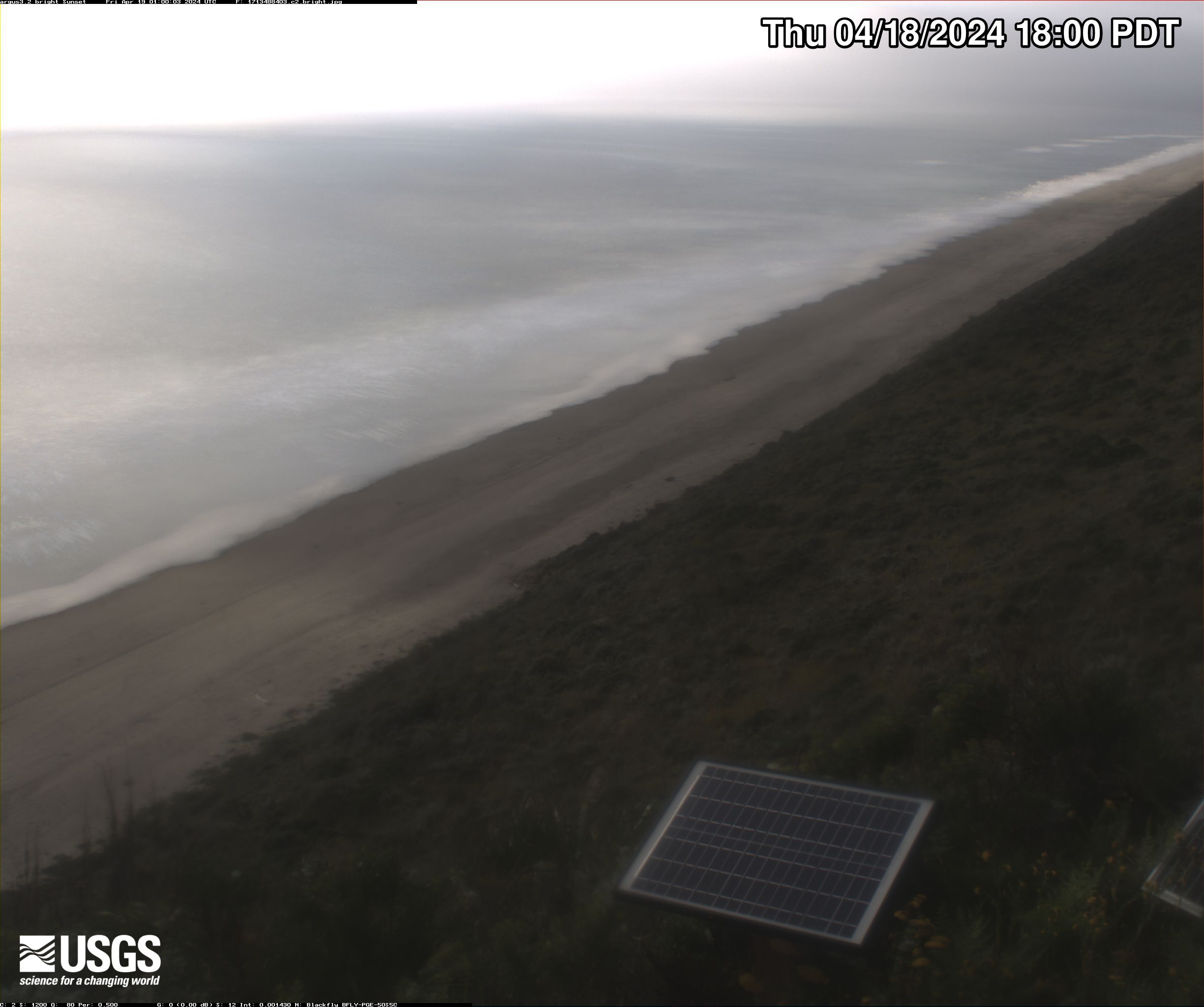
Bright images
A “bright” image shows the brightest pixel values throughout the video, useful for identifying the position of maximum wave run-up on the beach, position of all breaking waves, and sea-state.

Dark images
A “dark” image shows the darkest pixel values throughout the video, useful for tracking sediment plumes, tracking floating debris, and filtering out breaking waves.


Below are the projects that use the data collected by the video cameras, as well as other locations where similar video cameras are or were previously installed.

Remote Sensing Coastal Change
Two video cameras overlook the coast at Sunset State Beach in Watsonville, California. Camera 1 looks northwest while Camera 2 looks north. The cameras are part of the Remote Sensing Coastal Change project.
Every half hour during daylight hours, the cameras shoot video for 10 minutes. Today’s most recent images are shown below. Please note that it takes about 15 minutes for the images to be posted, once they are collected by the camera.
Currently, USGS video cameras are active at these locations:
- Dream Inn hotel in Santa Cruz, California
- Head of the Meadow Beach, Massachusetts
- Marconi Beach, Massachusetts
- Norton Sound, Unalakleet, Alaska
- Nuvuk (Point Barrow), Alaska
- Sunset State Beach, California
These and other images are used to remotely sense a range of processes, including:
- shoreline position,
- sandbar migration,
- rip-channel formation,
- wave run-up on the beach,
- alongshore current, and
- nearshore bathymetry.
The knowledge gained from these coastal camera studies will improve computer-derived simulations of shoreline change that communities can use to plan for sea-level rise, changing storm patterns, and other threats to beaches.
Please note: If old photos are displayed, cameras are temporarily offline.
Snapshot
The snapshot is the first frame of the video, just like a standard photo.
Timex (time-exposure) images
A timex is a time-averaged image of all frames, smoothing away surface waves and determining the location of persistent wave-breaking (indicative of shallow sandbars).
Variance images
A “variance” image shows the standard deviation of pixel intensity throughout the video, and it is useful for determining how much variation or movement is occurring at a given location.
Bright images
A “bright” image shows the brightest pixel values throughout the video, useful for identifying the position of maximum wave run-up on the beach, position of all breaking waves, and sea-state.
Dark images
A “dark” image shows the darkest pixel values throughout the video, useful for tracking sediment plumes, tracking floating debris, and filtering out breaking waves.
Below are the projects that use the data collected by the video cameras, as well as other locations where similar video cameras are or were previously installed.