
Deriving Spatial Waterfowl Inputs for Disease Risk Modeling Active
This project is an effort to create spatially and temporally explicit models for waterfowl distribution across the United States for use in avian influenza transmission risk modeling.
Published Results

The results of our models have been published in Diversity and Distributions.
Distribution Models
Seasonal distribution models for North American dabbling duck species are available for download.
Our Research Into Avian Influenza Transmission
The Prosser Lab is working to understand all aspects of Avian Influenza Transmission both in the United States and across the globe!
Disease risk modeling can be an important tool for identifying areas of high transmission risk within and between animal populations, allowing for strategic allocation of limited resources for disease surveillance and prevention. Acquiring a spatial understanding of the distributions of high risk populations is a critical first step in developing predictive disease transmission models. One such disease is highly pathogenic avian influenza, outbreaks of which have caused concern for both domestic and wild populations in the United States.
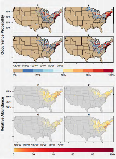
We aim to use multiple spatial modeling approaches that incorporate a temporal component. A bayesian hierarchical approach using Integrated Nested Laplace Approximation (INLA) is being applied to develop dynamic spatial distribution models for waterfowl species of importance to highly pathogenic avian influenza (HPAI). This method allows for building multiple distribution models across the breeding, wintering, and migratory seasons, leading to more temporally detailed disease risk models. For example, instead of a single risk map showing areas of high transmission potential between wild and domestic birds, we aim for monthly or seasonal maps showing differences in areas of transmission potential at this interface.
The temporally dynamic spatial distribution models for waterfowl (10 dabbling duck species for this project) developed from this modeling will serve as inputs to avian influenza disease transmission models. Collaborations with the United States Department of Agriculture are ongoing to investigate transmission risk at the interface of poultry and wild waterfowl.
Key team members:
Dr. John M. Humphreys, USGS-UMD post-doc, University of Michigan
Dr. Jennifer L. Mullinax (Murrow), University of Maryland
- Overview
This project is an effort to create spatially and temporally explicit models for waterfowl distribution across the United States for use in avian influenza transmission risk modeling.
Published Results
The results of our models have been published in Diversity and Distributions.
Distribution Models
Seasonal distribution models for North American dabbling duck species are available for download.
Our Research Into Avian Influenza TransmissionThe Prosser Lab is working to understand all aspects of Avian Influenza Transmission both in the United States and across the globe!
Disease risk modeling can be an important tool for identifying areas of high transmission risk within and between animal populations, allowing for strategic allocation of limited resources for disease surveillance and prevention. Acquiring a spatial understanding of the distributions of high risk populations is a critical first step in developing predictive disease transmission models. One such disease is highly pathogenic avian influenza, outbreaks of which have caused concern for both domestic and wild populations in the United States.
We aim to use multiple spatial modeling approaches that incorporate a temporal component. A bayesian hierarchical approach using Integrated Nested Laplace Approximation (INLA) is being applied to develop dynamic spatial distribution models for waterfowl species of importance to highly pathogenic avian influenza (HPAI). This method allows for building multiple distribution models across the breeding, wintering, and migratory seasons, leading to more temporally detailed disease risk models. For example, instead of a single risk map showing areas of high transmission potential between wild and domestic birds, we aim for monthly or seasonal maps showing differences in areas of transmission potential at this interface.
The temporally dynamic spatial distribution models for waterfowl (10 dabbling duck species for this project) developed from this modeling will serve as inputs to avian influenza disease transmission models. Collaborations with the United States Department of Agriculture are ongoing to investigate transmission risk at the interface of poultry and wild waterfowl.
Key team members:
Dr. John M. Humphreys, USGS-UMD post-doc, University of Michigan
Dr. Jennifer L. Mullinax (Murrow), University of Maryland

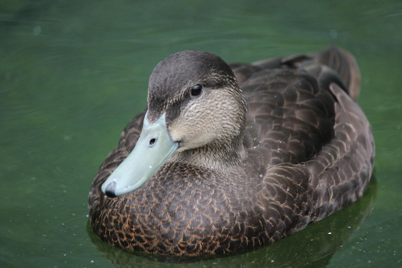
 Sources/Usage: Public Domain. View Media Details
Examples - Publications
- Web Tools
- Partners