
Laura Lapolice taking water-quality sample at Mountain Island, NC. Near USGS gage 0214267602.
Multimedia
Visit the SAWSC Picture Gallery
Browse our large collection of pictures about science at the South Atlantic Water Science Center
Browse our large collection of pictures about science at the South Atlantic Water Science Center
Visit the SAWSC Video Library
Browse our collection of videos about science at the South Atlantic Water Science Center
Browse our collection of videos about science at the South Atlantic Water Science Center
Visit the SAWSC Audio/Podcast Library
Browse our collection of audio podcasts about science at the South Atlantic Water Science Center
Browse our collection of audio podcasts about science at the South Atlantic Water Science Center
Images
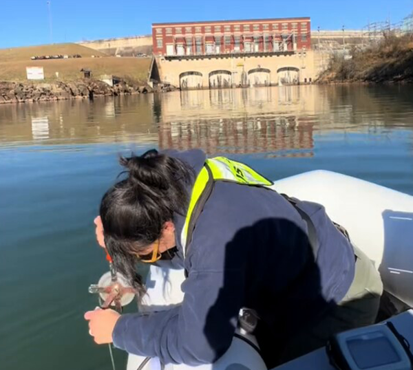
Laura Lapolice taking water-quality sample at Mountain Island, NC
Laura Lapolice taking water-quality sample at Mountain Island, NC. Near USGS gage 0214267602.
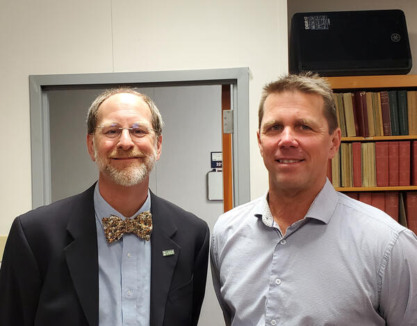
USGS Director David Applegate and South Atlantic Water Science Center Director Vic Engel
USGS Director David Applegate and South Atlantic Water Science Center Director Vic Engel visit Raleigh, North Carolina Office
USGS Director David Applegate and South Atlantic Water Science Center Director Vic Engel visit Raleigh, North Carolina Office
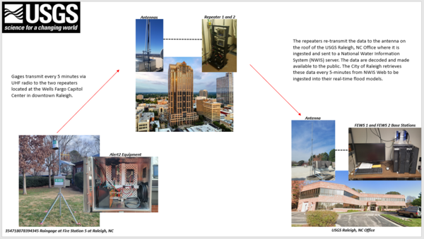
Raleigh, NC Flood Early Warning System System Diagram
System Diagram for Raleigh, NC Flood Early Warning System (FEWS). Gage data is transmitted every 5 minutes via UHF radio signals to repeaters located on a centrally located tall building. The repeaters relays the data to the Raleigh USGS office for processing.
System Diagram for Raleigh, NC Flood Early Warning System (FEWS). Gage data is transmitted every 5 minutes via UHF radio signals to repeaters located on a centrally located tall building. The repeaters relays the data to the Raleigh USGS office for processing.
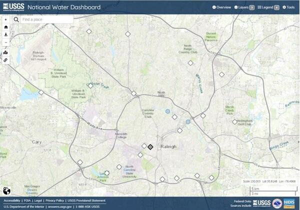
Map of the gages that make up the Raleigh Flood Early Warning System (FEWS)
Map of the gages that make up the Raleigh Flood Early Warning System (FEWS). Image from the USGS National Water Dashboard.
Map of the gages that make up the Raleigh Flood Early Warning System (FEWS). Image from the USGS National Water Dashboard.

Gage Greatness Bracket Round 1
At the USGS, we monitor our nation’s water. Our data informs many people, from kayakers to water managers. Gage Greatness allows any Twitter user to vote for their favorite gage (data collection station).
At the USGS, we monitor our nation’s water. Our data informs many people, from kayakers to water managers. Gage Greatness allows any Twitter user to vote for their favorite gage (data collection station).
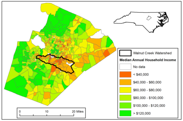
Map of Walnut Creek Watershed and Median Annual Household Income
Map of Walnut Creek Watershed, Raleigh, North Carolina and Median Annual Household Income
Map of Walnut Creek Watershed, Raleigh, North Carolina and Median Annual Household Income
Videos

What Does a USGS Hydrologic Technician Do to Inspect Streamgages?
What do USGS Hydrologic Technicians do on the job? This video features two Hydrologic Technicians from the South Atlantic Water Science Center sharing how they inspect streamgages, which is an integral part of a Hydrologic Technician's work. This video was sponsored by the USGS Hydrologic Data Advisory Committee.
What do USGS Hydrologic Technicians do on the job? This video features two Hydrologic Technicians from the South Atlantic Water Science Center sharing how they inspect streamgages, which is an integral part of a Hydrologic Technician's work. This video was sponsored by the USGS Hydrologic Data Advisory Committee.

USGS hydrologists respond to historic hurricane season
Throughout the historically active 2020 Atlantic Hurricane Season,USGS hydrologists have been working quickly to collect vital flood and streamflow information in impacted areas.
Throughout the historically active 2020 Atlantic Hurricane Season,USGS hydrologists have been working quickly to collect vital flood and streamflow information in impacted areas.

Establishing a Permanent Measuring Point and Reference Marks at a Well
This video demonstrates how to establish permanent reference points and markers at a well site.
This video demonstrates how to establish permanent reference points and markers at a well site.

Measuring Total Well Depth Using a Steel Tape - YouTube
This video demonstrates how to measure total well depth below land surface using a weighted, graduated steel tape.
This video demonstrates how to measure total well depth below land surface using a weighted, graduated steel tape.

USGS Live Video on Hurricane Matthew
This was a Facebook Live Video conducted with USGS Hydrologist, Brian McCallum from the South Atlantic Water Science Center in Norcross, GA. The original URL for this Facebook Live video is at: https://www.facebook.com/USGeologicalSurvey/videos/1179388798773768/
This was a Facebook Live Video conducted with USGS Hydrologist, Brian McCallum from the South Atlantic Water Science Center in Norcross, GA. The original URL for this Facebook Live video is at: https://www.facebook.com/USGeologicalSurvey/videos/1179388798773768/

Shale Baseline Sampling of Groundwater in North Carolina
Melinda Chapman and Sharon Fitzgerald discuss the U.S. Geological Survey groundwater sampling program to characterize water-suppy well water quality in the area of North Carolina with potential for shale gas production.
Melinda Chapman and Sharon Fitzgerald discuss the U.S. Geological Survey groundwater sampling program to characterize water-suppy well water quality in the area of North Carolina with potential for shale gas production.
Audio

Responding to Hurricanes, Floods and Droughts in North Carolina
North Carolina, like many years before, is responding to flooding in the East and drought in the West. Holly Weyers, USGS North Carolina Water Science Center Director, discusses these extreme events.
North Carolina, like many years before, is responding to flooding in the East and drought in the West. Holly Weyers, USGS North Carolina Water Science Center Director, discusses these extreme events.
USGS Water Activities in South Carolina - Update
An update on USGS Water activities in South Carolina as SC Water Science Center Director Eric Strom is interviewed by SC Public Radio ‘Your Day’ host, Donna London.
An update on USGS Water activities in South Carolina as SC Water Science Center Director Eric Strom is interviewed by SC Public Radio ‘Your Day’ host, Donna London.
USGS Hydrologic Investigation of West Africa's Congo River (part 3)
USGS South Carolina Water Science Center Data Chief, John Shelton in a special hydrologic expedition down the Congo River, West Africa. Part three of the three part episode, reveals a hydrologic data set that changed the world record books.
USGS South Carolina Water Science Center Data Chief, John Shelton in a special hydrologic expedition down the Congo River, West Africa. Part three of the three part episode, reveals a hydrologic data set that changed the world record books.

Groundwater Awareness Week is March 6-12
Groundwater is not a single vast pool of underground water; rather, it is contained within a variety of aquifer systems. Each of these aquifers has its own set of questions and challenges.
Groundwater is not a single vast pool of underground water; rather, it is contained within a variety of aquifer systems. Each of these aquifers has its own set of questions and challenges.
USGS Hydrologic Investigation of West Africa's Congo River (part two)
USGS South Carolina Water Science Center Data Chief, John Shelton in a special hydrologic expedition down West Africa's Congo River. In part two of this three part episode John describes the trials and tribulations of data collection on the Congo River.
USGS South Carolina Water Science Center Data Chief, John Shelton in a special hydrologic expedition down West Africa's Congo River. In part two of this three part episode John describes the trials and tribulations of data collection on the Congo River.
GEOSMIN in South Carolina Water's, What is it?
USGS Water Quality Specialist Celeste Journey discusses Geosmin. What is it? What
causes it? and Will it harm you?
USGS Water Quality Specialist Celeste Journey discusses Geosmin. What is it? What
causes it? and Will it harm you?
Webcams
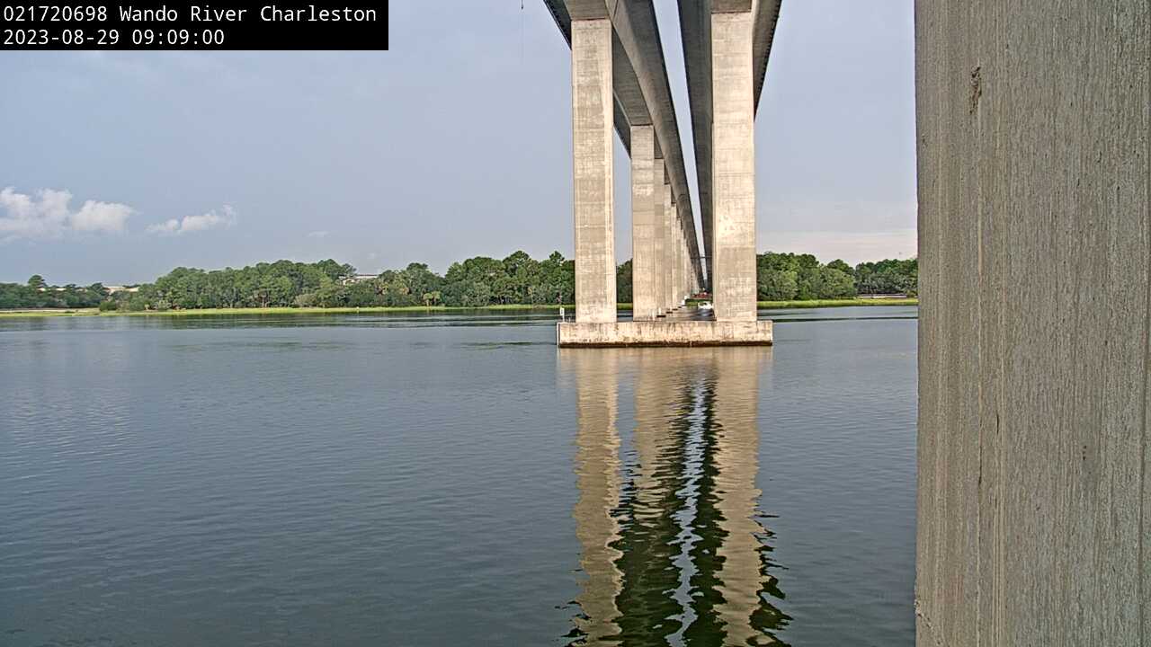
Wando River above Mt. Pleasant (021720698)
We have installed a webcam at Wando River above Mt. Pleasant to allow you to view (in real time) the current conditions.
We have installed a webcam at Wando River above Mt. Pleasant to allow you to view (in real time) the current conditions.
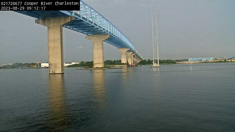
Cooper River at Filbin Creek at North Charleston (021720677)
We have installed a webcam at Cooper River at Filbin Creek at North Charleston to allow you to view (in real time) the current conditions.
We have installed a webcam at Cooper River at Filbin Creek at North Charleston to allow you to view (in real time) the current conditions.
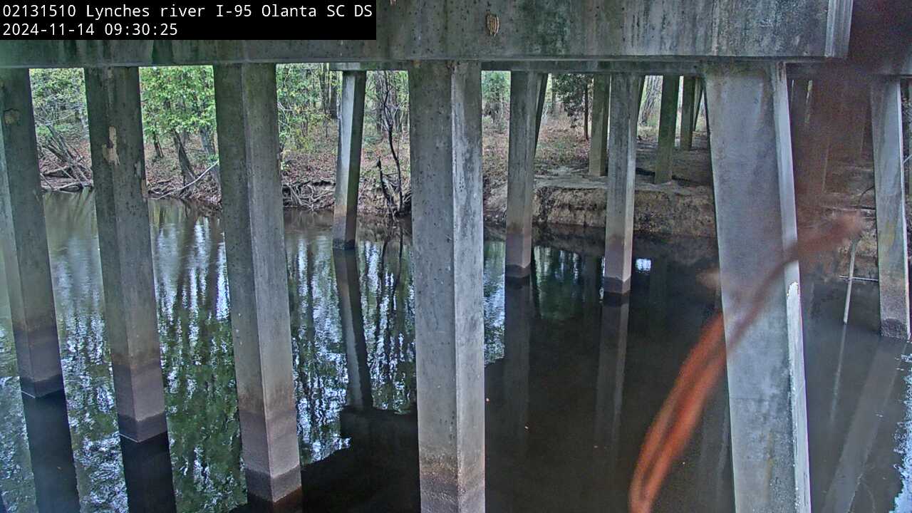
Lynches River at I-95, above Olanta, SC (02131510, Downstream)
We have installed a webcam at the Lynches River at I-95, above Olanta to allow you to view, in real time, the current river-stage conditions.
During periods of flooding, the South Atlantic Water Science Center - South Carolina will take control of the camera.
We have installed a webcam at the Lynches River at I-95, above Olanta to allow you to view, in real time, the current river-stage conditions.
During periods of flooding, the South Atlantic Water Science Center - South Carolina will take control of the camera.
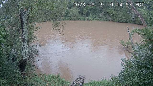
French Broad River below I-26 near Bent Creek, NC (03448050)
The camera is located on the right bank of the French Broad River facing northeast; the river flows from left to right.
Water-quality monitoring equipment can be seen at the bottom-center of the viewing area.
Camera is sponsored by the NC Department of Transportation .
The camera is located on the right bank of the French Broad River facing northeast; the river flows from left to right.
Water-quality monitoring equipment can be seen at the bottom-center of the viewing area.
Camera is sponsored by the NC Department of Transportation .
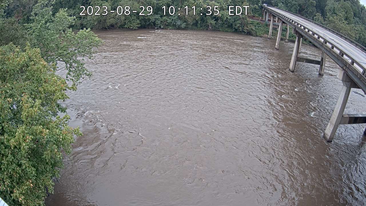
French Broad River at Asheville, NC (03451500)
The camera is located on the right bank of the French Broad River facing northwest; the river flows from left to right.
Discharge, precipitation, and water-quality monitoring equipment is also located at this station (not shown in viewing area).
Camera is sponsored by the NC Department of Transportation.
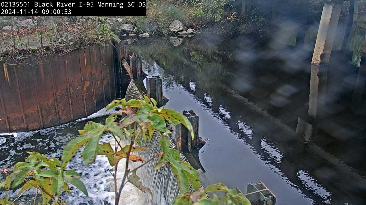
Black River at I-95, near Manning, SC (02135501, Downstream)
We have installed a webcam at the Black River at I-95, near Manning to allow you to view, in real time, the current river-stage conditions.
During periods of flooding, the South Atlantic Water Science Center - South Carolina will take control of the camera.
We have installed a webcam at the Black River at I-95, near Manning to allow you to view, in real time, the current river-stage conditions.
During periods of flooding, the South Atlantic Water Science Center - South Carolina will take control of the camera.