
Shoreface Morphology and Geology Active
Exchanges of sediment between the shoreface and barrier islands allow barrier islands to adjust to changes in water level, such as those associated with storms or sea-level rise. Characterizing shoreface morphology and geology allows us to explore how past and present processes have impacted modern barrier island sediment transport and what that means for future barrier island evolution.
Barrier islands are shaped by oceanographic conditions, sediment supply, frequency and intensity of storms, and human modification. We conduct fieldwork in a variety of barrier island settings to understand the relative importance of these factors.

Learn more about Coastal Change at Fire Island


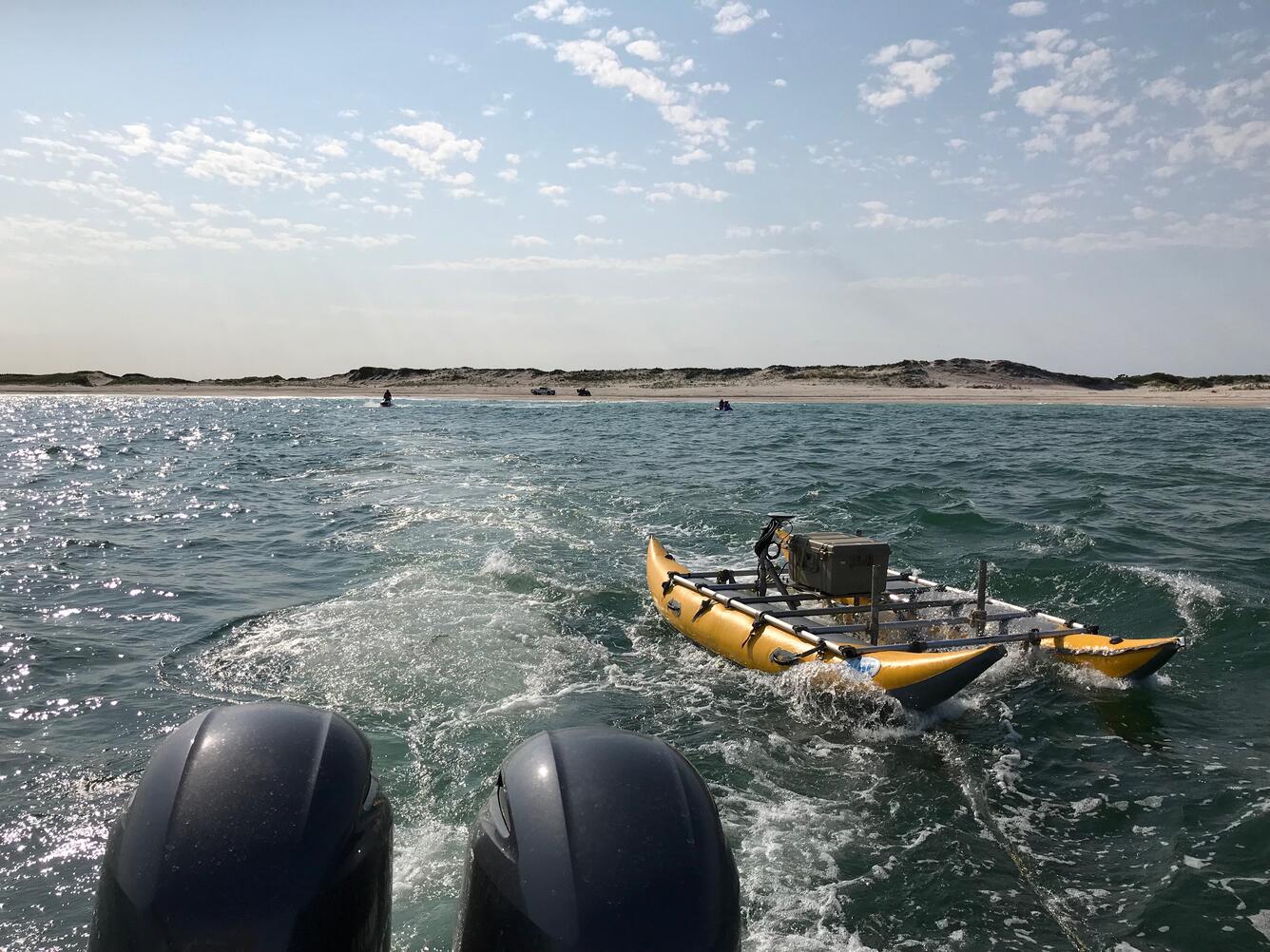

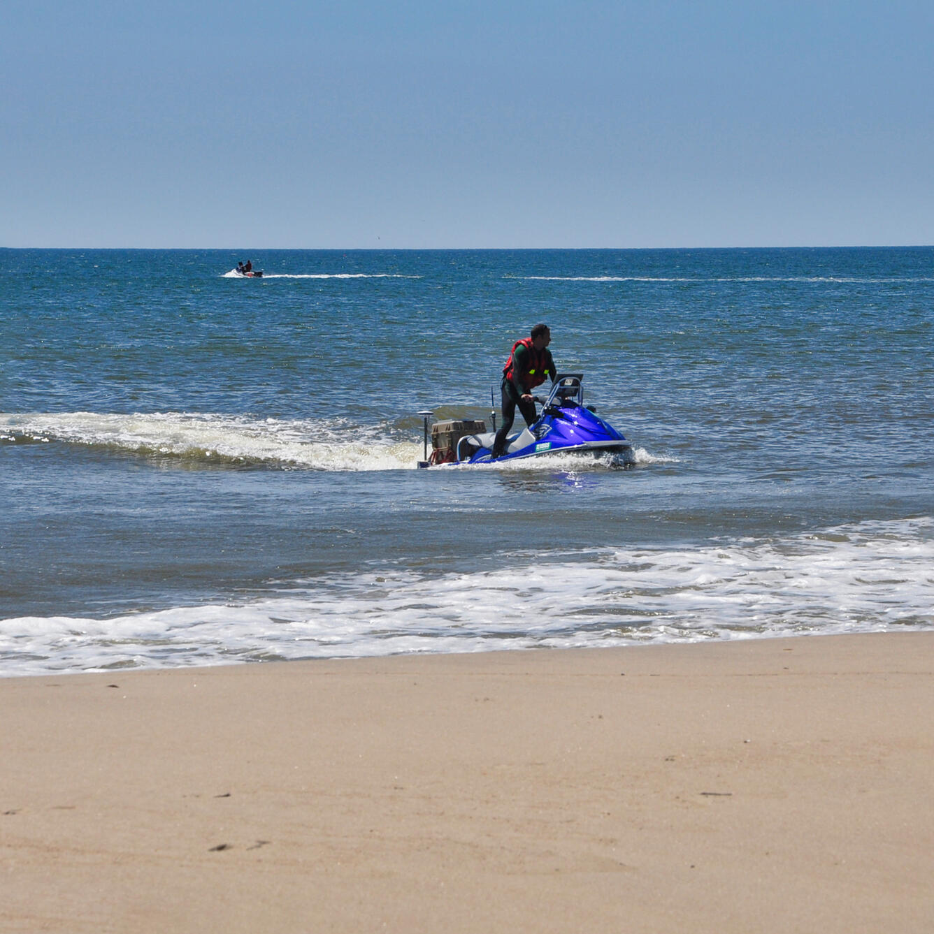
Most underwater seismic data is collected from large research vessels; however, the shoreface environment is shallower than areas in which most seismic surveys occur. To get the information we need to assess changes in shoreface geology, we mount our seismic instruments on pontoon floats and deploy the instrument from the beach.

Unlike the Fire Island shoreface, the shoreface offshore of Seven Mile Island, NJ has a much gentler gradient, which may be related to sediment supply or oceanographic conditions. Research conducted by the Coastal Sediment Availability and Flux project seeks to reveal links between shoreface morphology and geology.

Barrier island processes in Cedar Island, VA are much different than those in Fire Island, NY and Seven Mile Island, NJ. Cedar Island is a barrier island experiencing rapid landward retreat. Aerial imagery from 1984 to 2020 demonstrate that the barrier island has narrowed and has shifted west. We are currently exploring shoreface morphology and geology at Cedar Island to understand where sediment is on the shoreface.
- Overview
Exchanges of sediment between the shoreface and barrier islands allow barrier islands to adjust to changes in water level, such as those associated with storms or sea-level rise. Characterizing shoreface morphology and geology allows us to explore how past and present processes have impacted modern barrier island sediment transport and what that means for future barrier island evolution.
Barrier islands are shaped by oceanographic conditions, sediment supply, frequency and intensity of storms, and human modification. We conduct fieldwork in a variety of barrier island settings to understand the relative importance of these factors.
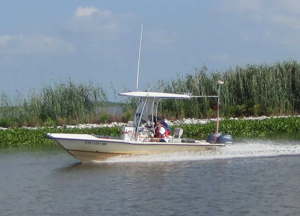
Sources/Usage: Public Domain. View Media DetailsWe conduct fieldwork in a variety of barrier island settings to understand the relative importance of these factors, including Fire Island, NY; Rockaway, NY; Seven Mile Island, NJ; and Cedar Island, VA. Learn more about Coastal Change at Fire Island


Most underwater seismic data is collected from large research vessels; however, the shoreface environment is shallower than areas in which most seismic surveys occur. To get the information we need to assess changes in shoreface geology, we mount our seismic instruments on pontoon floats and deploy the instrument from the beach.
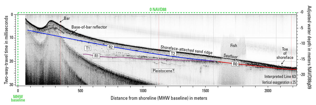
Sources/Usage: Public Domain. View Media DetailsAbove is a seismic profile collected from the shoreface of Fire Island, NY (Locker et al., 2017), which shows a steep shoreface, a nearshore bar, a sand ridge, and the geology beneath it all. The sediment above the blue and red lines is thought to be available for transport by waves or longshore drift. We map and quantify this volume of sediment along barrier islands, which improves estimates of shoreface sediment flux and connects geologic observations to models.
Sources/Usage: Public Domain. View Media DetailsThis three-dimensional view shows the bathymetry, or shape and depth, of the shoreface. The shoreface offshore of Seven Mile Island, NJ has a gentle gradient, which may be related to sediment supply or oceanographic conditions. Note that this image has a vertical exaggeration of 100. Bathymetry data from Farmer et al. (2019).
Unlike the Fire Island shoreface, the shoreface offshore of Seven Mile Island, NJ has a much gentler gradient, which may be related to sediment supply or oceanographic conditions. Research conducted by the Coastal Sediment Availability and Flux project seeks to reveal links between shoreface morphology and geology.
Sources/Usage: Public Domain. View Media DetailsCedar Island is a barrier island experiencing rapid landward retreat. This animation shows aerial imagery from 1984 to 2020 and demonstrates that the barrier island has narrowed and is retreating towards land. Barrier island processes in Cedar Island, VA are much different than those in Fire Island, NY and Seven Mile Island, NJ. Cedar Island is a barrier island experiencing rapid landward retreat. Aerial imagery from 1984 to 2020 demonstrate that the barrier island has narrowed and has shifted west. We are currently exploring shoreface morphology and geology at Cedar Island to understand where sediment is on the shoreface.
- Science
- Data
- Publications