


Meaghan Emory and Drs. Legna Torres-Garcia and Donya Frank-Gilchrist engage with stakeholders and explore potential partnerships across Caribbean nations and territories to further enhance USGS natural hazards research at the 2023 SCDRP annual meeting in Miami, Florida.
Stakeholder Engagement for Natural Hazards Investigations in the Caribbean (SENHIC) Active
By St. Petersburg Coastal and Marine Science Center
January 20, 2023
USGS staff are connecting with natural hazards researchers based in the Caribbean and those specializing in the region to find out which natural hazards are of primary concern, learn about their mitigation efforts, and explore the potential for research collaboration.
A Region Vulnerable to Hazards
Many Caribbean countries and U.S. Caribbean territories have been severely impacted by natural hazards such as hurricanes, earthquakes, and landslides. These hazardous events can exacerbate preexisting vulnerabilities such as health risks (e.g., contaminated water supplies), and conditions are expected to worsen with climate change. Some natural hazards impacting these small islands are driven by regional-scale processes that are linked to those of neighboring countries. Collaborative investigations on regional-scale hazards such as coastal storms, flooding, sea level rise, freshwater scarcity, earthquakes, droughts, and coral reef degradation will help us to better understand these physical processes and develop more accurate numerical models to predict their impacts, which could reduce loss of life and property.
USGS Natural Hazards Research in the Caribbean

Sources/Usage: Public Domain. View Media Details
Building Relationships to Enhance Natural Hazards Science

Sources/Usage: Public Domain. View Media Details
As part of the Stakeholder Engagement for Natural Hazards Investigations in the Caribbean (SENHIC) project, the USGS team aims to:
- Connect with scientists who are conducting, or have conducted, natural hazards research in the Caribbean;
- Build relationships with local experts in Caribbean countries and U.S. territories to learn about natural hazards of primary concern, mitigation efforts, and areas of overlapping interest;
- Construct a database of local experts to lay the groundwork for future collaborations;
- Inventory and create a list of regional natural hazard resources;
- Develop a framework for collaborating with international partners on natural hazards research in the Caribbean; and
- Document engagement strategies, best practices, key takeaways, and lessons learned.

Sources/Usage: Public Domain. View Media Details

Sources/Usage: Public Domain. View Media Details
The SENHIC project is jointly funded by the USGS Risk Community of Practice and the U.S. Agency for International Development (USAID) Bureau for Humanitarian Assistance. It is being led by Dr. Donya Frank-Gilchrist and Dr. Legna Torres-García of the USGS St. Petersburg Coastal and Marine Science Center. The team intends for this project to lay the foundation for future collaborations and information exchange to build resilience across the Caribbean region.
Project Milestones
- April 2022 – SENHIC team granted funding from the USGS Risk Community of Practice and the USAID Bureau for Humanitarian Assistance
- May 17, 2022 – Dr. Donya Frank-Gilchrist participated on Department of the Interior Environmental Justice panel, “Reframing the Science-Inequity Paradigm: Global Perspectives to Addressing Environmental Justice in Science”
- October 2022 – Dr. Legna Torres-García presents on, “Stakeholder Engagement for Natural Hazards Resource Development in the Caribbean” at Society for Advancement of Chicanos/Hispanics & Native Americans in Science (SACNAS) Diversity in STEM conference in San Juan, Puerto Rico
- January 24-25, 2023 – SENHIC hosted the panel discussion, “Approaches to Resilience from the International Caribbean” at the Southeast and Caribbean Disaster Resilience Partnership (SCDRP) Annual Meeting in Miami, Florida
- February 13, 2023 – Federal Register Notice closed for public input on, “Agency Information Collection Activities; Stakeholder Engagement for Natural Hazards Investigations in the Caribbean.”
- February 2023 – SENHIC project participated in the Southeast Conservation Adaptation Strategy Caribbean Community of Practice Meeting in the U.S. Virgin Islands
Click here for more information on past events and milestones.
Meet the Project Leads
If you are involved in natural hazards research in the Caribbean or are interested in collaborating with the USGS SENHIC team, please contact Dr. Donya Frank-Gilchrist or Dr. Legna Torres-García.

Sources/Usage: Public Domain. View Media Details

Sources/Usage: Public Domain. View Media Details
SENHIC Project Milestones and Meetings
As part of the Stakeholder Engagement for Natural Hazards Investigations in the Caribbean (SENHIC) project, the USGS team aims to connect with scientists who are conducting natural hazards research in the Caribbean, build relationships with natural hazards researchers based in the Caribbean and those specializing in the region, and develop a framework for collaborating with international partners.
Puerto Rico Natural Hazards: Water Resources | Peligros naturales de Puerto Rico: Recursos de agua
The USGS monitors and studies water resources to deliver a wide range of data including streamflow conditions, groundwater information, lake and reservoir elevation, water quality, water use, and water availability, which can be accessed through the USGS National Water Dashboard. As of 2022, the USGS real-time water data network is comprised of 109 streamflow observation stations, 20 groundwater...
Puerto Rico Natural Hazards: Tsunamis | Peligros naturales de Puerto Rico: Maremotos
Tsunamis are long waves formed from a sudden displacement of the sea floor due to a fault rupture, landslide, or volcanic activity. Given that Puerto Rico lies above a subduction zone in the Caribbean Sea, it is especially susceptible to large earthquakes and tsunamis. The greatest tsunami ever recorded in Puerto Rico occurred from an earthquake off the Mona Passage in 1918. The USGS Earthquake...
Puerto Rico Natural Hazards: Landslides | Peligros naturales de Puerto Rico: Deslizamientos de tierra
The Landslide Hazards Program from USGS works to help reduce the impact of landslides to people and infrastructure by furthering our understanding of causes of ground failure and by recommending strategies for risk mitigation. In Puerto Rico, USGS researchers have rigorously studied rainfall-induced landslides to provide maps that depict landslide susceptibility. Educational materials that...
Puerto Rico Natural Hazards: Hurricanes | Peligros naturales de Puerto Rico: Huracanes
Hurricanes are one of the most frequent natural hazards that Caribbean islands are prone to encounter. The frequency of storms and their intensity could increase with climate change. This page contains a variety of USGS research on hurricane impacts to Puerto Rico, dating back to 1989, when Hurricane Hugo impacted the island. Research topics include storm-induced landslides, as well as impacts on...
Puerto Rico Natural Hazards: Ecosystems and Environmental Contaminants | Peligros naturales de Puerto Rico: Ecosistemas y contaminantes ambientales
USGS researchers have studied environmental contaminants and pathogens to address questions involving exposure pathways and human-health implications. They also study climate change impacts and ecosystem health. On this page, read about ecosystems and environmental health research in Puerto Rico, including contaminants in tap water, and possible human exposures. Investigadores del USGS han...
Puerto Rico Natural Hazards: Earthquakes | Peligros naturales de Puerto Rico: Terremotos
USGS provides real-time earthquake data, information on historic earthquakes, resources for the most significant earthquakes, and seismicity and ground motions to support future updates to the seismic hazard models for Puerto Rico and the U.S. Virgin Islands. Our seismic research can help establish better building regulations that mitigate earthquake risks and improve public safety. The USGS...
Puerto Rico Natural Hazards: Coastal | Peligros naturales de Puerto Rico: Costas
This page is a collection of USGS coastal hazard research in Puerto Rico, including shoreline changes, coral reef assessments, and coastal flooding. A brief description of highlighted projects can be found below. All coastal hazard publications, data releases, and news for Puerto Rico can be accessed on this page. Esta página es una recopilación de investigaciones del USGS sobre los riesgos...
Puerto Rico Natural Hazards | Peligros naturales de Puerto Rico
The island of Puerto Rico is subject to numerous threats from natural hazards, including hurricanes, landslides, earthquakes, tsunamis, coastal and inland flooding, environmental contaminants, and freshwater scarcity, among others. USGS science can help citizens better prepare for, mitigate, and adapt to these hazards. This website compiles USGS resources available for Puerto Rico to provide...
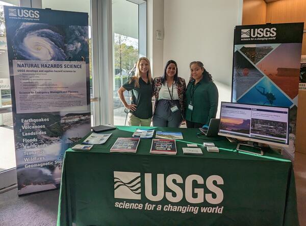
USGS staff engage with stakeholders and explore potential partnerships at SCDRP annual meeting
Meaghan Emory and Drs. Legna Torres-Garcia and Donya Frank-Gilchrist engage with stakeholders and explore potential partnerships across Caribbean nations and territories to further enhance USGS natural hazards research at the 2023 SCDRP annual meeting in Miami, Florida.

Donya-Frank Gilchrist presents on USGS Natural Hazards Science at the SCDRP Annual Meeting
Dr. Donya-Frank Gilchrist of the USGS St. Petersburg Coastal and Marine Science Center facilitated a session on "Approaches to Resilience from the International Caribbean" at the 2023 Southeast and Caribbean Disaster Resilience Partnership (SCDRP) Annual Meeting in Miami, Florida.
Dr. Donya-Frank Gilchrist of the USGS St. Petersburg Coastal and Marine Science Center facilitated a session on "Approaches to Resilience from the International Caribbean" at the 2023 Southeast and Caribbean Disaster Resilience Partnership (SCDRP) Annual Meeting in Miami, Florida.

Donya-Frank Gilchrist facilitates session on "Approaches to Resilience from the International Caribbean" at the SCDRP Annual Meeting
linkDr. Donya-Frank Gilchrist of the USGS St. Petersburg Coastal and Marine Science Center facilitated a session on "Approaches to Resilience from the International Caribbean" at the 2023 Southeast and Caribbean Disaster Resilience Partnership (SCDRP) Annual Meeting in Miami, Florida.
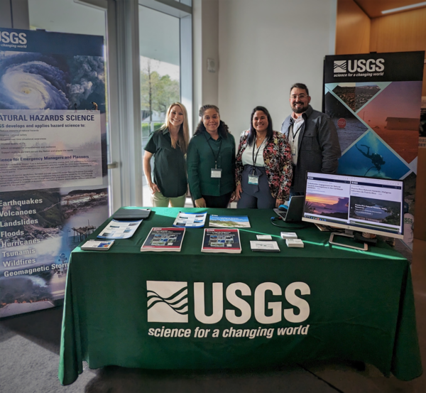
Engaging with Stakeholders on Caribbean Natural Hazards
From left to right: Meaghan Emory, Dr. Donya Frank-Gilchrist, Dr.
From left to right: Meaghan Emory, Dr. Donya Frank-Gilchrist, Dr.

Hurricane Maria Impacting the Eastern Caribbean
Colorized satellite imagery from 2017-09-19 15:00 UTC of Hurricane Maria impacting the Eastern Caribbean. Data provided by NOAA. Base image is intellectual property of NOAA and is used herein under license. Copyright Esri and its creator.
Colorized satellite imagery from 2017-09-19 15:00 UTC of Hurricane Maria impacting the Eastern Caribbean. Data provided by NOAA. Base image is intellectual property of NOAA and is used herein under license. Copyright Esri and its creator.

USGS project Stakeholder Engagement for Natural Hazards Investigations in the Caribbean (SENHIC) featured in White House Fact Sheet, "Vice President Harris Announces New Initiatives to Strengthen U.S-Caribbean Partnership"
Vice President Kamala Harris and Caribbean leaders launched the U.S.-Caribbean Partnership to Address the Climate Crisis 2030 (PACC 2030), the U.S. Government’s flagship partnership with Caribbean partners to advance climate adaptation, build resilience and expand clean energy access across the region.
- Overview
USGS staff are connecting with natural hazards researchers based in the Caribbean and those specializing in the region to find out which natural hazards are of primary concern, learn about their mitigation efforts, and explore the potential for research collaboration.
A Region Vulnerable to Hazards
Many Caribbean countries and U.S. Caribbean territories have been severely impacted by natural hazards such as hurricanes, earthquakes, and landslides. These hazardous events can exacerbate preexisting vulnerabilities such as health risks (e.g., contaminated water supplies), and conditions are expected to worsen with climate change. Some natural hazards impacting these small islands are driven by regional-scale processes that are linked to those of neighboring countries. Collaborative investigations on regional-scale hazards such as coastal storms, flooding, sea level rise, freshwater scarcity, earthquakes, droughts, and coral reef degradation will help us to better understand these physical processes and develop more accurate numerical models to predict their impacts, which could reduce loss of life and property.
USGS Natural Hazards Research in the Caribbean
Sources/Usage: Public Domain. View Media DetailsUSGS conducts natural hazards research in numerous Caribbean countries and U.S. territories on topics such as earthquakes, landslides, hurricanes, coastal erosion, and more. As part of the Stakeholder Engagement for Natural Hazards Investigations in the Caribbean (SENHIC) project, we are working to improve collaboration and consolidate information from these initiatives in order to make USGS science more accessible for stakeholders. Countries with colored dots indicate where current or past USGS natural hazards projects have been identified as of January 2023. View a larger map. Building Relationships to Enhance Natural Hazards Science
Sources/Usage: Public Domain. View Media DetailsHurricane tracks for Hugo (1989), Georges (1998), Irma (2017) and Maria (2017). Data provided by NOAA. Base image is intellectual property of Esri and is used herein under license. Copyright Esri and its creator. As part of the Stakeholder Engagement for Natural Hazards Investigations in the Caribbean (SENHIC) project, the USGS team aims to:
- Connect with scientists who are conducting, or have conducted, natural hazards research in the Caribbean;
- Build relationships with local experts in Caribbean countries and U.S. territories to learn about natural hazards of primary concern, mitigation efforts, and areas of overlapping interest;
- Construct a database of local experts to lay the groundwork for future collaborations;
- Inventory and create a list of regional natural hazard resources;
- Develop a framework for collaborating with international partners on natural hazards research in the Caribbean; and
- Document engagement strategies, best practices, key takeaways, and lessons learned.
Sources/Usage: Public Domain. View Media DetailsNortheastern Caribbean topobathymetry and fault trace map. View map for more details.
Sources/Usage: Public Domain. View Media DetailsMap shows the track of Hurricane Maria (2017) across the Caribbean. The SENHIC project is jointly funded by the USGS Risk Community of Practice and the U.S. Agency for International Development (USAID) Bureau for Humanitarian Assistance. It is being led by Dr. Donya Frank-Gilchrist and Dr. Legna Torres-García of the USGS St. Petersburg Coastal and Marine Science Center. The team intends for this project to lay the foundation for future collaborations and information exchange to build resilience across the Caribbean region.
Project Milestones
- April 2022 – SENHIC team granted funding from the USGS Risk Community of Practice and the USAID Bureau for Humanitarian Assistance
- May 17, 2022 – Dr. Donya Frank-Gilchrist participated on Department of the Interior Environmental Justice panel, “Reframing the Science-Inequity Paradigm: Global Perspectives to Addressing Environmental Justice in Science”
- October 2022 – Dr. Legna Torres-García presents on, “Stakeholder Engagement for Natural Hazards Resource Development in the Caribbean” at Society for Advancement of Chicanos/Hispanics & Native Americans in Science (SACNAS) Diversity in STEM conference in San Juan, Puerto Rico
- January 24-25, 2023 – SENHIC hosted the panel discussion, “Approaches to Resilience from the International Caribbean” at the Southeast and Caribbean Disaster Resilience Partnership (SCDRP) Annual Meeting in Miami, Florida
- February 13, 2023 – Federal Register Notice closed for public input on, “Agency Information Collection Activities; Stakeholder Engagement for Natural Hazards Investigations in the Caribbean.”
- February 2023 – SENHIC project participated in the Southeast Conservation Adaptation Strategy Caribbean Community of Practice Meeting in the U.S. Virgin Islands
Click here for more information on past events and milestones.
Meet the Project Leads
If you are involved in natural hazards research in the Caribbean or are interested in collaborating with the USGS SENHIC team, please contact Dr. Donya Frank-Gilchrist or Dr. Legna Torres-García.
Sources/Usage: Public Domain. View Media DetailsDr. Donya Frank-Gilchrist is a Research Physical Scientist at the St. Petersburg Coastal and Marine Science Center. Her research focuses on understanding nearshore hydrodynamics, the mobility of sand and other objects on the seafloor, as well as the impacts of storms on beaches and coastal communities.
Sources/Usage: Public Domain. View Media DetailsDr. Legna Torres-García is a Research Oceanographer at the St. Petersburg Coastal and Marine Science Center in St. Petersburg, Florida. Her research focuses on using multi-scale observational and numerical model data to understand circulation, waves, sediment transport and coastal vulnerability. - Science
SENHIC Project Milestones and Meetings
As part of the Stakeholder Engagement for Natural Hazards Investigations in the Caribbean (SENHIC) project, the USGS team aims to connect with scientists who are conducting natural hazards research in the Caribbean, build relationships with natural hazards researchers based in the Caribbean and those specializing in the region, and develop a framework for collaborating with international partners.Puerto Rico Natural Hazards: Water Resources | Peligros naturales de Puerto Rico: Recursos de agua
The USGS monitors and studies water resources to deliver a wide range of data including streamflow conditions, groundwater information, lake and reservoir elevation, water quality, water use, and water availability, which can be accessed through the USGS National Water Dashboard. As of 2022, the USGS real-time water data network is comprised of 109 streamflow observation stations, 20 groundwater...Puerto Rico Natural Hazards: Tsunamis | Peligros naturales de Puerto Rico: Maremotos
Tsunamis are long waves formed from a sudden displacement of the sea floor due to a fault rupture, landslide, or volcanic activity. Given that Puerto Rico lies above a subduction zone in the Caribbean Sea, it is especially susceptible to large earthquakes and tsunamis. The greatest tsunami ever recorded in Puerto Rico occurred from an earthquake off the Mona Passage in 1918. The USGS Earthquake...Puerto Rico Natural Hazards: Landslides | Peligros naturales de Puerto Rico: Deslizamientos de tierra
The Landslide Hazards Program from USGS works to help reduce the impact of landslides to people and infrastructure by furthering our understanding of causes of ground failure and by recommending strategies for risk mitigation. In Puerto Rico, USGS researchers have rigorously studied rainfall-induced landslides to provide maps that depict landslide susceptibility. Educational materials that...Puerto Rico Natural Hazards: Hurricanes | Peligros naturales de Puerto Rico: Huracanes
Hurricanes are one of the most frequent natural hazards that Caribbean islands are prone to encounter. The frequency of storms and their intensity could increase with climate change. This page contains a variety of USGS research on hurricane impacts to Puerto Rico, dating back to 1989, when Hurricane Hugo impacted the island. Research topics include storm-induced landslides, as well as impacts on...Puerto Rico Natural Hazards: Ecosystems and Environmental Contaminants | Peligros naturales de Puerto Rico: Ecosistemas y contaminantes ambientales
USGS researchers have studied environmental contaminants and pathogens to address questions involving exposure pathways and human-health implications. They also study climate change impacts and ecosystem health. On this page, read about ecosystems and environmental health research in Puerto Rico, including contaminants in tap water, and possible human exposures. Investigadores del USGS han...Puerto Rico Natural Hazards: Earthquakes | Peligros naturales de Puerto Rico: Terremotos
USGS provides real-time earthquake data, information on historic earthquakes, resources for the most significant earthquakes, and seismicity and ground motions to support future updates to the seismic hazard models for Puerto Rico and the U.S. Virgin Islands. Our seismic research can help establish better building regulations that mitigate earthquake risks and improve public safety. The USGS...Puerto Rico Natural Hazards: Coastal | Peligros naturales de Puerto Rico: Costas
This page is a collection of USGS coastal hazard research in Puerto Rico, including shoreline changes, coral reef assessments, and coastal flooding. A brief description of highlighted projects can be found below. All coastal hazard publications, data releases, and news for Puerto Rico can be accessed on this page. Esta página es una recopilación de investigaciones del USGS sobre los riesgos...Puerto Rico Natural Hazards | Peligros naturales de Puerto Rico
The island of Puerto Rico is subject to numerous threats from natural hazards, including hurricanes, landslides, earthquakes, tsunamis, coastal and inland flooding, environmental contaminants, and freshwater scarcity, among others. USGS science can help citizens better prepare for, mitigate, and adapt to these hazards. This website compiles USGS resources available for Puerto Rico to provide... - Multimedia
USGS staff engage with stakeholders and explore potential partnerships at SCDRP annual meeting
Meaghan Emory and Drs. Legna Torres-Garcia and Donya Frank-Gilchrist engage with stakeholders and explore potential partnerships across Caribbean nations and territories to further enhance USGS natural hazards research at the 2023 SCDRP annual meeting in Miami, Florida.
Meaghan Emory and Drs. Legna Torres-Garcia and Donya Frank-Gilchrist engage with stakeholders and explore potential partnerships across Caribbean nations and territories to further enhance USGS natural hazards research at the 2023 SCDRP annual meeting in Miami, Florida.
Donya-Frank Gilchrist presents on USGS Natural Hazards Science at the SCDRP Annual MeetingDr. Donya-Frank Gilchrist of the USGS St. Petersburg Coastal and Marine Science Center facilitated a session on "Approaches to Resilience from the International Caribbean" at the 2023 Southeast and Caribbean Disaster Resilience Partnership (SCDRP) Annual Meeting in Miami, Florida.
Dr. Donya-Frank Gilchrist of the USGS St. Petersburg Coastal and Marine Science Center facilitated a session on "Approaches to Resilience from the International Caribbean" at the 2023 Southeast and Caribbean Disaster Resilience Partnership (SCDRP) Annual Meeting in Miami, Florida.
Donya-Frank Gilchrist facilitates session on "Approaches to Resilience from the International Caribbean" at the SCDRP Annual MeetingDonya-Frank Gilchrist facilitates session on "Approaches to Resilience from the International Caribbean" at the SCDRP Annual Meeting
linkDr. Donya-Frank Gilchrist of the USGS St. Petersburg Coastal and Marine Science Center facilitated a session on "Approaches to Resilience from the International Caribbean" at the 2023 Southeast and Caribbean Disaster Resilience Partnership (SCDRP) Annual Meeting in Miami, Florida.
Donya-Frank Gilchrist facilitates session on "Approaches to Resilience from the International Caribbean" at the SCDRP Annual Meeting
linkDr. Donya-Frank Gilchrist of the USGS St. Petersburg Coastal and Marine Science Center facilitated a session on "Approaches to Resilience from the International Caribbean" at the 2023 Southeast and Caribbean Disaster Resilience Partnership (SCDRP) Annual Meeting in Miami, Florida.
Engaging with Stakeholders on Caribbean Natural HazardsFrom left to right: Meaghan Emory, Dr. Donya Frank-Gilchrist, Dr.
From left to right: Meaghan Emory, Dr. Donya Frank-Gilchrist, Dr.
Hurricane Maria Impacting the Eastern CaribbeanColorized satellite imagery from 2017-09-19 15:00 UTC of Hurricane Maria impacting the Eastern Caribbean. Data provided by NOAA. Base image is intellectual property of NOAA and is used herein under license. Copyright Esri and its creator.
Colorized satellite imagery from 2017-09-19 15:00 UTC of Hurricane Maria impacting the Eastern Caribbean. Data provided by NOAA. Base image is intellectual property of NOAA and is used herein under license. Copyright Esri and its creator.
- News
USGS project Stakeholder Engagement for Natural Hazards Investigations in the Caribbean (SENHIC) featured in White House Fact Sheet, "Vice President Harris Announces New Initiatives to Strengthen U.S-Caribbean Partnership"
Vice President Kamala Harris and Caribbean leaders launched the U.S.-Caribbean Partnership to Address the Climate Crisis 2030 (PACC 2030), the U.S. Government’s flagship partnership with Caribbean partners to advance climate adaptation, build resilience and expand clean energy access across the region.
- Connect