Groundwater Flow Modeling
Aerial view of part of the Eastern Shore Peninsula from the south
Courtesy of F. Ray Gefken, Eagle Eyes' Aerial Photography
A major revision to the current Virginia Eastern Shore groundwater flow model will improve simulation of the aquifer system by incorporating new hydrogeologic data, increasing spatial and temporal resolution, and using up-to-date MODFLOW modeling software and techniques. Better simulation of the surficial aquifer system is an important goal of the revision.
A USGS groundwater model of the Virginia Eastern Shore published in 2009 (Sanford and others) is currently used by the Virginia Department of Environmental Quality as a tool to manage groundwater resources by predicting the effects of future withdrawals on groundwater levels in various aquifers and estimating areas of possible intrusion of saline water into freshwater aquifers.
In over a decade since the development of the model currently in use, the availability of new hydrologic information and enhancements in modeling technology have resulted in the need for a revised groundwater model. A new model currently in development will 1) incorporate new information on the geospatial configuration of buried paleochannels intersecting the confined Yorktown-Eastover aquifer system, 2) improve the simulation of the unconfined surficial aquifer with increased spatial discretization and explicit representation of streams, 3) increase temporal model resolution from yearly to monthly intervals to improve simulation of seasonal variations in groundwater conditions, and 4) incorporate up-to-date MODFLOW modeling software and data management.
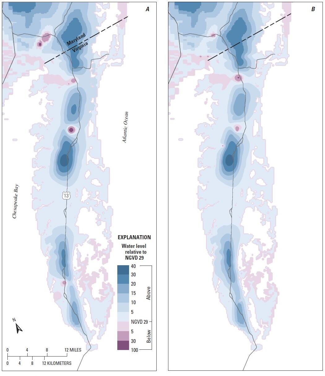
Model-simulated water levels in the upper Yorktown-Eastover aquifer of the Eastern Shore of Virginia, for (A) 1980 and (B) 2000.
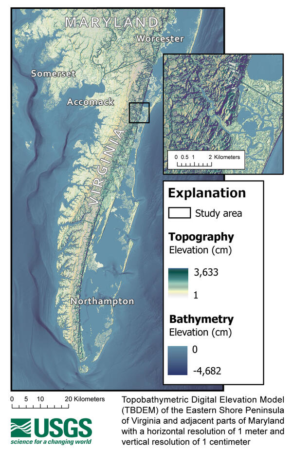
Topobathymetric Digital Elevation Model of the Eastern Shore Peninsula of Virginia and adjacent parts of Maryland with a horizontal resolution of 1 meter and vertical resolution of 1 centimeter.