Saltwater Interface Mapping
Electromagnetic induction logging
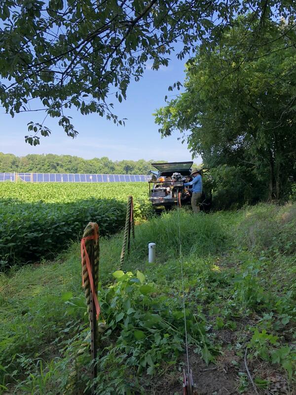
Eastern Shore groundwater monitoring well
To improve understanding of the saltwater-transition zone within the Eastern Shore aquifer system, electromagnetic-induction well logging is being used to supplement previous sampling and mapping studies with detailed information about temporal changes in salinity near individual wells.
The configuration of the saltwater-transition zone as described by McFarland and Beach (2019) is based on limited data and is considered to be preliminary. Movement of the saltwater-transition zone is not characterized because most wells are not sampled with adequate frequency. A monitoring strategy using conventional well sampling possibly augmented with electromagnetic-induction well logging could potentially be used to detect changes in the position of the saltwater-transition zone.
USGS hydrologist sampling and logging an Eastern Shore groundwater observation well.
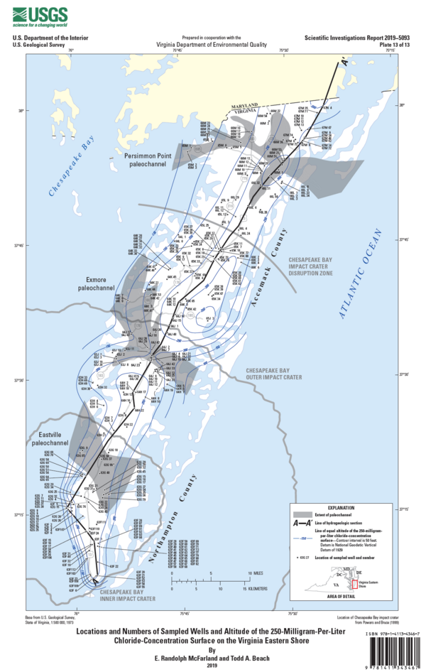
Locations and numbers of sampled wells and altitude of the 250-milligram-per-liter chloride-concentration surface on the Virginia Eastern Shore.