
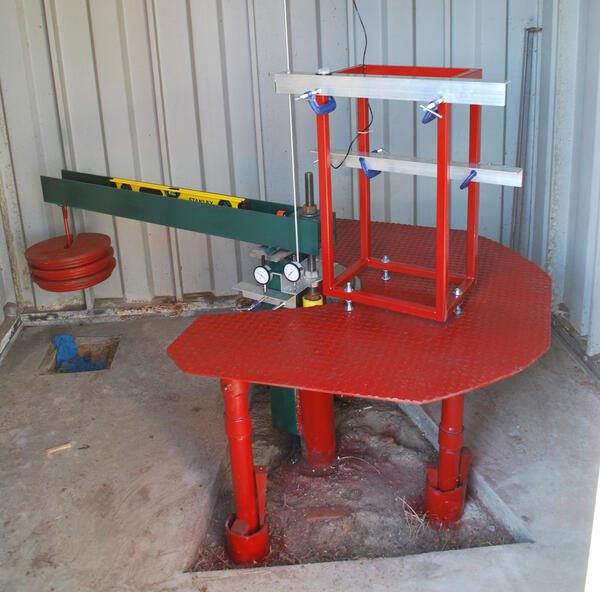
Shenandoah mobile laboratory fathead minnow experiment station
Images
Explore our planet and learn more about our work through photographs and imagery from scientists and support staff.
Filter Total Items: 212

Shenandoah mobile laboratory fathead minnow experiment station
Shenandoah mobile laboratory fathead minnow experiment station

Lick Run water quality instrumentation and automatic sampler intake
Lick Run water quality instrumentation and automatic sampler intake
Lick Run water quality instrumentation and automatic sampler intake

Inside the Lick Run gage house showing the instrumentation
Inside the Lick Run gage house showing the instrumentation
Inside the Lick Run gage house showing the instrumentation

Hampton Roads WQMP CoverImage1.png
Hampton Roads WQMP Image 1. Water flowing from a culvert.
Hampton Roads WQMP Image 1. Water flowing from a culvert.

USGS intern making a discharge measurement
USGS intern, James Willey (2016), making a discharge measurement
USGS intern, James Willey (2016), making a discharge measurement

Water quality and stream gage equipment at Lick Run
View of water quality and stream gage equipment at Lick Run.
View of water quality and stream gage equipment at Lick Run.


A forest stream in Virginia with fall leaves.
A forest stream in Virginia with fall leaves.
A forest stream in Virginia with fall leaves.

Looking West To Old Rag Mountain in Madison County Virginia
Looking West To Old Rag Mountain in Madison County Virginia
Looking West To Old Rag Mountain in Madison County Virginia

Gage house at the Lick Run Monitoring site
Gage house at the Lick Run Monitoring site
Gage house at the Lick Run Monitoring site

Connecting drill stem to the top head drive on the USGS Research Rig
Connecting drill stem to the top head drive on the USGS Research Drilling program’s rig.
Connecting drill stem to the top head drive on the USGS Research Drilling program’s rig.

Lick Run concrete lined channel with Mill Mountain in the background
Lick Run concrete lined channel with Mill Mountain in the background
Lick Run concrete lined channel with Mill Mountain in the background

Lick Run concrete lined channel
View of the Lick Run concrete lined channel
View of the Lick Run concrete lined channel
The USGS Franklin pipe extensometer with a total depth of 860 feet.
The USGS Franklin pipe extensometer with a total depth of 860 feet.
Period of record: 1979-1995; 2016-present
The USGS Franklin pipe extensometer with a total depth of 860 feet.
Period of record: 1979-1995; 2016-present

Building housing the USGS Suffolk extensometer
This photograph shows the building housing the USGS Suffolk extensometer. Inside, the extensometer extends to a depth of 1,599 feet below groundlevel.
Period of record: 1982-1995; 2016-present
This photograph shows the building housing the USGS Suffolk extensometer. Inside, the extensometer extends to a depth of 1,599 feet below groundlevel.
Period of record: 1982-1995; 2016-present

The USGS Suffolk pipe extensometer with a total depth of 1,620 feet.
The USGS Suffolk pipe extensometer with a total depth of 1,620 feet.
Period of record: 1982-1995; 2016-present
The USGS Suffolk pipe extensometer with a total depth of 1,620 feet.
Period of record: 1982-1995; 2016-present

Building housing the USGS Franklin extensometer
Building housing the USGS Franklin extensometer. Inside, the extensometer extends 866 feet below land surface.
Period of record: 1979-1995; 2016-present
Building housing the USGS Franklin extensometer. Inside, the extensometer extends 866 feet below land surface.
Period of record: 1979-1995; 2016-present

Trail Near Blue Ridge Parkway Near Afton, Virginia
Trail Near Blue Ridge Parkway Near Afton, Virginia
Trail Near Blue Ridge Parkway Near Afton, Virginia

Learning water quality methods: calibrating a water quality sodne
Learning water quality methods: Sequoya Bua-Iam (2015) calibrates a sonde in the USGS laboratory.
Learning water quality methods: Sequoya Bua-Iam (2015) calibrates a sonde in the USGS laboratory.

Learning water quality methods: recording a water quality sonde
Learning water quality methods: Sequoya Bua-Iam (2015) records a sonde in the USGS laboratory.
Learning water quality methods: Sequoya Bua-Iam (2015) records a sonde in the USGS laboratory.

Conveyance Chain at Ramsgate, Hampton Roads
This stormwater monitoring site is a part of the Hampton Roads Regional Water Quality Monitoring Program.
This stormwater monitoring site is a part of the Hampton Roads Regional Water Quality Monitoring Program.