
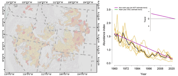
Trend estimation calculated from seven nadirs defining six unique periods of complete population oscillation
linkTrend estimation calculated from seven nadirs defining six unique periods of complete population oscillation. Purple lines indicate periods of erroneous inference about population trend. Green lines indicate nadir-to-nadir inference and more accurate trend estimation.


