
GIS
GIS
Filter Total Items: 30
Western U.S. Using Networked Weather Radar and Wildlife Tracking Data
USGS scientists from the Wetland and Aquatic Research Center and the Western Ecological Research Center are collaborating to synthesize data on migratory bird use of Bureau of Land Management lands in the western U.S. to support permitting decisions.

Tracking Non-breeding Habitat Use by Dunlin, Pectoral Sandpipers, and Other Migratory Shorebirds in the Mississippi Delta
USGS researchers and heir partners are capturing and banding birds that use man-made habitats to gather data on species occurrence, abundance, and energetic condition during autumn migration.

Spatial Analysis Support for Coastal Wetlands Planning, Protection and Restoration Act (Breaux Bill) Planning Activities
WARC first implemented geographic information systems (GIS) in 1980 to help monitor the nature and extent of wetland habitat changes. The center continues to use GIS, remote sensing, and other computer based technologies to address a wide range of natural resource related issues.

Geographic Information and Technical Support
USGS WARC first implemented geographic information systems (GIS) in 1980 to assist in monitoring the nature and extent of wetland habitat changes. Today, WARC geographers and support staff create, maintain, and use geospatial data to analyze restoration efforts in Louisiana.

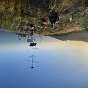
Use of Portable Radar to Monitor Flying Animals in the Offshore Environment
USGS will deploy a small, portable radar aboard a National Oceanic and Atmospheric Administration research vessel to measure the abundance, geographic distribution, and flight altitude of birds migrating across the continental shelf of the northern Gulf.

Barriers and Opportunities for Landward Migration of Coastal Wetlands along Texas' Upper and Middle Coast
Researchers at WARC will use data and models to produce probabilistic maps of current and future wetland inundation, coastal wetland extent, and coastal and wetland trangression.

Coastal Wetland Vulnerability to Climate Change and Sea-Level Rise: Understanding Ecological Thresholds and Ecosystem Transformations
Eighteen USGS coastal scientists from all four coasts of the conterminous United States are working together to advance the understanding of climate change and sea-level rise impacts to coastal wetlands.
By
California Water Science Center, Chesapeake Bay Activities, Eastern Ecological Science Center, Florence Bascom Geoscience Center, Great Lakes Science Center, Pacific Coastal and Marine Science Center, St. Petersburg Coastal and Marine Science Center, Western Ecological Research Center (WERC), Western Geographic Science Center, Wetland and Aquatic Research Center , Woods Hole Coastal and Marine Science Center

GIS and Custom Application Support for the Gulf Coast Ecosystem Restoration Council
The scientists at the Wetland and Aquatic Science Center (WARC) have provided coastal restoration project managers and decision makers with GIS planning, database and custom application capacity since 1992. The scope and complexity of this support has increased over the years and has resulted in the development of a comprehensive geospatial and advanced application teams that provide decision...

Developing General Coastal Vegetation Maps for Coastal Morphodynamic Models
The USGS is collaborating with researchers from other agencies, academia, and industry to predict coastal impacts from hurricanes. The results from this study will better inform coastal morphological change models, which will lead to improved hurricane impact projections.

Seagrass Beds and Manatee Foraging Areas in the Ten Thousand Islands: Mapping and Characterizing by Incorporating Manatee GPS Tracking Data and Habitat Information
Turbid water conditions make the delineation and characterization of benthic habitats difficult by traditional in situ and remote sensing methods. Consequently, only a small fraction of this valuable resource has been mapped or characterized.

Understanding Avian Habitat Availability and Use After Barrier Island Restoration in Coastal Louisiana
Using ecological and geographical data, WARC researchers and their partners are analyzing avian and benthic sampling on Whiskey Island and Caminda Headland to compare pre- and post-restoration aspects of habitat occupancy, habitat availability, habitat use, and kernal density estimation.

Restoration Impacts to Avian Populations along the Louisiana Outer Coast
USGS researchers are conducting ground surveys and collecting aerial imagery to understand avian use of restored habitats at Whiskey Island, Shell Island, Cheniere Ronquille, and Breton Island. They will also develop habitat maps to understand how coastal processes and episodic events influence barrier islands.