
Ocean Resources
USGS conducts research studies focused on geologic mapping, sampling and understanding of mineral and energy resources and studies of the geologic setting and processes to inform renewable energy development offshore. Resources of high interest and value are gas hydrates, renewable kinetic energy in offshore winds, tides and currents, deposits of rare earth elements, and sand and gravel deposits.
Gas Hydrates
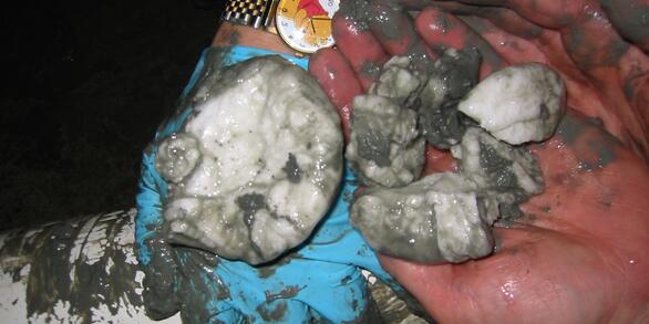
The USGS Gas Hydrates Project has been making contributions to advance understanding of US and international gas hydrates science for at least three decades and has expertise in all the major geoscience disciplines, as well as in the physics and chemistry of gas hydrates, the geotechnical properties of hydrate-bearing sediments.
Stellwagen Bank
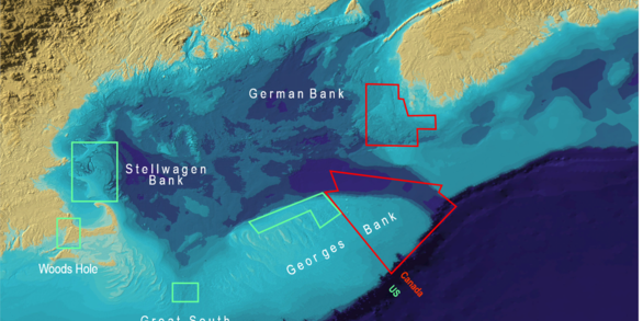
Stellwagen Bank National Marine Sanctuary Geologic Mapping project is part of the combined effort by the U.S. Geological Survey and NOAA’s Stellwagen Bank National Marine Sanctuary to map the geologic substrates of Stellwagen Bank and to study the ecology of fish and invertebrate species that inhabit the bank’s sandy substrates off Boston, Massachusetts.


