
Landsat Data Continuity Mission Underfly with Landsat 7
On March 29-30, 2013, the Landsat Data Continuity Mission (later named Landsat 8) was in position under the Landsat 7 satellite. This provided opportunities for near-coincident data collection from both satellites. The images below show a portion of the Great Salt Lake in Utah, and the Dolan Springs, Arizona area, the latter of which is used in Landsat calibration activities.
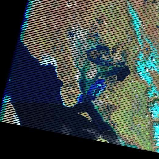
The Scan Line Corrector (SLC) lines are clearly visible in Landsat 7 images. Since the LDCM is in a slightly lower orbit, the pixel resolution is approximately 29.3 meters.
Great Salt Lake, Utah
The Great Salt Lake and surrounding waters provide for vivid imagery. The dark color of the deep salt water of the Great Salt Lake gives way to shallower, stored water confinements, to green mineral-rich sediment along the coastline.

Dolan Springs, Arizona
The desert area of Dolan Springs, Arizona is a vicarious calibration site, at which airborne and field spectroradiometeric measurements are collected and used to characterize, calibrate, and validate the radiomeric performance of the Landsat sensors.

