
Landsat GCP Updates
In 2014, improvements to GCP files began – these include removing outdated files, and creating new, time-specific and seasonal GCP’s. Details about each update are provided below, in reverse chronological order.
Return to Landsat Ground Control Points Overview
January 2020: Phase 4 - Collection 2
Phase 4 involves a re-baselining of the Landsat 8 Operational Land Imager (OLI) Ground Control Points (GCPs) to the European Space Agency Sentinel-2 Global Reference Image (GRI). This involved updating over 5.1 million GCPs as well as the extraction of 2.5 million new Landsat 8 GCPs globally for inclusion in Collection 2 Level-1 product generation. The purpose is to improve the per-pixel geodetic accuracy and interoperability of the global Landsat archive spatially, temporally, and with Sentinel-2. The article “Bundle Adjustment Using Space-Based Triangulation Method for Improving the Landsat Global Ground Reference” provides a description of the triangulation based method used in this Phase 4 GCP update.
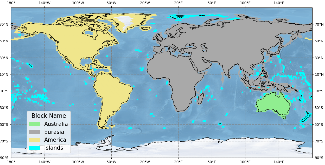

The table below displays summary statistics of the global Ground Control Point (GCP) re-adjustment effort to harmonize Landsat 8 Operation Land Imager-based GCPs with Sentinel-2 Global Reference Image. Updated Collection 2 OLI GCPs results yield a Landsat/Sentinel-2 global average registration accuracy of <10 meters circular error at the 90th percentile (CE90).
| Landsat Collection 1 | Collection 2 Landsat 8 OLI-only | Sentinel 2 Global Reference Image (GRI) | |||
|---|---|---|---|---|---|
| Block | Type | #Tiles | CE90 (meters) | CE90 (meters) | CE90 (meters) |
| North America | All | 778 | 20.80 | 11.47 | 7.61 |
| South America | All | 228 | 31.75 | 12.87 | 6.06 |
| Australia | All | 77 | 7.15 | 7.15 | 5.44 |
| Islands | All | 159 | 28.21 | 15.01 | 9.22 |
| Asia | All | 819 | 27.83 | 10.74 | 6.95 |
| EurAfrica | All | 1,134 | 25.84 | 8.33 | 6.44 |
| Total | All | 3,195 | 25.56 | 10.51 | 6.98 |
May 2016: Phase 3
Phase 3 updated 918 path/rows, covering high latitude arctic regions where the existing GLS2000-based ground control points were found to contain errors of 50 meters or more. In addition to correcting the existing GCPs and adding new GCPs where the existing coverage is sparse or absent, this update implements improvements to the digital elevation model (DEM) used for Greenland, and for the islands of Svalbard and Jan Mayen Land. This DEM update uses more accurate data recently created by the Greenland Ice Mapping Project (GIMP) and the Norwegian Polar Institute (NPI).*
List of Phase 3 Path/Rows (.txt)
*The new Greenland DEM data are described in this publication:
Howat, I., A. Negrete, and B. Smith. 2015. MEaSURES Greenland Ice Mapping Project (GIMP) Digital Elevation Model, Version 1. The 90-meter resolution data set was used. Boulder, Colorado USA. NASA National Snow and Ice Data Center Distributed Active Archive Center. doi:http://dx.doi.org/10.5067/NV34YUIXLP9W. Accessed 29 January 2016.
*The new NPI DEMs for Svalbard and Jan Mayen Land are described in the following publications:
Norwegian Polar Institute. (2014). Terrengmodell Svalbard (S0 Terrengmodell). The 50-meter resolution data set was used. Tromsø, Norway: Norwegian Polar Institute. https://data.npolar.no/dataset/dce53a47-c726-4845-85c3-a65b46fe2fea Accessed 10 February 2016.
Norwegian Polar Institute. (2014). Terrengmodell Jan Mayen (J0 Terrengmodell). The 25-meter resolution data set was used. Tromsø, Norway: Norwegian Polar Institute. https://data.npolar.no/dataset/e2b2417e-9926-4519-b6a9-7eefb3bb1012 Accessed 10 February 2016.
January 2016: Phase 2
Phase 2 includes 1,151 WRS-2 paths/rows, covering island areas and inland regions where the estimated absolute accuracy of the original Global Land Survey 2000 (GLS2000)-based ground control varied between 50-75 meters. This update affected:
- Middle to low latitude regions
-
Specific updates to GCPs used over Australia in order for that region to be more consistent with the Australian Geographic Reference Image (AGRI).
The metadata file (MTL.txt) delivered with the reprocessed Level-1 scenes include a new field, to indicate newly processed data:
- The GROUND_CONTROL_POINTS_VERSION parameter will display version number “3”: [GROUND_CONTROL_POINTS_VERSION=3]
-
The FILE_DATE will be updated with a date after January 11, 2016
List of Phase 2 Path/Rows (.txt)
April 2015: Phase 1- Software Fix
In April 2015, a software issue was fixed. The GCP image chips used to perform the precision correction for L1TP products are in a UTM projection. When the set of GCPs to use is identified for a specific scene, some of the chips might be in different UTM zones – so some of the image chips are reprojected to get all the chips into the correct UTM zone for the scene being processed.
It was discovered that the chip reprojection software had a rounding bug that added a bias to the image chip location. On average, the bias would be roughly half of a 30m pixel. The impact was considered minor enough that no data has been reprocessed to correct this. The impact should always be less than half a pixel and usually much, much less than that (depending on how many chips with the location bias end up being used in the precision solution).
-
Landsat 8: PROCESSING_SOFTWARE_VERSION = “LPGS_2.5.0” for this correction.
August 2014: Phase 1
Phase 1 updated the accuracy within a number of GCPs in high priority areas, known to have large offsets in the original points. The new GCPs allowed scenes that once created only a systematic Level-1GT product to process a precision Level-1TP. 171 paths/rows covering the following areas were updated:
- Island and coastal locations where meager coverage existed (lack of reference data in the original triangulation, few GCPs available, etc.)
-
Desert regions where shifting dunes caused existing GCPs to become obsolete and other anomalous locations in which an apparent bias remained.
Phase 1 updates were implemented in the following Landsat Product Generation System (LPGS) releases (noted in the MTL file):
- Landsat 8: PROCESSING_SOFTWARE_VERSION = “LPGS_2.4.0”
-
Landsat 1-7: PROCESSING_SOFTWARE_VERSION = "LPGS_12.5.0"
List of Phase 1 paths/rows (.txt)
February 2014: GCPs created for the WRS-2 paths/rows 138/41, 151/30, and 172/43.
These new GCPs allowed Landsat 8 scenes that once processed only to systematic Level-1 (L1GT) product to process a precision and terrain corrected Level-1T (L1TP). Additionally, GCPs that were contained within large bodies of water were removed from use during Level-1 processing. Although the presence of these points typically has little effect on the quality of the geometric registration of the L1TP data, the removal of these GCPs indicated that generating L1TP products was possible.
The GCP Improvement Plan (page 15 of this 2014 Landsat Update) provides the triangulation results for the paths/rows improved in Phase 1. Because the updated GCPs will be more accurate, users may consider re-ordering previously downloaded images, as new GCPs may allow scenes that once could only be processed to systematic L1GT products to be processed as a precision and terrain corrected L1TP.