


Field sampling in the Hells Canyon Reservoir Complex, with Dr. M. Marvin-DiPasquale at the bow of the sediment collection boat. Photographer: D. Krabbenhoft.
Microbial Biogeochemistry Core Technology Team Active
By Environmental Health Program
March 3, 2024
Studies of contaminant biogeochemistry and microbial processes in surface sediments.
Ecosystem restoration research.
Studies of contaminant biogeochemistry and microbial processes in surface waters.
Laboratory approaches for quantifying microbial process rates and analyte concentrations.
Studies of contaminant biogeochemistry and microbial processes in wetland environments.
About the Research
The Microbial Biogeochemistry Laboratory Core Technology Team (CTT) as part of the Environmental Health Program focuses on environmental questions in aquatic systems (sediment and water) involving the linkages between major biogeochemical cycles (those involving carbon, sulfur, iron and nitrogen) and those associated with contaminants of concern.
The research interests and analytical capabilities of the Microbial Biogeochemistry Laboratory CTT bridge the intersection of fundamental microbial biogeochemistry and ecosystem contaminants science.

Sources/Usage: Public Domain. View Media Details
The mobility, transport, and chemical transformation of many contaminants in aquatic systems are ultimately mediated by microbial process, which are in turn mediated and defined by the availability of specific electron donors (such as various forms of organic carbon) and electron acceptors (such as oxygen, iron, manganese, nitrogen and sulfur).
The Microbial Biogeochemistry Laboratory has a long history of focusing on the intersection of microbial biogeochemistry and contaminants in mercury specific studies, in a wide range of aquatic systems (streams/rivers, wetlands, reservoirs, tidal estuaries and hypersaline salt ponds). In recent years their analytical capabilities have expanded to a much wider range of elements of concern (including Al, As, Cd, Cr, Cu, Fe, Mn, Pb, Se, U, and Zn) and energy production associated waste streams (oil and gas production wastewater, and coal mining regions).
Key Analytical Capabilities include:
- Measurement of microbial reaction rates using isotopic tracer methods
- Mercury speciation in a range of matrices
- Nutrients, anions/cations and trace elements
- Chemical speciation and quantification of major biogeochemical cycle constituents associated with carbon, sulfur, iron, and nitrogen

Sources/Usage: Public Domain. View Media Details
Key Instrumentation:
- Quadrupole Inductively coupled plasma mass spectrometer (ICP-MS)
- Ion, liquid and gas chromatography
- Total mercury analyzer
- Methylmercury analyzer
- Nutrient analyzer
- Chlorophyll analyzer
- Field fluorometry and other in-situ sensor technology
- Total carbon analyzer (with 13C isotopes)
Science Team Collaborators
Science Team Collaborators
-
Energy Integrated Science Team
The Energy Lifecycle Integrated Science Team focuses on the potential for contaminant exposures in the environment that might originate from energy resource activities including, extraction, production, transportation, storage, extraction, waste management and restoration. Perceived health risks to humans and other organisms will be distinguished from actual risks, if any. If actual risks are...Ecologically-Driven Exposure Pathways Science Team
The Ecologically-Driven Exposure Pathways Integrated Science Team identifies how ecological pathways and physiological processes within a single organism can alter exposure and toxicity of contaminants and pathogens and seek to understand outcomes at different scales from individuals to populations and ecosystems.Proxies Project
The Proxies Project is a series of studies to improve our understanding of water contaminants and water quality hazards. These studies develop models and technical approaches for estimating concentrations and assessing risk associated with: - harmful algal blooms (HABs) - per- and polyfluoroalkyl substances (PFAS) - 12 elements of concern (EoC)
Multimedia items related to the Microbial Biogeochemistry Core Technology Team can be found below.

Hells Canyon Sediment Collection
Field sampling in the Hells Canyon Reservoir Complex, with Dr. M. Marvin-DiPasquale at the bow of the sediment collection boat. Photographer: D. Krabbenhoft.

Studies of contaminant biogeochemistry and microbial processes in surface waters
Left: USGS Employee L. Windham-Myers showing a surface water sample collected in acid-cleaned mason jar (deployed for 24 hours) for a mercury study conducted at the Cosumnes River Nature Preserve (CA). Photographer: M. Marvin-DiPasquale. Date: 10/29/2014.
Left: USGS Employee L. Windham-Myers showing a surface water sample collected in acid-cleaned mason jar (deployed for 24 hours) for a mercury study conducted at the Cosumnes River Nature Preserve (CA). Photographer: M. Marvin-DiPasquale. Date: 10/29/2014.

Laboratory approaches for quantifying microbial process rates and analyte concentrations
Left: Distillation rig used in the measurement of microbial sulfate reduction rates associated with a method based on the incubation of sediment samples with radioactively labeled sulfate. Photographer: M. Marvin-DiPasquale. Date: 3/5/2001.
Left: Distillation rig used in the measurement of microbial sulfate reduction rates associated with a method based on the incubation of sediment samples with radioactively labeled sulfate. Photographer: M. Marvin-DiPasquale. Date: 3/5/2001.

Taking surface sediment measurements at Crissy Marsh in San Francisco, CA.
USGS researcher Jennifer Agee taking surface sediment oxidation-reduction and pH measurements at Crissy Marsh, a vegetated saltmarsh near the Golden Gate Bridge (background) in San Francisco, CA. Photographer: L. Windham-Myers.
USGS researcher Jennifer Agee taking surface sediment oxidation-reduction and pH measurements at Crissy Marsh, a vegetated saltmarsh near the Golden Gate Bridge (background) in San Francisco, CA. Photographer: L. Windham-Myers.

Studies of contaminant biogeochemistry and microbial processes in wetland environments.
Left Image: Managed wetland at the Yolo Bypass Wildlife Preserve (California Central Valley) showing mixed flocks of foraging birds. Photographer: M. Marvin-DiPasquale.
Left Image: Managed wetland at the Yolo Bypass Wildlife Preserve (California Central Valley) showing mixed flocks of foraging birds. Photographer: M. Marvin-DiPasquale.

Studies of contaminant biogeochemistry and microbial processes in surface sediments.
Left: USGS Employee Sherry Wren removing a square meter of surface sediment in pickleweed dominated marsh along the Petaluma River (California), for a study designed to investigate the role of marsh plant root zone on the cycling of mercury. Photographer: L. Windham-Myers. Date: 4/4/2006
Left: USGS Employee Sherry Wren removing a square meter of surface sediment in pickleweed dominated marsh along the Petaluma River (California), for a study designed to investigate the role of marsh plant root zone on the cycling of mercury. Photographer: L. Windham-Myers. Date: 4/4/2006

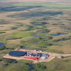
Ecosystem restoration research in South San Francisco Bay.
Hilltop view of the Ravenswood ponds (right side of levee) in South San Francisco Bay. These former salt-production ponds were subsequently slated for a major wetland restoration project.
Hilltop view of the Ravenswood ponds (right side of levee) in South San Francisco Bay. These former salt-production ponds were subsequently slated for a major wetland restoration project.

Surface sediment sampling in a vegetated Louisiana saltmarsh.
USGS researchers Jennifer Agee and Le Kieu sampling surface sediment in a vegetated Louisiana saltmarsh. Photographer: M. Marvin-DiPasquale.
USGS researchers Jennifer Agee and Le Kieu sampling surface sediment in a vegetated Louisiana saltmarsh. Photographer: M. Marvin-DiPasquale.
- Overview
About the Research
The Microbial Biogeochemistry Laboratory Core Technology Team (CTT) as part of the Environmental Health Program focuses on environmental questions in aquatic systems (sediment and water) involving the linkages between major biogeochemical cycles (those involving carbon, sulfur, iron and nitrogen) and those associated with contaminants of concern.
The research interests and analytical capabilities of the Microbial Biogeochemistry Laboratory CTT bridge the intersection of fundamental microbial biogeochemistry and ecosystem contaminants science.
Sources/Usage: Public Domain. View Media DetailsUSGS researchers Jennifer Agee and Le Kieu sampling surface sediment in a vegetated Louisiana saltmarsh. Photographer: M. Marvin-DiPasquale. The mobility, transport, and chemical transformation of many contaminants in aquatic systems are ultimately mediated by microbial process, which are in turn mediated and defined by the availability of specific electron donors (such as various forms of organic carbon) and electron acceptors (such as oxygen, iron, manganese, nitrogen and sulfur).
The Microbial Biogeochemistry Laboratory has a long history of focusing on the intersection of microbial biogeochemistry and contaminants in mercury specific studies, in a wide range of aquatic systems (streams/rivers, wetlands, reservoirs, tidal estuaries and hypersaline salt ponds). In recent years their analytical capabilities have expanded to a much wider range of elements of concern (including Al, As, Cd, Cr, Cu, Fe, Mn, Pb, Se, U, and Zn) and energy production associated waste streams (oil and gas production wastewater, and coal mining regions).
Key Analytical Capabilities include:
- Measurement of microbial reaction rates using isotopic tracer methods
- Mercury speciation in a range of matrices
- Nutrients, anions/cations and trace elements
- Chemical speciation and quantification of major biogeochemical cycle constituents associated with carbon, sulfur, iron, and nitrogen
Sources/Usage: Public Domain. View Media DetailsUSGS researcher Jennifer Agee taking surface sediment oxidation-reduction and pH measurements at Crissy Marsh, a vegetated saltmarsh near the Golden Gate Bridge (background) in San Francisco, CA. Photographer: L. Windham-Myers. Key Instrumentation:
- Quadrupole Inductively coupled plasma mass spectrometer (ICP-MS)
- Ion, liquid and gas chromatography
- Total mercury analyzer
- Methylmercury analyzer
- Nutrient analyzer
- Chlorophyll analyzer
- Field fluorometry and other in-situ sensor technology
- Total carbon analyzer (with 13C isotopes)
Science Team Collaborators-
Energy Integrated Science Team
The Energy Lifecycle Integrated Science Team focuses on the potential for contaminant exposures in the environment that might originate from energy resource activities including, extraction, production, transportation, storage, extraction, waste management and restoration. Perceived health risks to humans and other organisms will be distinguished from actual risks, if any. If actual risks are...Ecologically-Driven Exposure Pathways Science Team
The Ecologically-Driven Exposure Pathways Integrated Science Team identifies how ecological pathways and physiological processes within a single organism can alter exposure and toxicity of contaminants and pathogens and seek to understand outcomes at different scales from individuals to populations and ecosystems.Proxies Project
The Proxies Project is a series of studies to improve our understanding of water contaminants and water quality hazards. These studies develop models and technical approaches for estimating concentrations and assessing risk associated with: - harmful algal blooms (HABs) - per- and polyfluoroalkyl substances (PFAS) - 12 elements of concern (EoC)
- Data
- Multimedia
Multimedia items related to the Microbial Biogeochemistry Core Technology Team can be found below.
Hells Canyon Sediment CollectionField sampling in the Hells Canyon Reservoir Complex, with Dr. M. Marvin-DiPasquale at the bow of the sediment collection boat. Photographer: D. Krabbenhoft.
Field sampling in the Hells Canyon Reservoir Complex, with Dr. M. Marvin-DiPasquale at the bow of the sediment collection boat. Photographer: D. Krabbenhoft.
Studies of contaminant biogeochemistry and microbial processes in surface watersLeft: USGS Employee L. Windham-Myers showing a surface water sample collected in acid-cleaned mason jar (deployed for 24 hours) for a mercury study conducted at the Cosumnes River Nature Preserve (CA). Photographer: M. Marvin-DiPasquale. Date: 10/29/2014.
Left: USGS Employee L. Windham-Myers showing a surface water sample collected in acid-cleaned mason jar (deployed for 24 hours) for a mercury study conducted at the Cosumnes River Nature Preserve (CA). Photographer: M. Marvin-DiPasquale. Date: 10/29/2014.
Laboratory approaches for quantifying microbial process rates and analyte concentrationsLeft: Distillation rig used in the measurement of microbial sulfate reduction rates associated with a method based on the incubation of sediment samples with radioactively labeled sulfate. Photographer: M. Marvin-DiPasquale. Date: 3/5/2001.
Left: Distillation rig used in the measurement of microbial sulfate reduction rates associated with a method based on the incubation of sediment samples with radioactively labeled sulfate. Photographer: M. Marvin-DiPasquale. Date: 3/5/2001.
Taking surface sediment measurements at Crissy Marsh in San Francisco, CA.USGS researcher Jennifer Agee taking surface sediment oxidation-reduction and pH measurements at Crissy Marsh, a vegetated saltmarsh near the Golden Gate Bridge (background) in San Francisco, CA. Photographer: L. Windham-Myers.
USGS researcher Jennifer Agee taking surface sediment oxidation-reduction and pH measurements at Crissy Marsh, a vegetated saltmarsh near the Golden Gate Bridge (background) in San Francisco, CA. Photographer: L. Windham-Myers.
Studies of contaminant biogeochemistry and microbial processes in wetland environments.Left Image: Managed wetland at the Yolo Bypass Wildlife Preserve (California Central Valley) showing mixed flocks of foraging birds. Photographer: M. Marvin-DiPasquale.
Left Image: Managed wetland at the Yolo Bypass Wildlife Preserve (California Central Valley) showing mixed flocks of foraging birds. Photographer: M. Marvin-DiPasquale.
Studies of contaminant biogeochemistry and microbial processes in surface sediments.Left: USGS Employee Sherry Wren removing a square meter of surface sediment in pickleweed dominated marsh along the Petaluma River (California), for a study designed to investigate the role of marsh plant root zone on the cycling of mercury. Photographer: L. Windham-Myers. Date: 4/4/2006
Left: USGS Employee Sherry Wren removing a square meter of surface sediment in pickleweed dominated marsh along the Petaluma River (California), for a study designed to investigate the role of marsh plant root zone on the cycling of mercury. Photographer: L. Windham-Myers. Date: 4/4/2006
Ecosystem restoration research in South San Francisco Bay.Hilltop view of the Ravenswood ponds (right side of levee) in South San Francisco Bay. These former salt-production ponds were subsequently slated for a major wetland restoration project.
Hilltop view of the Ravenswood ponds (right side of levee) in South San Francisco Bay. These former salt-production ponds were subsequently slated for a major wetland restoration project.
Surface sediment sampling in a vegetated Louisiana saltmarsh.USGS researchers Jennifer Agee and Le Kieu sampling surface sediment in a vegetated Louisiana saltmarsh. Photographer: M. Marvin-DiPasquale.
USGS researchers Jennifer Agee and Le Kieu sampling surface sediment in a vegetated Louisiana saltmarsh. Photographer: M. Marvin-DiPasquale.
- Publications
- Web Tools
- Connect