
Early morning panorama of cliffs that signal the start of Desolation Canyon. This was our last, and probably most spectacular, campsite of this section of Uinta Basin. It was approximately 9 miles from our take-out at Sand Wash.
Images
Images intro.
Filter Total Items: 228

Sunrise in canyon country from our last campsite
Early morning panorama of cliffs that signal the start of Desolation Canyon. This was our last, and probably most spectacular, campsite of this section of Uinta Basin. It was approximately 9 miles from our take-out at Sand Wash.
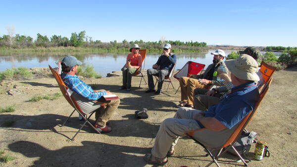
Tom leads a discussion of Powell's legacy and the West's future.
An integral part of each segment of the expedition is a recorded dialogue in which participans reflect on such things as Powell's legacy, the future of the West in light of water and energy issues, and what personal growth has occurred as a result of the expedition.
An integral part of each segment of the expedition is a recorded dialogue in which participans reflect on such things as Powell's legacy, the future of the West in light of water and energy issues, and what personal growth has occurred as a result of the expedition.

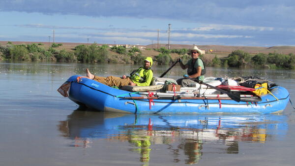
A properly rigged cataraft on the banks of the Green River
A properly rigged cataraft on the banks of the Green River in the Uintah Basin
A properly rigged cataraft on the banks of the Green River in the Uintah Basin

Hydrologist Nick plays a river tune
Hydrologist Nick plays a river tune
Hydrologist Nick plays a river tune

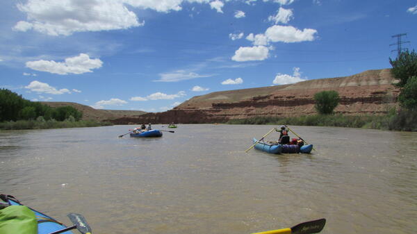
Panoramic vista of rafts on brown water below red and white cliffs
Although this section of the Green River in the Uinta basin lies between sections of dramatic red-stone cliffs of Ladore and Desolation Canyons, we did experience some profound geology. These cliffs are near the start of Desolation Canyon to the south.
Although this section of the Green River in the Uinta basin lies between sections of dramatic red-stone cliffs of Ladore and Desolation Canyons, we did experience some profound geology. These cliffs are near the start of Desolation Canyon to the south.

Sunset highlights distant cliffs beyond the river
Our last evening on this section of river, exploring the cliffs and buttresses of the Uinta Basin. One of our team member pauses on heavily banded member of the Green River Formation with distant cliffs glowing in the setting sun
Our last evening on this section of river, exploring the cliffs and buttresses of the Uinta Basin. One of our team member pauses on heavily banded member of the Green River Formation with distant cliffs glowing in the setting sun
Prof. Tom Minckley got the SCREE ball floating two years ago.
Starting two years ago, Professor Tom Minckley, from the University of Wyoming geology department, conceived and organized the Sesquicentennial Colorado River Exploring Expedition (SCREE), also known as the Powell 150 expedition. The USGS joined as a partner last year.
Starting two years ago, Professor Tom Minckley, from the University of Wyoming geology department, conceived and organized the Sesquicentennial Colorado River Exploring Expedition (SCREE), also known as the Powell 150 expedition. The USGS joined as a partner last year.
Graham (L) wrote a song and Pat (R) sketched the landscape.
USGS geologist Graham Lederer (L) wrote a song about the expedition while floating down the river, and Professor Pat Likut (R), who teaches art at the University of Wyoming, did landscape sketches that he will later turn into oil paintings.
USGS geologist Graham Lederer (L) wrote a song about the expedition while floating down the river, and Professor Pat Likut (R), who teaches art at the University of Wyoming, did landscape sketches that he will later turn into oil paintings.

Team D braces itself on a bluff to watch another beautiful sunset
Team D braces itself on a windy bluff to watch another beautiful sunset
Team D braces itself on a windy bluff to watch another beautiful sunset

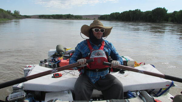
Ben Kraushaar (UWYO expedition film maker) oars his raft through Ouray
This calm section of river flows through a National Wildlife Refuge where we observed a great deal of wildlife, including beaver, peregrin falcons, waterfowl, a coyote, bighorn sheep and American white pelicans
This calm section of river flows through a National Wildlife Refuge where we observed a great deal of wildlife, including beaver, peregrin falcons, waterfowl, a coyote, bighorn sheep and American white pelicans
Brick-red Duchesne Fm. dominates landscape on Day 3.
The brick-red, flat-lying Duchesne Formation sandstones dominated the landscape for a couple days. Its bluffs are a favorite nesting spot for cliff swallows, of which we saw many, and peregrine falcons, of which we saw two.
The brick-red, flat-lying Duchesne Formation sandstones dominated the landscape for a couple days. Its bluffs are a favorite nesting spot for cliff swallows, of which we saw many, and peregrine falcons, of which we saw two.
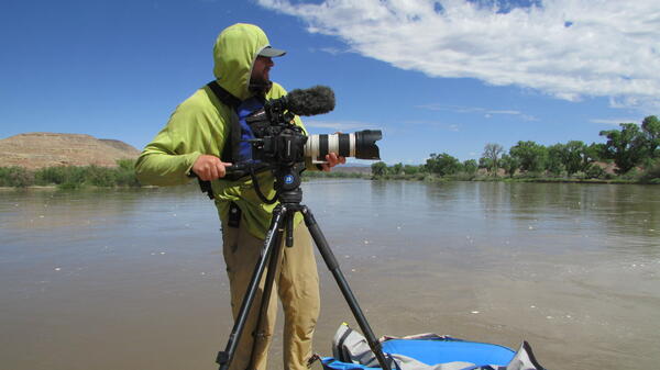
Ben Kraushaar is making a film about the expedition.
University of Wyoming grad student (media and communications) Ben Kraushaar is also an accomplished filmmaker, and is making a film of the expedition using both eyelevel shots and lofty drone aerials. He was instrumental in getting equipment of all types donated to the expedition.
University of Wyoming grad student (media and communications) Ben Kraushaar is also an accomplished filmmaker, and is making a film of the expedition using both eyelevel shots and lofty drone aerials. He was instrumental in getting equipment of all types donated to the expedition.

Graham birds from a duckie.
Graham birds from a duckie. USGS isn't only geology and Graham isn't only a geologist!
Graham birds from a duckie. USGS isn't only geology and Graham isn't only a geologist!

Mitch and Graham collect sediment samples on a transect
Mitch and Graham collect sediment samples on a transect
Mitch and Graham collect sediment samples on a transect

Man in cowboy hat walking through sagebrush with guitar at sunset
We spent the evening listening to the rhythmic sounds of an oil pumpjack straining at the efforts to connect with its Cretaceous past, accompanied by Pat matcing this rhythm on his guitar . Even in the presence of industrial oil extraction, the desert is spectacular at sunset.
We spent the evening listening to the rhythmic sounds of an oil pumpjack straining at the efforts to connect with its Cretaceous past, accompanied by Pat matcing this rhythm on his guitar . Even in the presence of industrial oil extraction, the desert is spectacular at sunset.

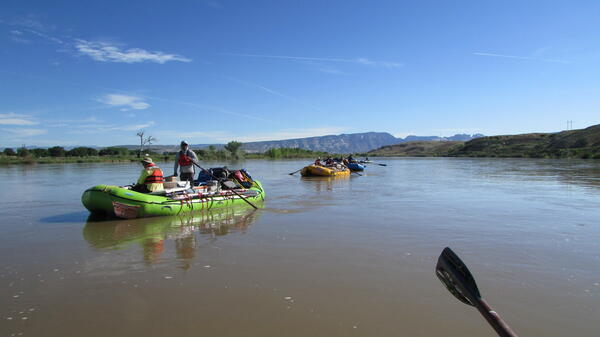
A flotilla of rafts on the Green River from a bird's eye perspective
On a calm river with no rapids or impediments, boaters often tie up rafts together in a flotilla or 'party barge' to socialize, share snacks or just enjoy the scenery with a group
On a calm river with no rapids or impediments, boaters often tie up rafts together in a flotilla or 'party barge' to socialize, share snacks or just enjoy the scenery with a group
On Day 2, flow rises due to controlled dam release upstream.
Team D enters the middle of the Uinta basin on Day 2, with Split Mountain still visible. The flow of the river greatly increased that day due to a controlled release at Flaming Gorge Dam. The high flow is meant to carry the larvae of an endangered species of sucker fish into bordering wetlands, where the larvae can grow under more protected conditions.
Team D enters the middle of the Uinta basin on Day 2, with Split Mountain still visible. The flow of the river greatly increased that day due to a controlled release at Flaming Gorge Dam. The high flow is meant to carry the larvae of an endangered species of sucker fish into bordering wetlands, where the larvae can grow under more protected conditions.
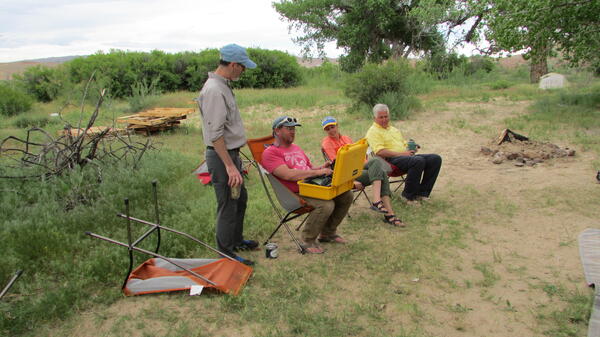
Tom explains the bioacoustic monitor to USGS scientists.
One of the ongoing experiments on the expedition is a bioacoustic survey monitor, which will parse recorded nighttime sounds into species and numbers of individuals. Here Tom Minckley explains it to USGS scientists Mitch Eaton, Jamie Delano, and John Parks.
One of the ongoing experiments on the expedition is a bioacoustic survey monitor, which will parse recorded nighttime sounds into species and numbers of individuals. Here Tom Minckley explains it to USGS scientists Mitch Eaton, Jamie Delano, and John Parks.
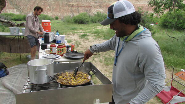
Ben Capelin and Austin Alvarado are also expert boatmen.
Ben Capelin and Austin Alvarado have multi-faceted roles on the expedition, serving as expert boatmen, talented cooks, evening companions, and contributors to any discussions.
Ben Capelin and Austin Alvarado have multi-faceted roles on the expedition, serving as expert boatmen, talented cooks, evening companions, and contributors to any discussions.

A beautiful pink blossom on a cactus in the desert.
Early June is a great time to view wildflowers in the Utah desert. Although they may have had a vicious appearance, these cacti had absolutely lovely blossoms.
Early June is a great time to view wildflowers in the Utah desert. Although they may have had a vicious appearance, these cacti had absolutely lovely blossoms.

Ecologist smiles as she holds a vial of aquatic invertebrates
Sampling pre-emergent aquatic insects is not always easy, especially on a river with little cobble substrate. Because of the high water from dam release, a lot of floating driftwood was making its way down river.
Sampling pre-emergent aquatic insects is not always easy, especially on a river with little cobble substrate. Because of the high water from dam release, a lot of floating driftwood was making its way down river.