
Rigging the boats on chilly desert mornings is a slow affair. All our food and gear must be sorted, distributed and carefully packed among the six rafts to be able to accommodate its passengers and so it can all be easily found again when we reach our evening camp.
Images
Images intro.
Filter Total Items: 228

High angle view of 6 rafts tied to the banks of a river
Rigging the boats on chilly desert mornings is a slow affair. All our food and gear must be sorted, distributed and carefully packed among the six rafts to be able to accommodate its passengers and so it can all be easily found again when we reach our evening camp.

Scientist on boat examines a large piece of driftwood
Sampling pre-emergent aquatic insects is not always easy, especially on a river with little cobble substrate. Because of the high water from dam release, a lot of floating driftwood was making its way down river. We are testing a new method to sample this substrate for benthic invertebrates to examine questions of species diversity, dispersal and habitat use.
Sampling pre-emergent aquatic insects is not always easy, especially on a river with little cobble substrate. Because of the high water from dam release, a lot of floating driftwood was making its way down river. We are testing a new method to sample this substrate for benthic invertebrates to examine questions of species diversity, dispersal and habitat use.
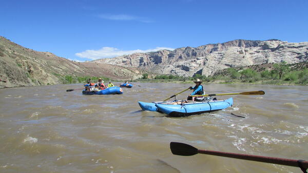
After a mid-morning launch, Team D floats south from Split Mtn
In high-flow conditions, Team D took off from Split Mountain campground in 6 rafts. Split Mountain is shown in the background.
In high-flow conditions, Team D took off from Split Mountain campground in 6 rafts. Split Mountain is shown in the background.

A scientist is scooping up sand near the river bank.
The sediment sampling project was intended to provide insight into the presence of microplastics in the Colorado River basin. Samples were collected at every campsite that had an adequate supply of sand.
The sediment sampling project was intended to provide insight into the presence of microplastics in the Colorado River basin. Samples were collected at every campsite that had an adequate supply of sand.

Bill Burton with Paper Powell and the first female geologist
Bill Burton with Paper Powell and (I think??) the first female geologist at USGS.
Bill Burton with Paper Powell and (I think??) the first female geologist at USGS.

Man stands on green raft with white sandstone cliff as background
For Team D, this was our first morning on the river, putting-in at Split Mountain campground in Dinosaur Nat'l Monument. The whole group was very excited as none of the expedition members had ever rafted this section of the Green River.
For Team D, this was our first morning on the river, putting-in at Split Mountain campground in Dinosaur Nat'l Monument. The whole group was very excited as none of the expedition members had ever rafted this section of the Green River.

Public Outreach event at Split Mountain Campground
There was an educational outreach event to describe the fish conservation and Powell expedition involving SCREE and Bureau of Reclamation.
There was an educational outreach event to describe the fish conservation and Powell expedition involving SCREE and Bureau of Reclamation.

Split Mountain - a very large rock.
Split Mountain Campground was the beginning of our jouney. We met up with the SCREE expedition in this cozy spot tucked beneath the imposing Split Mountains.
Split Mountain Campground was the beginning of our jouney. We met up with the SCREE expedition in this cozy spot tucked beneath the imposing Split Mountains.

The Green River traces its course through the desert.
Looking at the route we would be taking the next day, we pondered what lay ahead. Vast, open country and lots of rocks were in our future.
Looking at the route we would be taking the next day, we pondered what lay ahead. Vast, open country and lots of rocks were in our future.

Tom, Tildon Jones (USFWS), and Jim Prairie (BoR)
Tom, Tildon Jones (USFWS), and Jim Prairie (BoR) present at the Green River Campground for an "evening program" at Dinosaur National Monument. Many campers were in attendance, as were several deer across the river.
Tom, Tildon Jones (USFWS), and Jim Prairie (BoR) present at the Green River Campground for an "evening program" at Dinosaur National Monument. Many campers were in attendance, as were several deer across the river.

Green field borders white and red rock cliffs
The Uinta Basin represents an area of high productivity for agriculture, ranching and fossil fuel exploration. Recreational activities such as rafting share this landscape with wildlife and industry.
The Uinta Basin represents an area of high productivity for agriculture, ranching and fossil fuel exploration. Recreational activities such as rafting share this landscape with wildlife and industry.

Scientists talking to the public in front of cliffs and a river
Tildon Jones (Fish Biologist, USFWS) and Jim Prairie (hydro modeler, BOR) lecture to a public audience at Dinosaur the intricacies of the modern Adaptive Management Program for hydropower operation that considers the ecological needs of 3 endangered, endemic fish species in the Basin.
Tildon Jones (Fish Biologist, USFWS) and Jim Prairie (hydro modeler, BOR) lecture to a public audience at Dinosaur the intricacies of the modern Adaptive Management Program for hydropower operation that considers the ecological needs of 3 endangered, endemic fish species in the Basin.

Milky Way
Night 2 Milky Way galaxy with panorama near Firehole

USGS personnel at the end of their journey at the Gates of Lodore, Gre
Members of USGS Team B and paper Powell sharing a moment at the end of their 4-day river journey at the Gates of Lodore
Members of USGS Team B and paper Powell sharing a moment at the end of their 4-day river journey at the Gates of Lodore

View towards town of Green River from scenic overlook
View towards town of Green River from scenic overlook
View towards town of Green River from scenic overlook

Yellow SCREE expedition raft in Browns Park, Green River.
The yellow raft of SCREE expedition leader, Tom Minckley, floating through calm waters of Browns Park National Wildlife Refuge, Colorado. The far bank in the midground of the photo are the exposed sediments of the pre-dam floodplain of the Green River. The layers of rock in the background are the exposed layers of the red Uinta Mountain Group quartzite.
The yellow raft of SCREE expedition leader, Tom Minckley, floating through calm waters of Browns Park National Wildlife Refuge, Colorado. The far bank in the midground of the photo are the exposed sediments of the pre-dam floodplain of the Green River. The layers of rock in the background are the exposed layers of the red Uinta Mountain Group quartzite.

Camp and River in Dinosaur National Monument
View looking upstream from the hiking trail at Dinosaur national monument. Shows Brown's Park, our camp and the boats, beach, river, scenic background with cottonwoods
View looking upstream from the hiking trail at Dinosaur national monument. Shows Brown's Park, our camp and the boats, beach, river, scenic background with cottonwoods

A meander in the Green River at Brown's Park
A view looking down on the river from the hills above camp. View is upstream and shows a nice river meander with a point bar and scenic hills in the background. This is in Brown's Park.
A view looking down on the river from the hills above camp. View is upstream and shows a nice river meander with a point bar and scenic hills in the background. This is in Brown's Park.

Gates of Lodore looming from Brown's Park
The scenic view of the Gates of Lodore from Brown's Park. The Green River through Brown's Park is very calm, slow moving water, with canyon walls and up ahead looms the scar where the river has eroded it's way down through the mountains.
The scenic view of the Gates of Lodore from Brown's Park. The Green River through Brown's Park is very calm, slow moving water, with canyon walls and up ahead looms the scar where the river has eroded it's way down through the mountains.

Expedition photographers
Day 2 expedition photographers

View towards Firehole
Day 2 Rusty looking towards Firehole public use area
Day 2 Rusty looking towards Firehole public use area