
Energy
What are the types of coal?
What is hydraulic fracturing?
How much wind energy does it take to power an average home?
The USGS conducts basic research on geologic energy resources including oil, gas, gas hydrates, geothermal, and coal.

How do I cite the U.S. Wind Turbine Database if I want to use the data?
We suggest the following citation for use in academic papers and where applicable: Hoen, B.D., Diffendorfer, J.E., Rand, J.T., Kramer, L.A., Garrity, C.P., Hunt, H.E. (<year of USWTDB access>) United States Wind Turbine Database. U.S. Geological Survey, American Clean Power Association, and Lawrence Berkeley National Laboratory data release: USWTDB Version # (Version Date). https://eerscmap...

How often is the U.S. Wind Turbine Database updated?
The U.S. Wind Turbine Database (USWTDB) is updated every three months [or four times a year] and contains turbines that were installed as recently as 3 months preceding the update. Learn more: Wind Energy

How many turbines are contained in the U.S. Wind Turbine Database?
As of January 2022, the U.S. Wind Turbine Database (USWTDB) contains more than 70,800 turbines. These turbines have all been constructed since 1980 in approximately 1,500 wind power projects spanning at least 44 states (plus Puerto Rico and Guam). Learn more: Wind Energy

Can the oil and gas that the USGS assesses be produced today?
USGS oil and gas assessments are for technically recoverable resources, meaning they can be produced using today’s technology and standard industry practices. However, our assessments do not look at what infrastructure would be required to produce these resources, nor does it look at whether it would be profitable to produce them. In addition, USGS assessments are for undiscovered resources, which...

Does an assessment of the National Petroleum Reserve-Alaska mean there should or should not be oil and gas production in the Arctic National Wildlife Refuge?
The USGS is an unbiased, non-regulatory science agency, and therefore we do not advocate for or against oil and gas development in any location. The USGS role is to provide scientifically robust, publicly available estimates of potential resources so decision-makers have the best possible information to manage the Nation’s resources. Learn more: About USGS USGS Energy Assessments Alaska Petroleum...

How do the USGS and Bureau of Ocean Energy Management (BOEM) divide up which areas to be assessed for Oil and Gas Resources?
The USGS is responsible for oil and gas assessments onshore and in state waters (up to 3 miles offshore), while the Bureau of Ocean Energy Management (BOEM) assesses energy resources in the Federal offshore waters and the outer continental shelf. Learn more: USGS Energy Assessments

What is the difference between the National Petroleum Reserve-Alaska and the Arctic National Wildlife Refuge?
The National Petroleum Reserve-Alaska (NPR-A) is a roughly 23.4 million acre area of Federal land managed by the Bureau of Land Management. It lies in northwest Alaska and borders both the Chukchi Sea to the west and the Beaufort Sea to the north. The NPR-A was originally established in 1923 as a petroleum reserve for the U.S. Navy, then transferred to the Department of the Interior in 1976. The...

How does carbon get into the atmosphere?
Atmospheric carbon dioxide comes from two primary sources—natural and human activities. Natural sources of carbon dioxide include most animals, which exhale carbon dioxide as a waste product. Human activities that lead to carbon dioxide emissions come primarily from energy production, including burning coal, oil, or natural gas. Learn more: Sources of Greenhouse Gas Emissions (EPA)
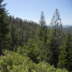
Has the USGS made any Biologic Carbon Sequestration assessments?
The USGS is congressionally mandated (2007 Energy Independence and Security Act) to conduct a comprehensive national assessment of storage and flux (flow) of carbon and the fluxes of other greenhouse gases (including carbon dioxide) in ecosystems. At this writing, reports have been completed for Alaska , the Eastern U.S. , the Great Plains , and the Western U.S. Learn more: Land Change Science...
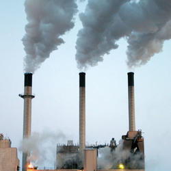
How much carbon dioxide does the United States and the World emit each year from energy sources?
The U.S. Energy Information Administration estimates that in 2019, the United States emitted 5,130 million metric tons of energy-related carbon dioxide, while the global emissions of energy-related carbon dioxide totaled 33,621.5 million metric tons.

Which area is the best for geologic carbon sequestration?
It is difficult to characterize one area as “the best” for carbon sequestration because the answer depends on the question: best for what? However, the area of the assessment with the most storage potential for carbon dioxide is the Coastal Plains region, which includes coastal basins from Texas to Georgia. That region accounts for 2,000 metric gigatons, or 65 percent, of the storage potential...
How much carbon dioxide can the United States store via geologic sequestration?
In 2013, the USGS released the first-ever comprehensive, nation-wide assessment of geologic carbon sequestration , which estimates a mean storage potential of 3,000 metric gigatons of carbon dioxide. The assessment is the first geologically-based, probabilistic assessment, with a range of 2,400 to 3,700 metric gigatons of potential carbon dioxide storage. In addition, the assessment is for the...