
Natural Hazards
How do volcanoes erupt?
Can you predict earthquakes?
What is the difference between a tsunami and a tidal wave?
What is a landslide and what causes one?
The USGS monitors and conducts research on a wide range of natural hazards to help decision-makers prepare for and respond to hazard events that threaten life and property.

How often do Alaskan volcanoes erupt?
Alaskan volcanoes have produced one or two eruptions per year since 1900. At least 20 catastrophic caldera -forming eruptions have occurred in the past 10,000 years; the awesome eruption of 1912 at Novarupta in what is now Katmai National Park and Preserve is the most recent. Scientists are particularly concerned about the volcanoes whose eruptions can affect the Cook Inlet region, where 60...

How often does Mount Shasta erupt?
USGS scientists are currently working on this question. Mount Shasta doesn’t erupt on a regular timescale. Research indicates that the volcano erupts episodically with ten or more eruptions occurring in short (500-2,000 year) time periods separated by long intervals (3,000-5,000 years) with few or no eruptions. Evidence suggests that magma most recently erupted at the surface about 3,200 years ago...

What was the largest volcanic eruption in the 20th century?
The world's largest eruption of the 20th century occurred in 1912 at Novarupta on the Alaska Peninsula in what is now Katmai National Park and Preserve. An estimated 15 cubic kilometers of magma was explosively erupted during 60 hours beginning on June 6th. This volume is equivalent to 230 years of eruption at Kilauea (Hawaii) or about 30 times the volume erupted by Mount St. Helens (Washington)...
Where can I find information about volcanoes in Alaska?
Alaska contains over 130 volcanoes and volcanic fields which have been active within the last two million years. Of these volcanoes more than 50 have been active within historical time (since about 1760, for Alaska). Visit the Alaska Volcano Observatory (AVO) for information on Alaska Volcanoes. The Alaska Volcano Observatory (AVO) covers volcanoes in Alaska from offices in Anchorage and Fairbanks...

How much water does the typical hydraulically fractured well require?
There isn’t really a “typical” fractured well because the amount of water used depends on the rock formation, the operator, whether the well is vertical or horizontal, and the number of portions (or stages) of the well that are fractured. In addition, some water is recycled from fluids produced by the well, so the net consumption might be smaller at sites that recycle. Water use per well can be...

What is the role of the USGS in responding to hurricanes?
The USGS creates detailed maps of our Nation’s shorelines, dunes, and coastal cliffs, and studies how storm processes impact our coastlines. This information is used to predict and map coastal vulnerability to changes caused by major storms, long-term shoreline erosion, sea-level rise, and sea cliff erosion. One example is the USGS Total Water Level and Coastal Change Forecast Viewer , which uses...

Why is elevation data so important to forecasting hurricane impact?
The fundamental lesson of Hurricane Sandy in 2012 (and prior catastrophic storms and hurricanes) was that storm vulnerability is first and foremost a consequence of elevation. The height at which infrastructure, resources, and communities sit in relation to average tides and water levels, storm waves, surge, and flood waters determines their exposure to overwhelmingly powerful damaging forces...
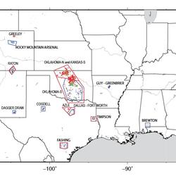
How is hydraulic fracturing related to earthquakes and tremors?
Reports of hydraulic fracturing causing felt earthquakes are extremely rare. However, wastewater produced by wells that were hydraulic fractured can cause “induced” earthquakes when it is injected into deep wastewater wells. Wastewater disposal wells operate for longer durations and inject much more fluid than the hydraulic fracturing operations. Wastewater injection can raise pressure levels in...

Will extinct volcanoes on the east coast of the U.S. erupt again?
No. The geologic forces that generated volcanoes in the eastern United States millions of years ago no longer exist. Through plate tectonics, the eastern U.S. has been isolated from the global tectonic features (tectonic plate boundaries and hot spots in the mantle), that cause volcanic activity. So new volcanic activity is not possible now or in the near future. If you wait around several hundred...

Where does the United States rank in the number of volcanoes?
The United States ranks third, behind Indonesia and Japan, in the number of historically active volcanoes (that is, those for which we have written accounts of eruptions). In addition, about 10 percent of the more than 1,500 volcanoes that have erupted in the past 10,000 years are located in the United States. Most of these volcanoes are found in the Aleutian Islands, the Alaska Peninsula, the...

Where is the largest active volcano in the world?
Rising gradually to more than 4 km (2.5 mi) above sea level, Hawaii’s Mauna Loa is the largest active volcano on our planet. Its submarine flanks descend to the sea floor an additional 5 km (3 mi), and the sea floor in turn is depressed by Mauna Loa's great mass another 8 km (5 mi). This makes the volcano's summit about 17 km (10.5 mi) above its base! Learn more: USGS Hawaiian Volcano Observatory

Which volcanoes in the conterminous United States have erupted since the Nation was founded?
Excluding steam eruptions, these volcanoes have shown activity: Mount St. Helens, Washington - Eruptions and/or lava dome growth occurred in the late 1700s, 1800-1857, 1980-1986, and 2004-2008. Lassen Peak, California - A series of steam blasts began on May 30, 1914. An eruption occurred 12 months later on May 21, 1915. Minor activity continued through the middle of 1917. Mount Hood, Oregon -...