
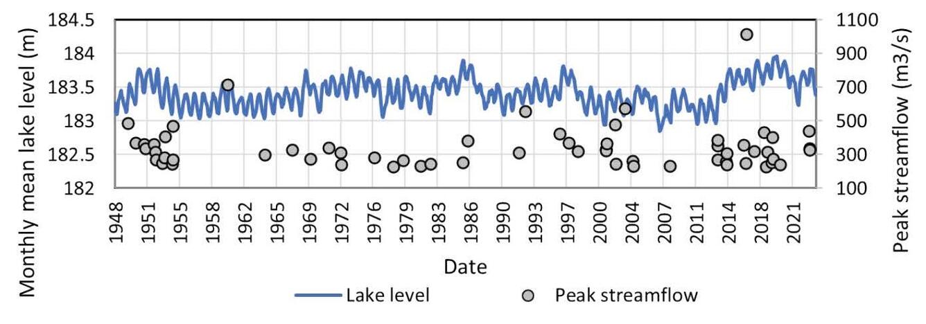
Monthly water level data from Lake Superior at Duluth and peak streamflow from combined Bad and White Rivers
By Upper Midwest Water Science Center
December 2021 (approx.)
Detailed Description
Monthly water level data from Lake Superior at Duluth (co-Ops Site 9099064) (NOAA, 2024) and peak streamflow from combined Bad and White Rivers (USGS ID 0402700 and 04027500, respectively; U.S. Geological Survey, 2024) for floods larger than 226 m3 s-1 that potentially connect Bad River flows to Kakagon River Sloughs and Chequamegon Bay.
Sources/Usage
Public Domain.
Related

Bad River Watershed Assessments
The Bad River has one of the highest sediment loads of all Lake Superior tributaries and is an important resource for lake sturgeon and the Bad River Tribe. This study monitors the effects of streamflow variability on sediment-related problems, including understanding the influence of land cover on hydrology, habitat, erosion and sedimentation rates, and water quality of the Bad River.
Related
Bad River Watershed Assessments
The Bad River has one of the highest sediment loads of all Lake Superior tributaries and is an important resource for lake sturgeon and the Bad River Tribe. This study monitors the effects of streamflow variability on sediment-related problems, including understanding the influence of land cover on hydrology, habitat, erosion and sedimentation rates, and water quality of the Bad River.