
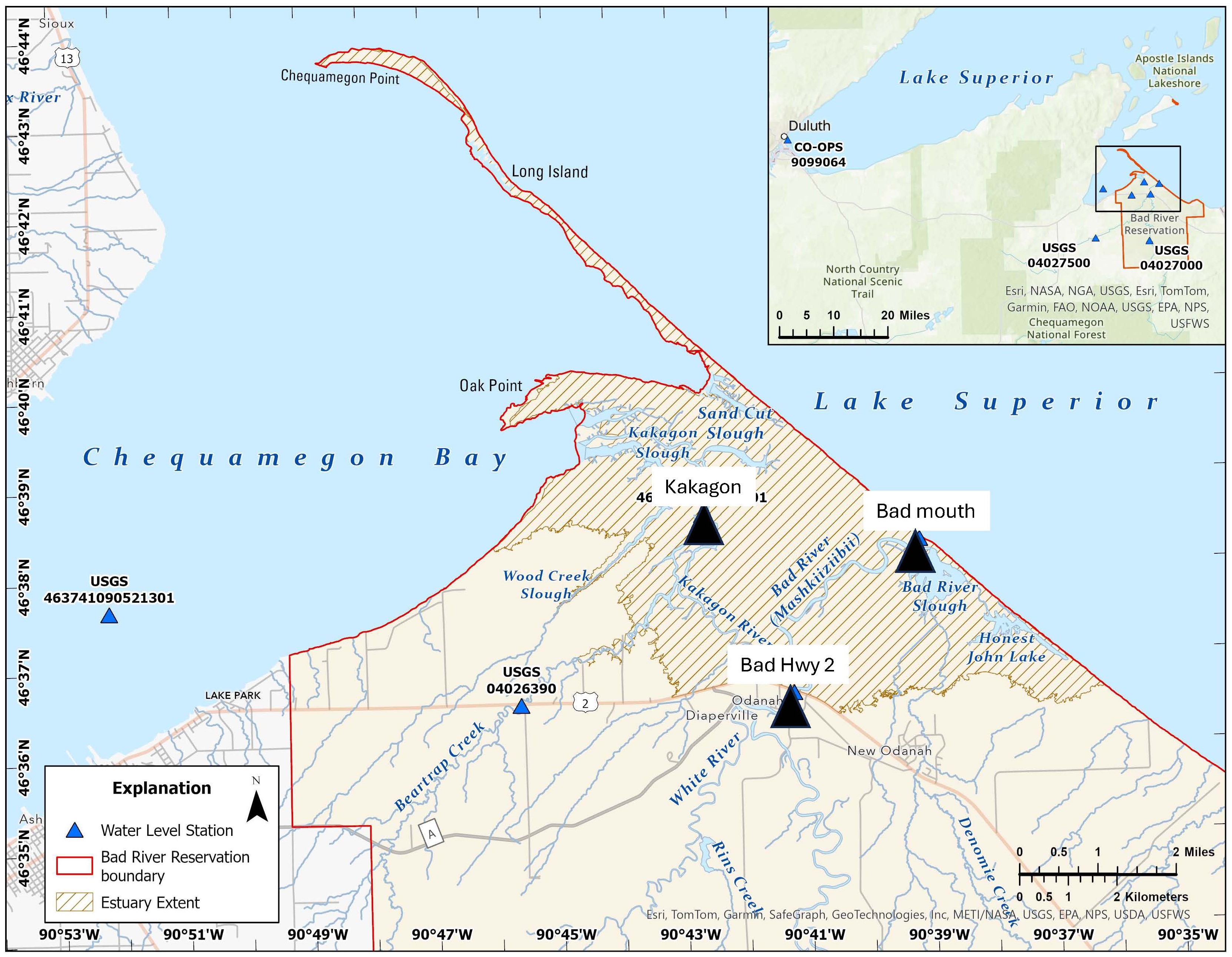
Three velocity gages in Sloughs (Bad River at the mouth, Bad River at Hwy 2, and Kakagon River
By Upper Midwest Water Science Center
September 2025 (approx.)

Detailed Description
Three velocity gages in Sloughs (Bad River at the mouth, 04027655; Bad River at Hwy 2, 04027595; and Kakagon River are helping to understand how water moves through the sloughs relative to river floods, lake level fluctuations, and ice. Data are realtime and publicly available. The gages are in part funded by the Great Lakes Oil Spill Center of Excellence to aid in oil spill response planning along coastal wetlands. Locations and data are available at the USGS National Water Information System Mapper: https://maps.waterdata.usgs.gov/mapper/index.html
Sources/Usage
Public Domain.
Related

Bad River Watershed Assessments
The Bad River has one of the highest sediment loads of all Lake Superior tributaries and is an important resource for lake sturgeon and the Bad River Tribe. This study monitors the effects of streamflow variability on sediment-related problems, including understanding the influence of land cover on hydrology, habitat, erosion and sedimentation rates, and water quality of the Bad River.
Related
Bad River Watershed Assessments
The Bad River has one of the highest sediment loads of all Lake Superior tributaries and is an important resource for lake sturgeon and the Bad River Tribe. This study monitors the effects of streamflow variability on sediment-related problems, including understanding the influence of land cover on hydrology, habitat, erosion and sedimentation rates, and water quality of the Bad River.