
A primary governmental division of the United States or a United States jurisdiction that is neither a part of one of the several States nor a federal district (for example, the United States Virgin Islands).
Multimedia
Images

OnDemand - 100K - BND - State - Label
A primary governmental division of the United States or a United States jurisdiction that is neither a part of one of the several States nor a federal district (for example, the United States Virgin Islands).

The National Map 3D Viewer 3D View from Wotans Throne, CA
The National Map 3D Viewer 3D View from Wotans Throne, CAScreenshot of the National Map 3D Viewer showing a 3D view looking northeast. The location is near Wotans Throne.
The National Map 3D Viewer 3D View from Wotans Throne, CA
The National Map 3D Viewer 3D View from Wotans Throne, CAScreenshot of the National Map 3D Viewer showing a 3D view looking northeast. The location is near Wotans Throne.

The National Map 3D Viewer, Elevation Profile
Screenshot of the National Map 3D Viewer showing the elevation profile tool. The screen shot is of the Inyo National Forest area of California, near Tunnabora Peak.
Screenshot of the National Map 3D Viewer showing the elevation profile tool. The screen shot is of the Inyo National Forest area of California, near Tunnabora Peak.
The National Map 3D Viewer
This is a screen shot of the National Map (TNM) 3D Viewer Application. This new application will replace the existing TNM Viewer on or around April 7th 2025
This is a screen shot of the National Map (TNM) 3D Viewer Application. This new application will replace the existing TNM Viewer on or around April 7th 2025
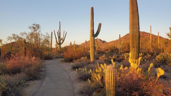
Desert Discovery Trail, Saguaro National Park (Elizabeth McCartney)
Desert Discovery Trail, Saguaro National Park (Elizabeth McCartney)Desert scenery highlighting tall Saguaro cacti and other types of desert vegetation with a paved trail running through the middle. There are low hills in the distance and the scene is bathed in the soft yellow light of sunset.

TNMCorps Status Map: Volunteer Contributions through March 31, 2022
TNMCorps Status Map: Volunteer Contributions through March 31, 2022A map showing volunteer contributions from the inception of TNMCorps through March 31, 2022. Contributions are displayed by fiscal year with contributions during the current fiscal year displayed by quarter. Points are color-coded on a graduated gray-to-red scale; older points are gray and newer points are red.