
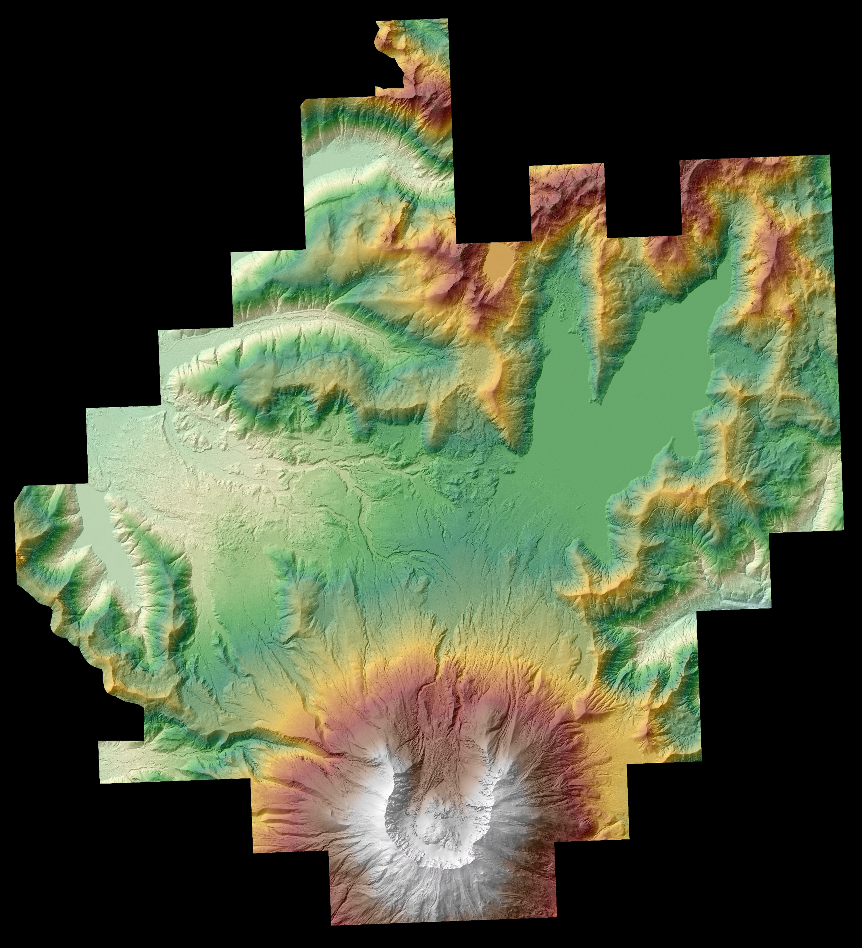
Available online, a high-resolution digital elevation model of Mount St. Helens

Detailed Description
"In 2017, the U.S. Forest Service contracted the acquisitions of airborne lidar surveys of Mount St. Helens and upper North Fork Toutle River basin, as part of a larger 2017-2018 survey of the Gifford Pinchot National Forest. The USGS subsequently combined and reprojected 81 raster datasets provided by the USFS into a single digital elevation model (DEM) of the ground surface, including beneath forest cover (that is, 'bare earth'). The online data release contains digital elevation data as a 1-meter resolution raster dataset (.tif file) and can be used to support a variety of earth science investigations.
The "High-resolution digital elevation model of Mount St. Helens and upper North Fork Toutle River basin, based on airborne lidar surveys of July-September, 2017" is available at https://doi.org/10.5066/P9H16RC7."
Sources/Usage
Public Domain.