
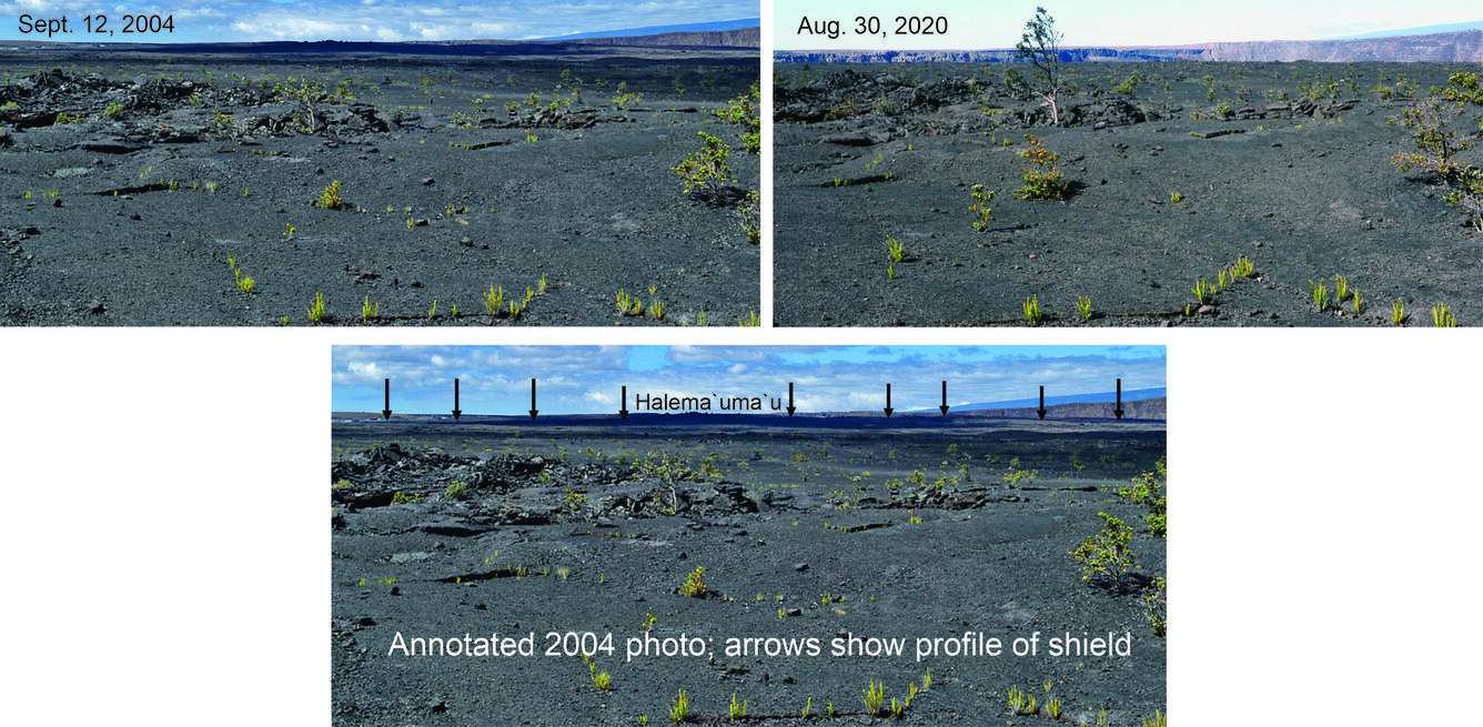
Comparison photos of the floor of Kīlauea Caldera
By Kīlauea
Detailed Description
Comparison photos of the floor of Kīlauea Caldera from the foot of the Halema‘uma‘u Trail in Hawai‘i Volcanoes National Park, from 2004 and 2020. In 2004 (top left and bottom photos), the floor sloped gently left and right away from Halema‘uma‘u in the distance, defining a low shield created by overflows from the crater mainly during the 19th century (see the bottom annotated 2004 photo). Kīlauea's 2018 summit-collapse events swallowed the shield. The photos were taken from nearly the same place; note the tree growth in 16 years. USGS photos by Don Swanson.
Sources/Usage
Public Domain.