
Comparison photos of Uēkahuna Bluff
By Kīlauea

Detailed Description
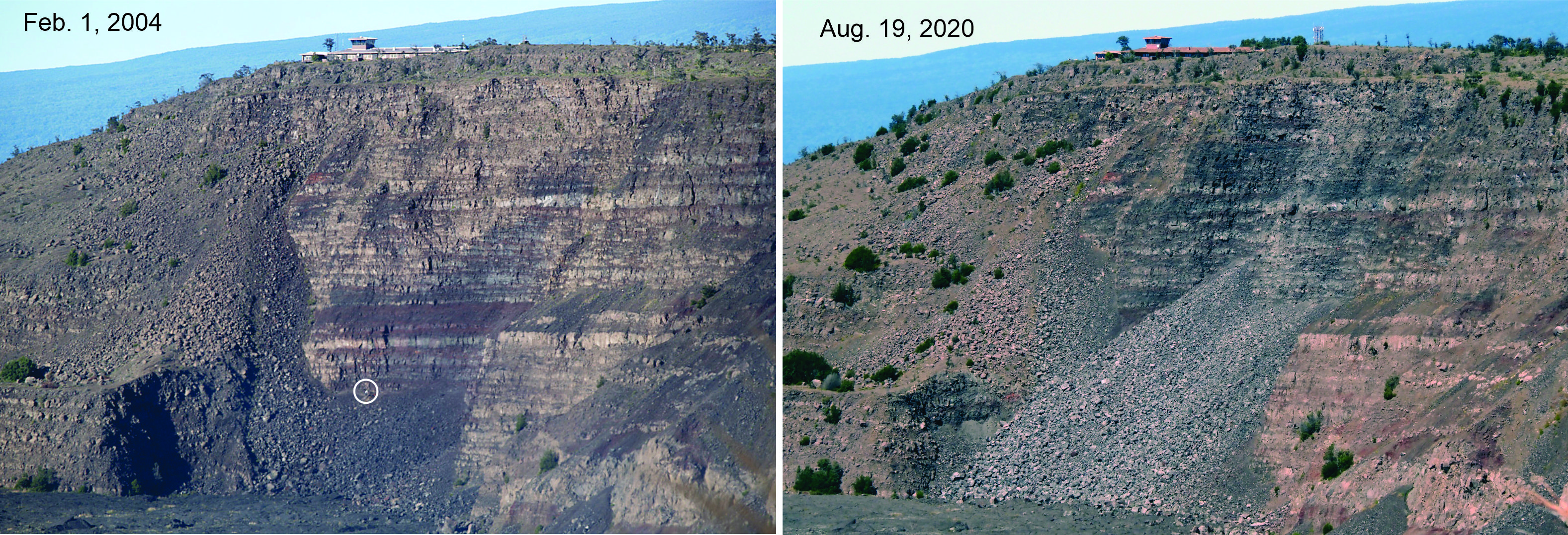
Comparison photos of Uēkahuna Bluff on the edge of Kīlauea Caldera, from 2004 and 2020. Both photos were taken from Steaming Bluff in Hawai‘i Volcanoes National Park. The white circle on the 2004 photo (left) surrounds two geologists examining ash deposits produced by many explosions between about 500 and 900 C.E. Lava flows erupted between about 1000 and 1400 CE overlie the ash deposits. The 2020 photo (right) shows deposits of rock falls, triggered during Kīlauea's 2018 summit-collapse events, that now bury the outcrop. The buildings that previously housed the Hawaiian Volcano Observatory and Jaggar Museum sit atop the bluff. Mauna Loa’s Southwest Rift Zone is visible in the background. USGS photos by Don Swanson.
Sources/Usage
Public Domain.