
Drift and Retention of Sturgeon Larvae
Detailed Description
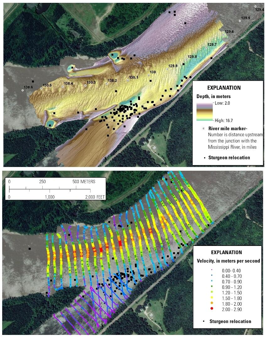
Multibeam bathymetry (top) and current velocities (bottom) at the mouth of the Osage River mapped during high water June, 2011. Sturgeon telemetry positions (black squares) show concentrations in slow, deep water.
Sources/Usage
Public Domain.