
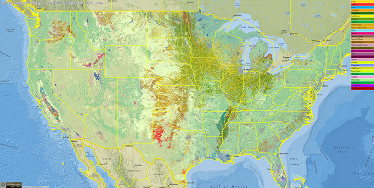
Geospatial Data Analysis in-season crop type map for the United States
Detailed Description
This image shows Geospatial Data Analysis Corporation (GDA Corp.) in-season crop type map for the United States. More information available at https://www.usgs.gov/land-resources/lrs/landsat/landsat-action.
Sources/Usage
Public Domain.