
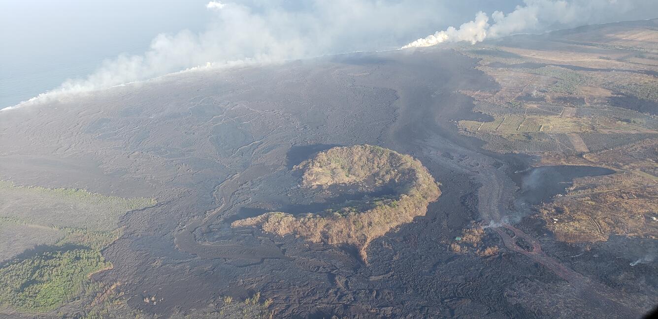
This Hawai‘i County Fire Department aerial image shows Kapoho Crater
By Kīlauea
Detailed Description
This Hawai‘i County Fire Department aerial image shows Kapoho Crater with the most active branch of the fissure 8 lava channel now to the west (right) of the cone and feeding a robust ocean entry. The path of the fissure 8 channel prior to being diverted can be seen east (below and left) of the crater; despite no visible surface connection between this branch and the sea, lava continues to feed a broad ocean entry, forming a diffuse laze plume.
Sources/Usage
Courtesy: Hawaii County Fire Department