
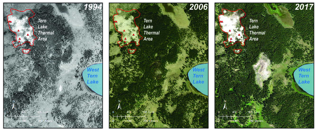
High-spatial-resolution airborne images of the Tern Lake area from 1994, 2006, a
Detailed Description
High-spatial-resolution airborne images of the Tern Lake area from 1994, 2006, and 2017. The area of bright pixels identified in the Landsat-8 thermal infrared image corresponds to a newly emerging area of warm ground and tree kills about 32,500 m2 (8 acres, or 4 soccer fields) in area. The air photo from 2006 shows the beginnings of a tree kill zone. The black and white air photo from 1994 shows no evidence of a newly emerging thermal area. Lakes are outlined in blue; known thermal areas are outlined in red; and the red triangles are individual thermal features that have been mapped.
Sources/Usage
Public Domain.
R.